 Cap-travel.ru
To the Barents Sea on two wheels.
Today was an unbelievably eventful day. In the morning we left Belozersk and after crossing the small river Sheksna by an old ferry went on a grader road. It's not difficult to ride in a pair along a ground road in dry weather. You can keep a decent speed, up to 140 km/h and even more, but this way the rest of the team wouldn't be pleased! Motorbikes leave huge clouds of dust behind themselves, through which hardly is anything visible. And in windless weather the dust settles for a long time, so the third rider and all the following ones either have to keep a very long distance between each other, or take a risk, which is quite dangerous at such speeds.
We raced to the village of Lipin Bor "in one breath". Some participants had to hold their breath from time to time, though. :)
Vytegra.
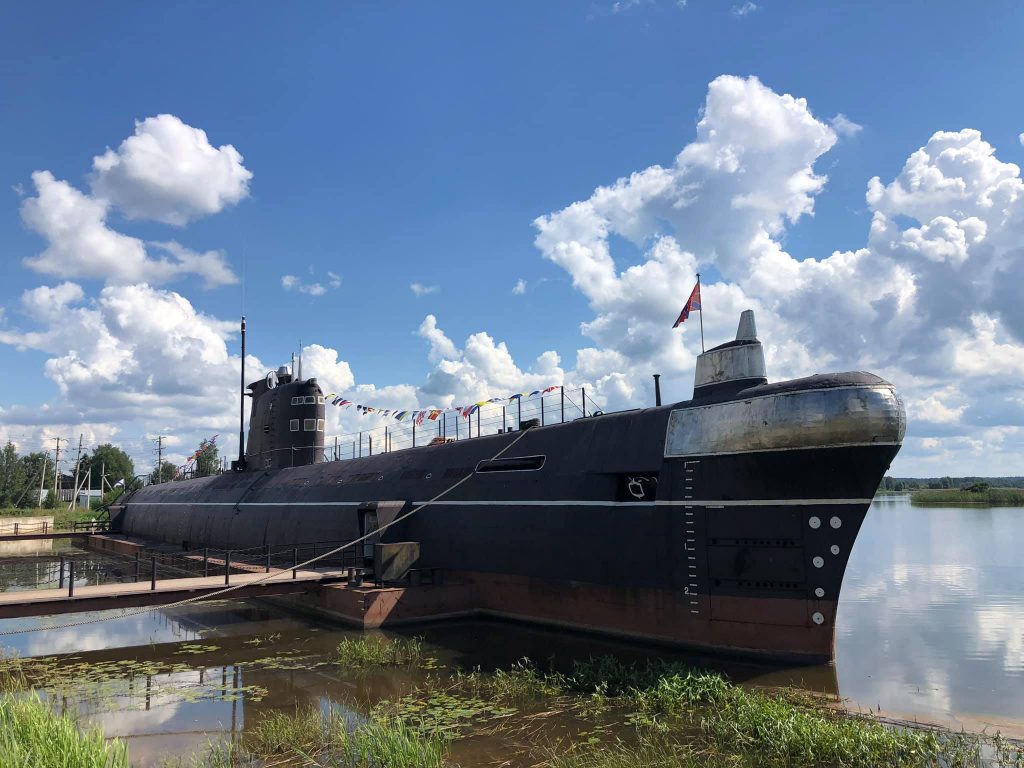
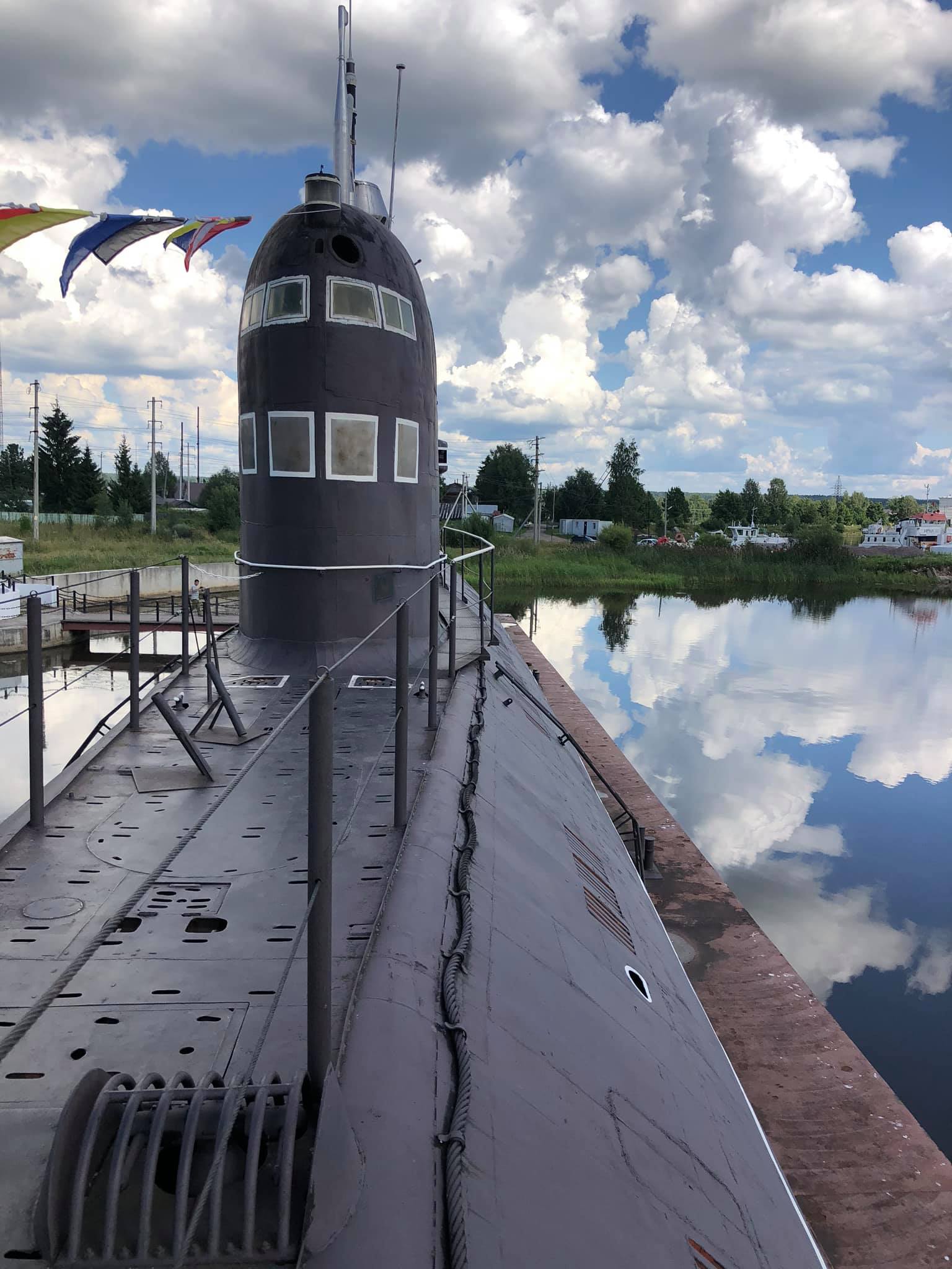
It's a small town in the north of the Vologda region. If you happen to be here one day, make sure to visit the submarine. This is not a café or a nightclub but it is a real diesel-electric submarine B-440, which did a glorious combat path, being a part of the USSR Navy from 1970 to 1998. After having been decommissioned it was towed to Lake Onega and turned into an interesting museum. (N 60.998354, E 36.433662)
Pyalma.
We are going further north, following the A-119 highway along the eastern shore of Lake Onega. Our next stop is the old village of Pyalma, situated on the banks of the river that has got the same name as the aforementioned village. (N 62.578117, E 35.577305)
There you can see huge log houses, built in the 19th century and blackened by time; a beautiful chapel of Elijah the Prophet, built in the 18th century; a quiet graveyard, a ground road and a wooden bridge over a rocky river. If you want to see how people lived in Karelia 150-200 years ago, then you should visit Pyalma. It's worth it!
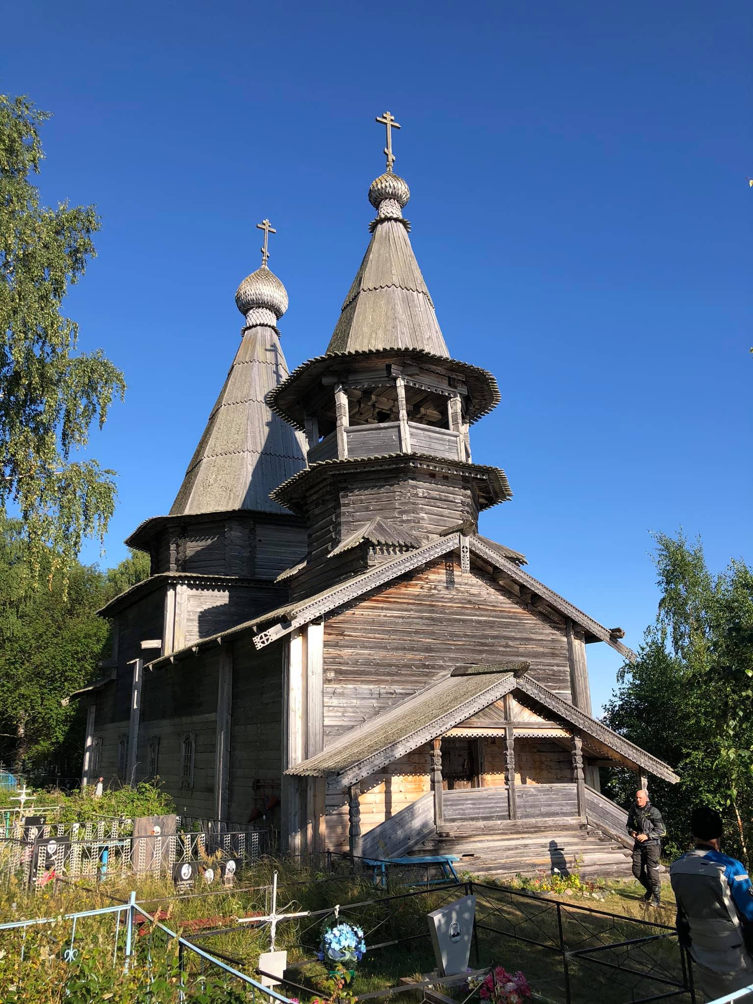
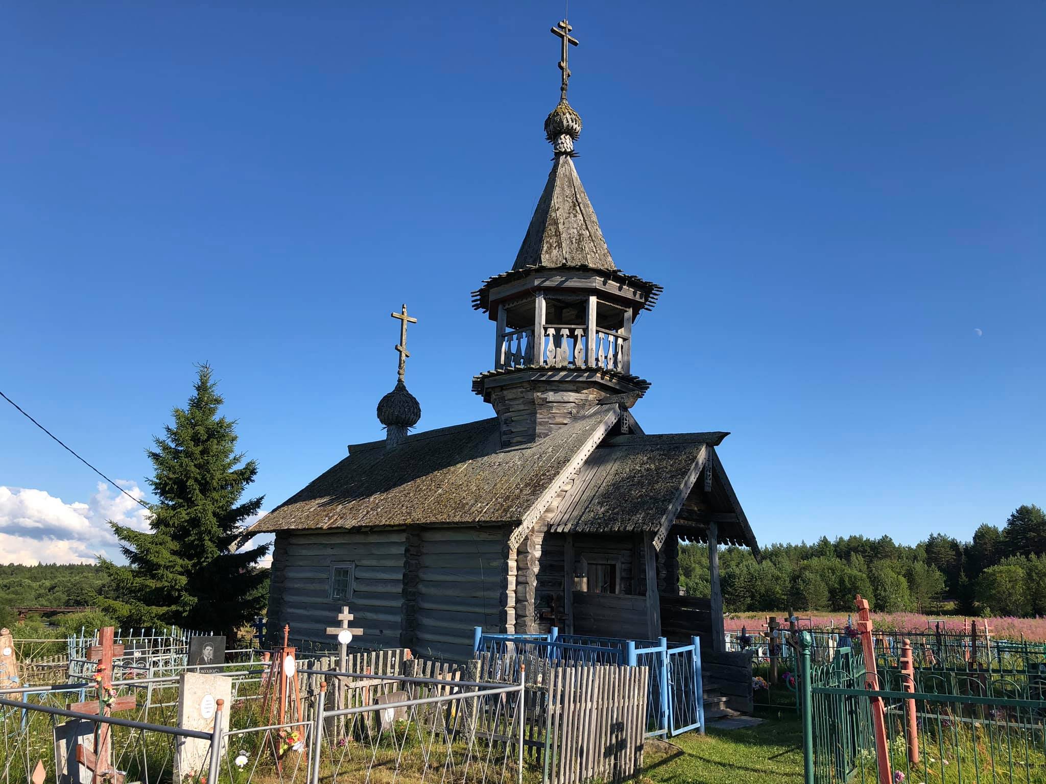
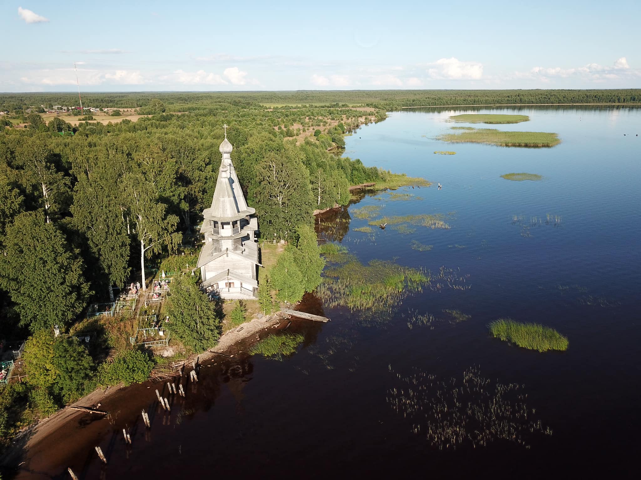
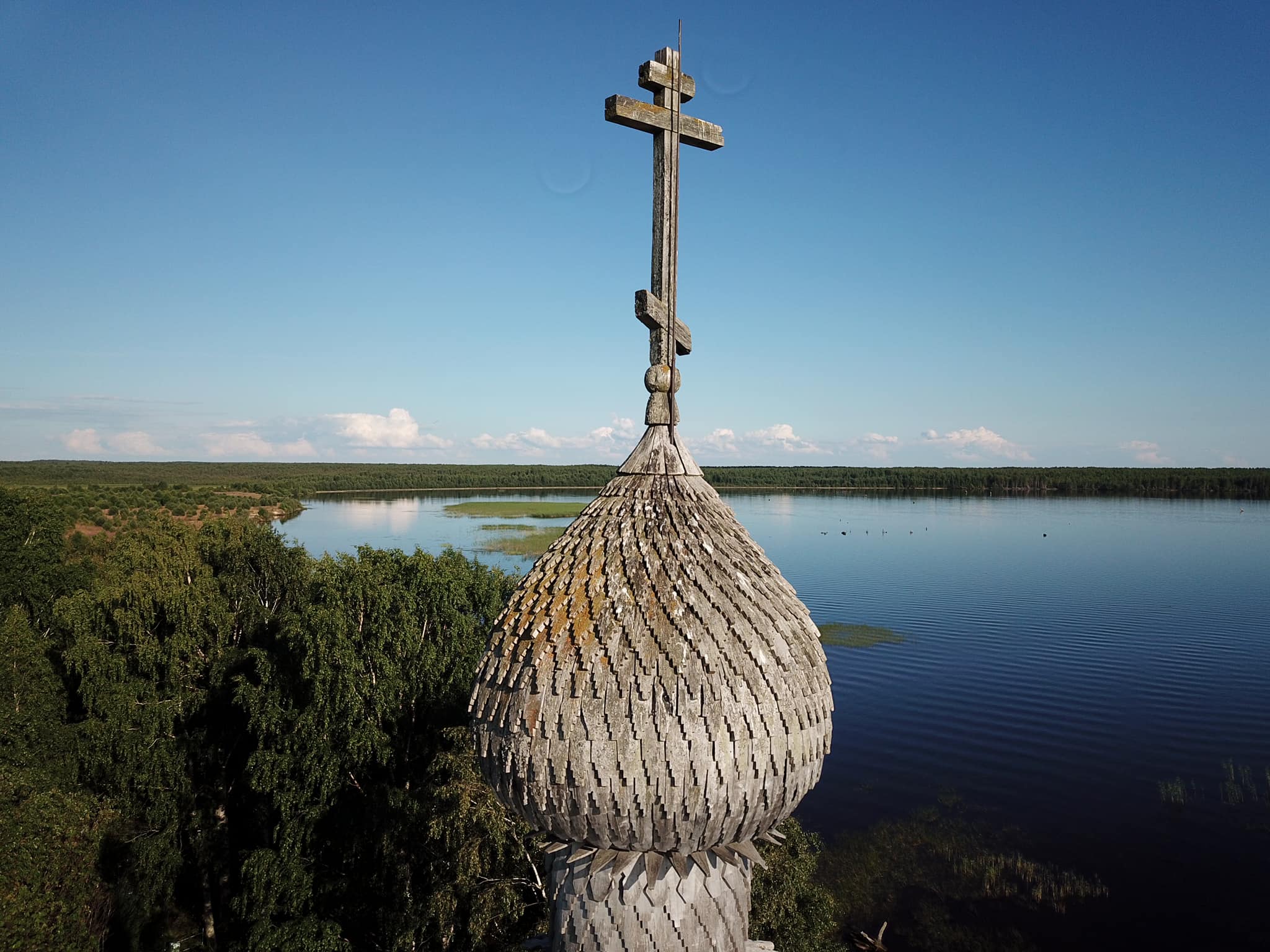
And if you want to feel some tranquility and peaceful atmosphere, then I recommend you to have a stop in another old village, named Chelmuzhi. Here, on the outskirts of the village, on the high shore of a protruding cape, the amazing Epiphany Church has been standing for about four hundred years. There is a rural graveyard nearby, surrounded by the forest on three sides. In my opinion, it's one of the most spiritual places in Russia. I didn't want to leave it. ( N 62.578117, E 35.577305)
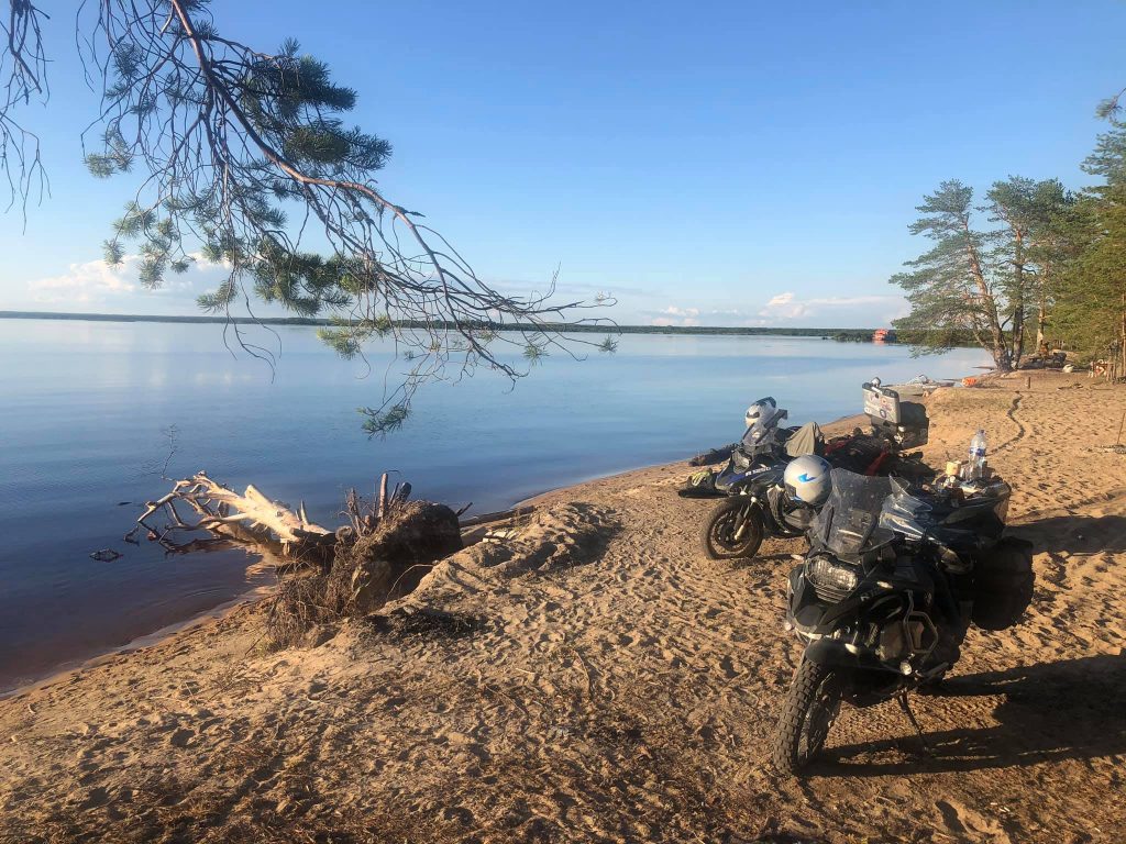
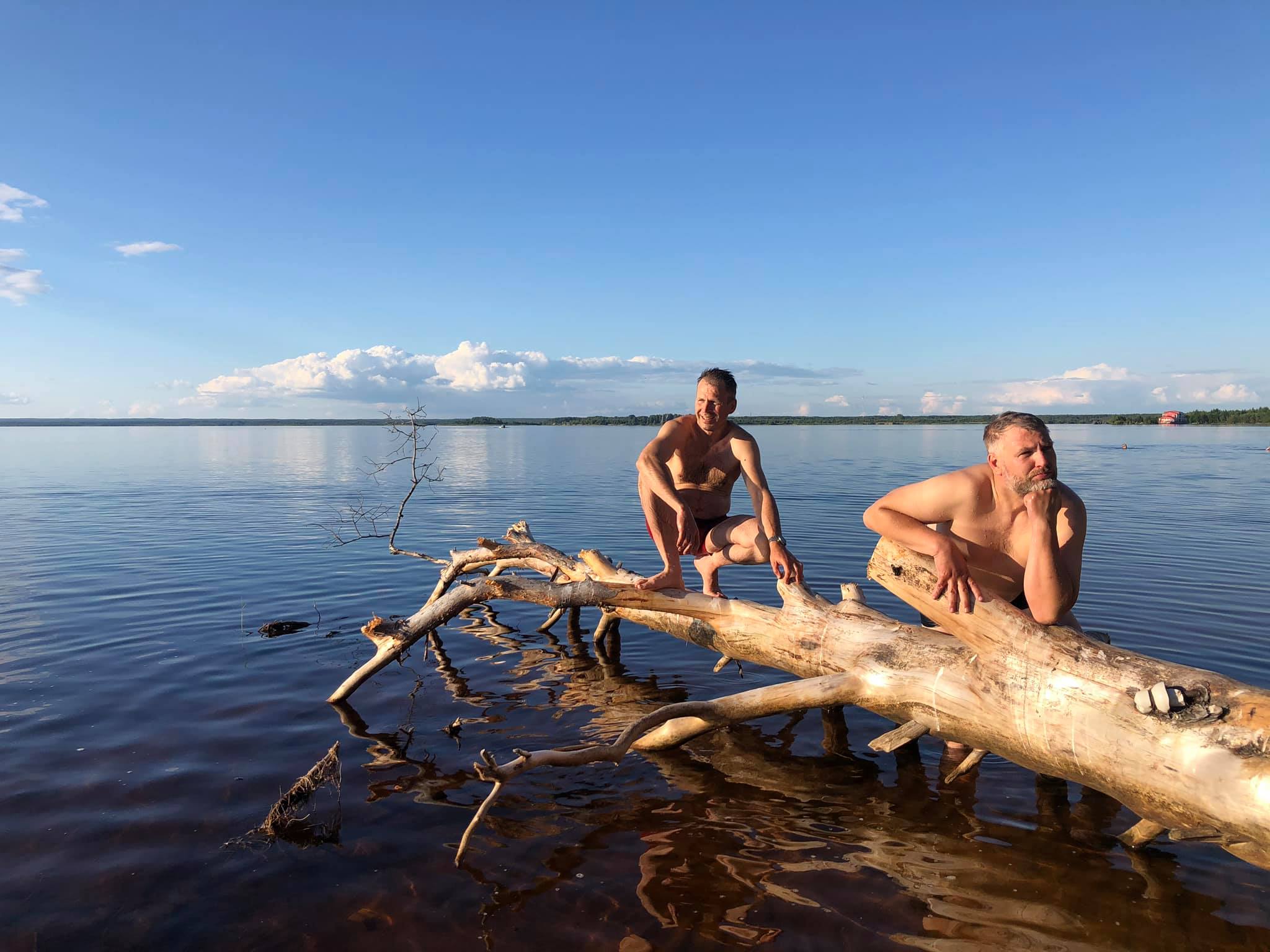

And there is a great place to relax in seven kilometres from Chelmuzhi: a sandy beach in a pine forest.
The pure water, soft sand and the smell of coniferous trees is better than in any southern sea resort. (N 62.559497, E 35.549942)
We crossed the White Sea Canal late in the evening, rode through Medvezhegorsk non-stop and stayed overnight in Segezha.
Kem.
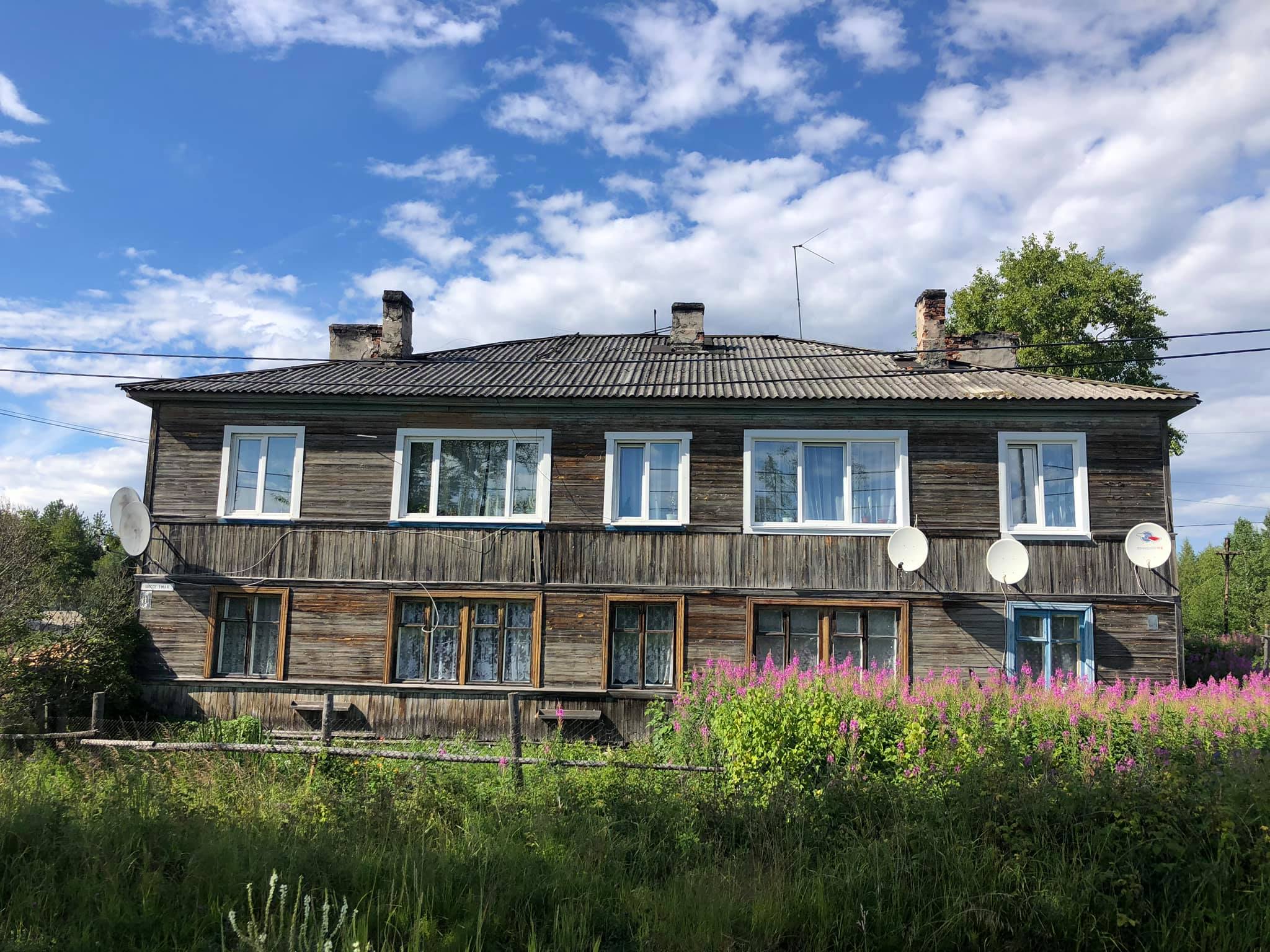
A small town in Karelia on the shore of the White Sea met us with broken roads, two-storey wooden barracks darkened by time,
dirty streets and squalid "architecture" of the 90s..


Kem is an ancient city. In the 15th-16th centuries it was the centre of one township in Russia of the same name. Do you remember the scene and the dialogue from the movie "Ivan Vasilievich changes profession"?
— What do they want?
— It's clear, Your Majesty. They want the Kemsk's township.
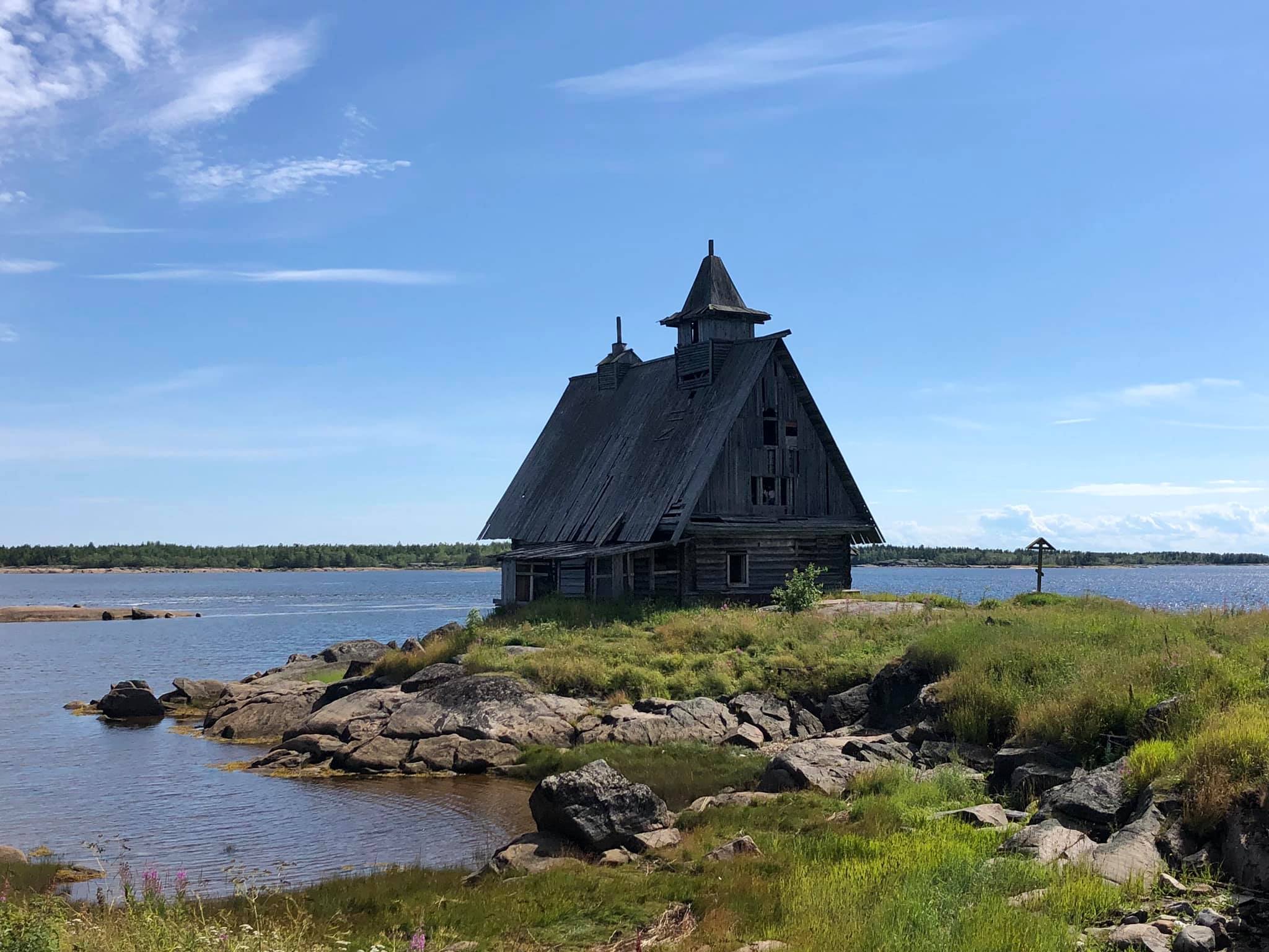
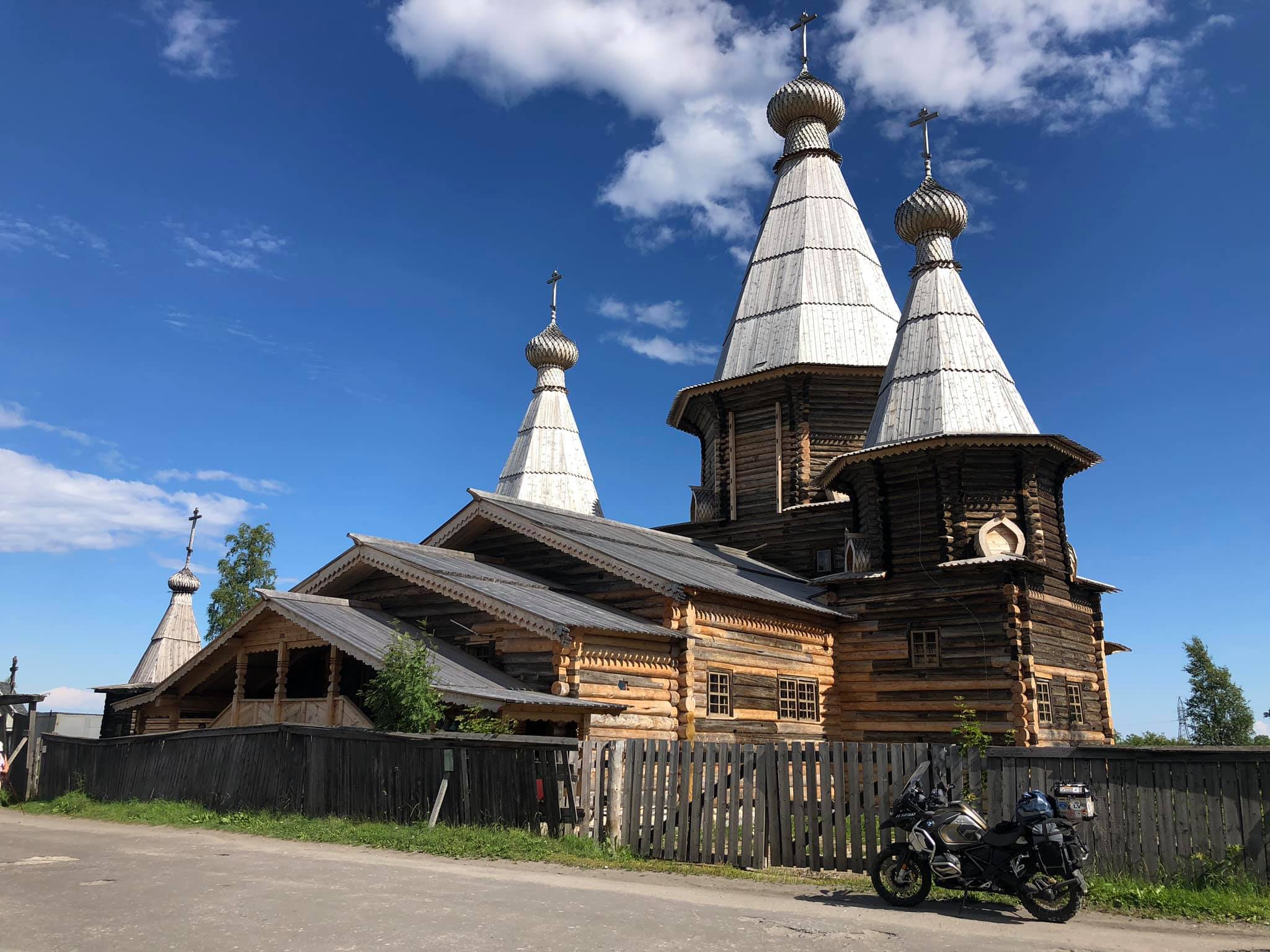
There are two attractions in Kem that you should visit if you happen to come here. The Assumption Church of the 17th century is a beautiful wooden church, which has been completely restored recently. There's a museum next to the church and a small stone island half the size of a football field in a 12 km distance from the first attraction.. In the island you can see a small house, which is similar to a church, but without crosses.
In fact, this house was a church, though not for long, only while Pavel Lungin's movie "The Island" was being filmed.
Yeah, exactly here Peter Mamonov, playing a part of a monk, expiated his mortal sin, rang the bells and cast out demons. What a beautiful place! ( N 64.994292, E 34.799582)
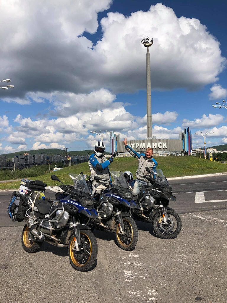
We arrived in Murmansk late in the evening. The Cola highway is almost perfect and has minimal traffic, so it's a pleasure to go.
The Sredny Peninsula.
There is a border guard checkpoint a hundred kilometres from Murmansk, if you move along the perfect Cola highway towards the Norwegian border.Here the security officers will check whether you have a passport of the Russian Federation, identify by your face whether you are a spy or not and then lift the barrier and wish you a nice journey. And just a kilometre from the checkpoint there is a wonderful motel "Titovka", a cafe where you can have some tasty snack and a clean toilet. ( N 69.481388, E 31.812446)
If you turn off the asphalt road between the checkpoint and the motel, you'll see the road that leads to Rybachy. But before you get to the edge of the earth, you will have to drive 30 km along a broken ground road to the Sredny Peninsula. At the top of one of the passes you will enjoy a fascinating view of the sea and both peninsulas.
As soon as you get to the Sredny one, turn left at the crossroad and in 2.5 km you will see several wooden buildings. This is a private museum of defense. (N 69.641698, E 31.892819)
A week after the beginning of the war selected mountain divisions of the Wehrmacht reached the isthmus of the peninsula and were stopped by Red Army soldiers on the Musta-Tunturi mountain range. The defense of strategically important borders lasted for almost three years.
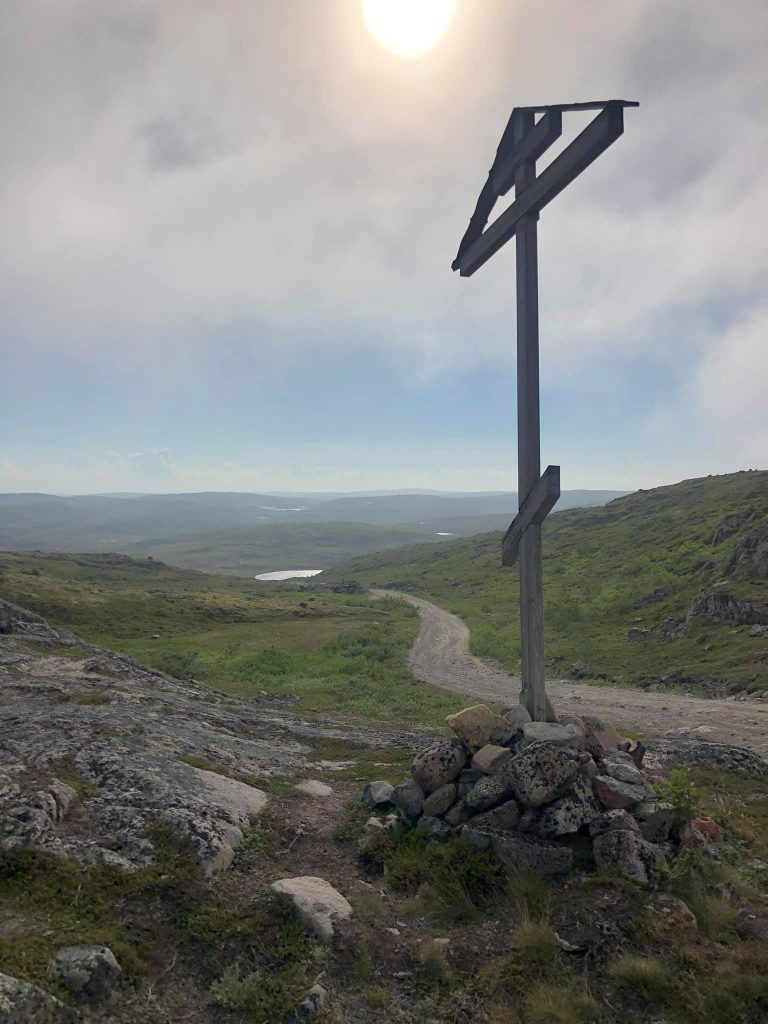
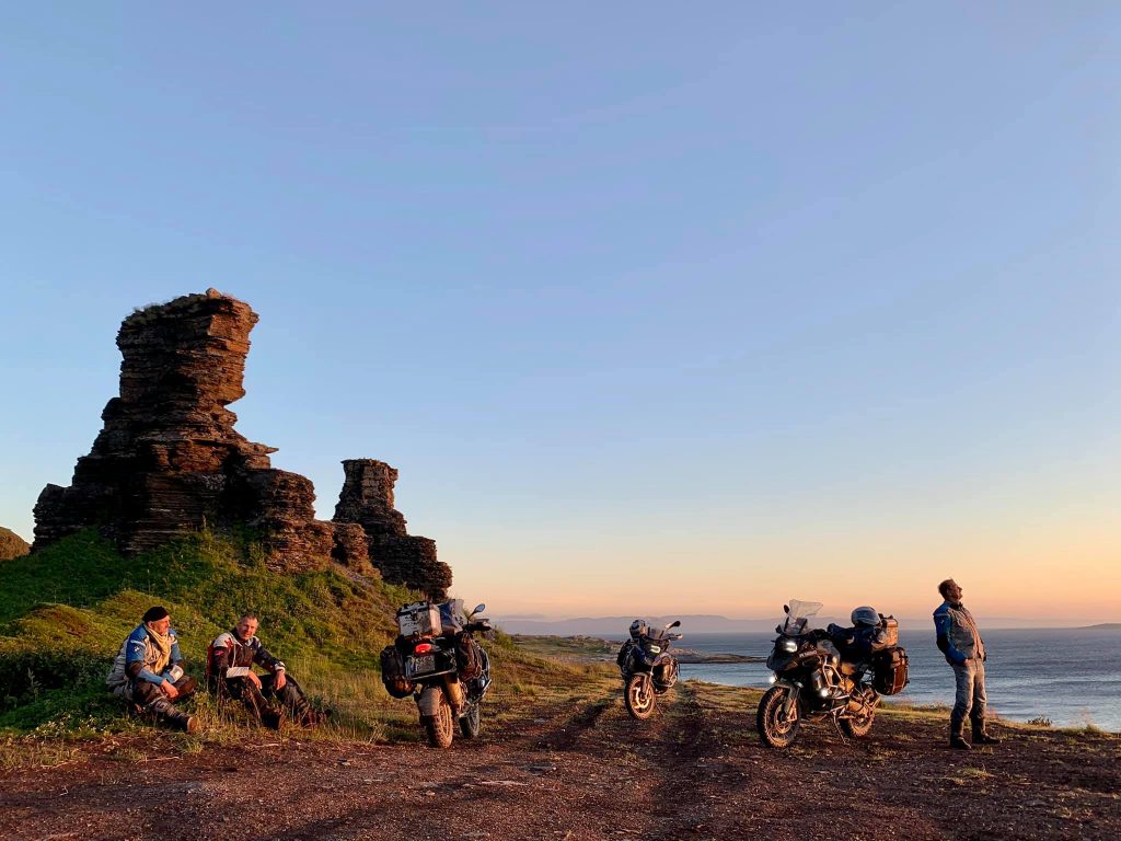
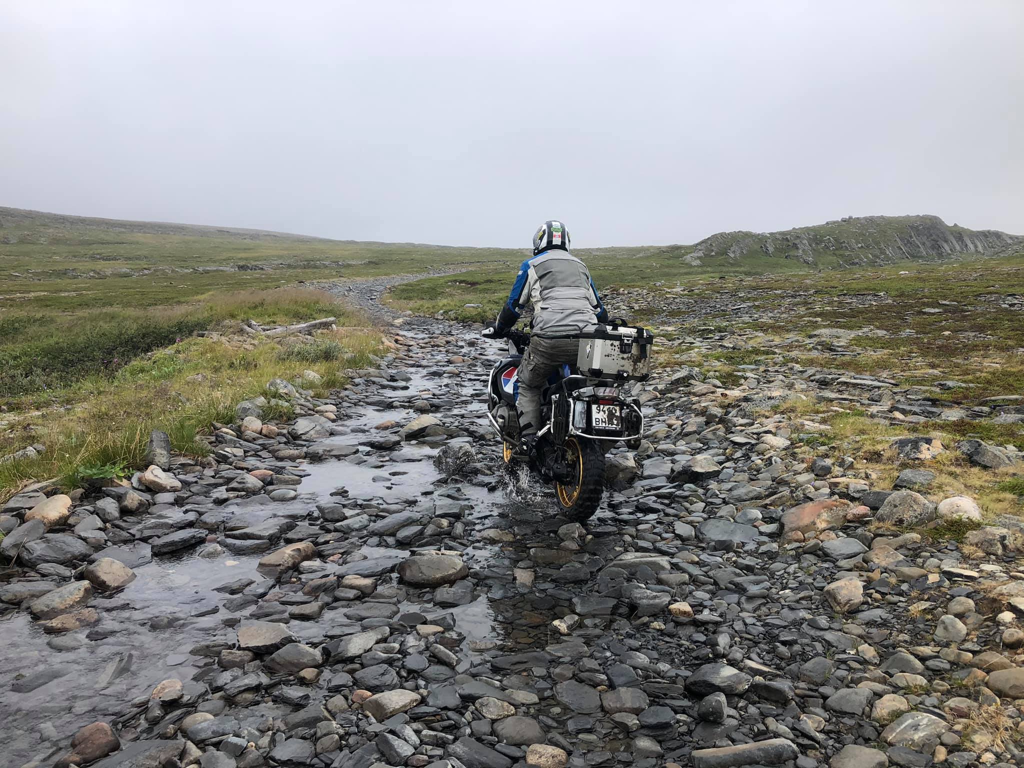
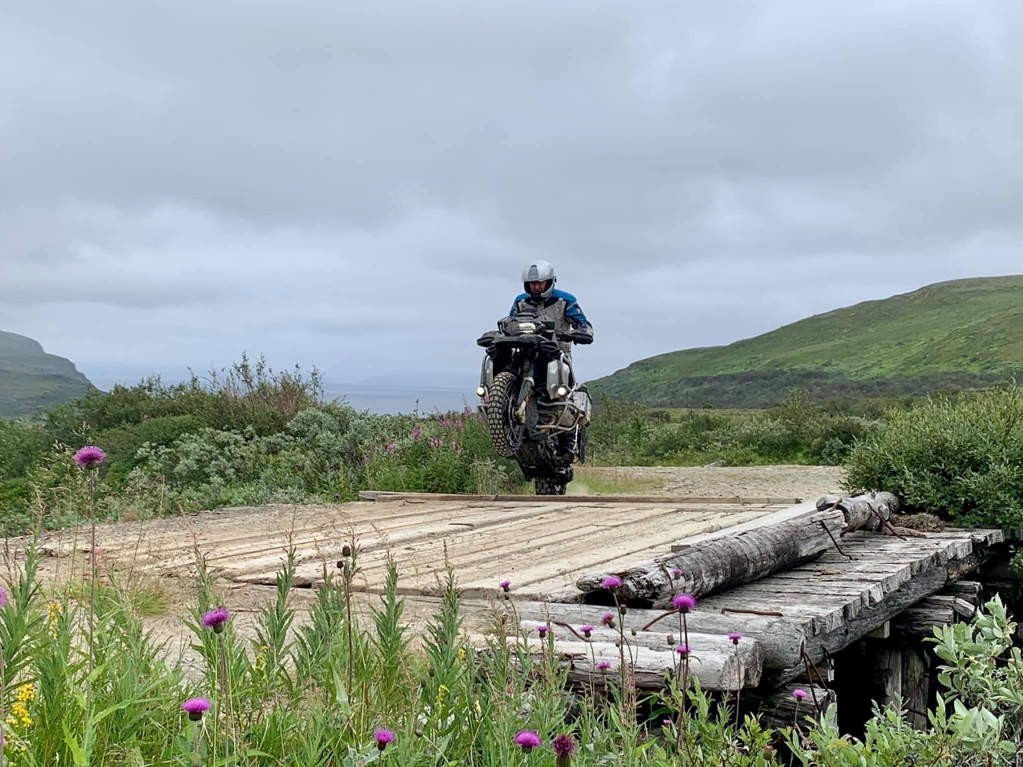
You can... no, you should climb to the top of the ridge and walk along it for several kilometres. Trenches and dugouts hollowed out in the rocks are strewn with rusty shell casings, cartridges, mortar shells. There is barbed wire on half-rotted poles along the whole way. And all this is not a scenery, but the very reality of that terrible battle. We are going further north along the coast of the Barents Sea. The road is not easy because of deep puddles, rocky ascents and steep descents. We climbed another hill and saw an awesome view! The sun is slowly going a circle above the horizon. The polar day has recently ended, but the night lasts less than three hours and looks more like twilight.
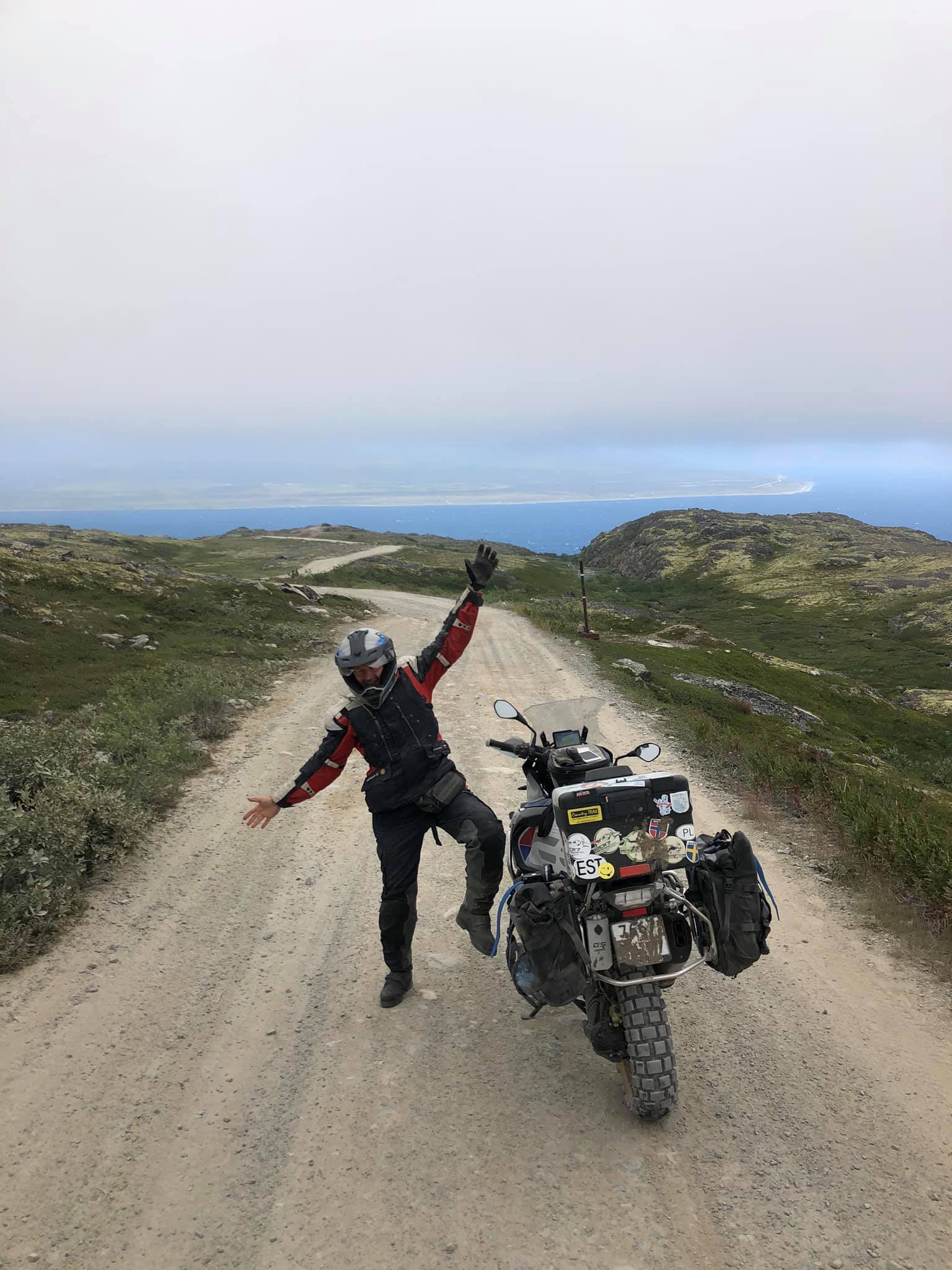
By the end of the day we had reached the Two brothers. This is one of the most exciting and wonderful places on the peninsula! Two rocks, which look like two minarets, stand on the shore of the Barents Sea. ( N 69.824148, E 31.767283)
Late in the evening we arrived at the Big Lake camp in the Rybachy Peninsula. (N 69.717265, E 32.165975)
Rybachy.
The Big Lake camp, where we had settled for the next three days, consisted of several small wooden houses with 4-6 beds. There was also a dining room, a sauna, a dryer, a pretty toilet and even showers. All this pleasure cost 2500 roubles per one person per day. Meals were paid separately.
All the rooms had been purchased a few months before and since we hadn't not take care of the accommodation in advance, we had to settle in our own tents. This isn't free either, one tent-place cost 1500 roubles.

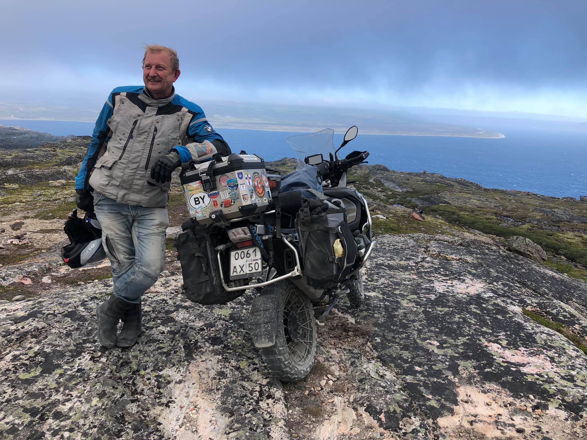
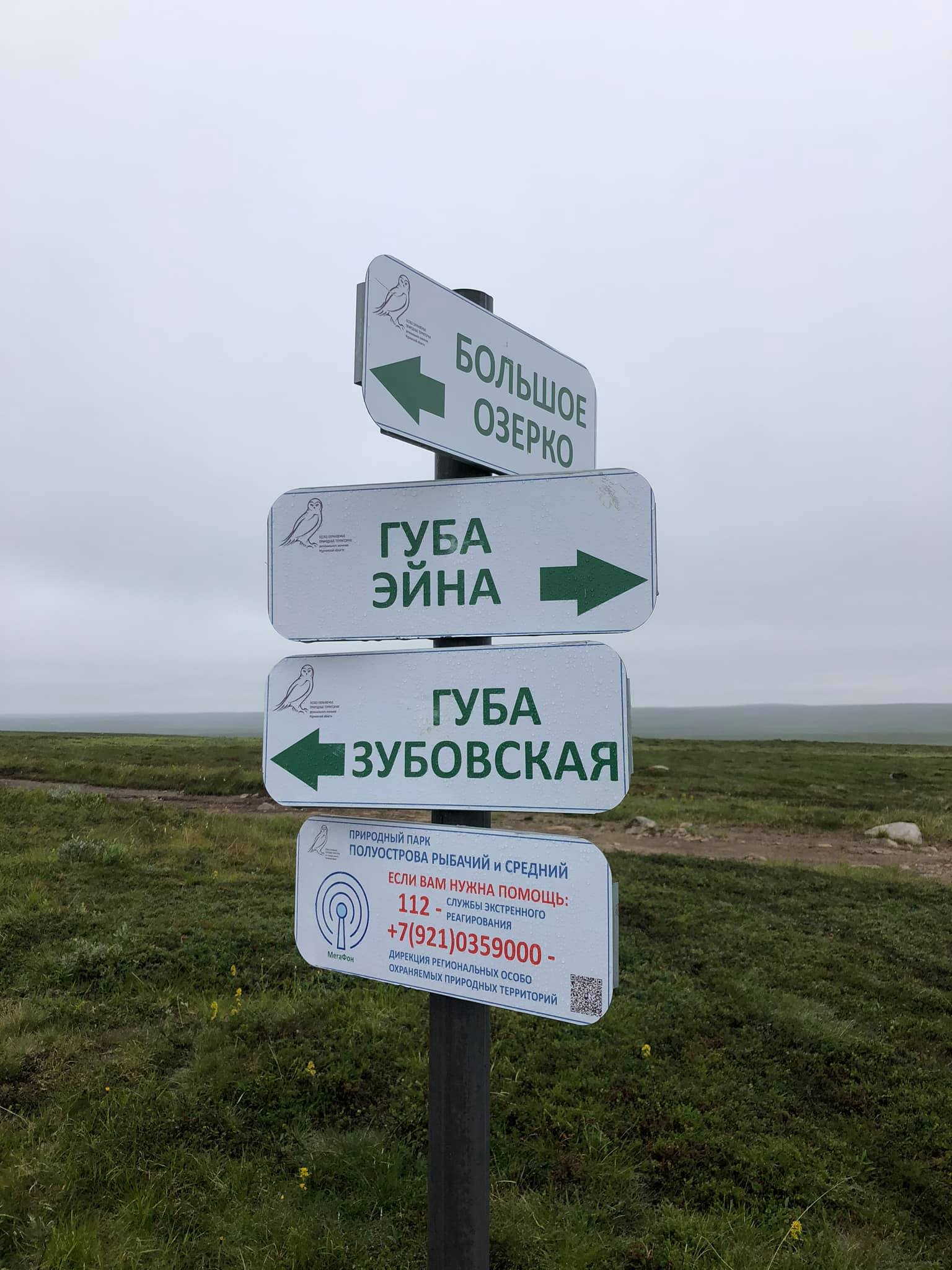
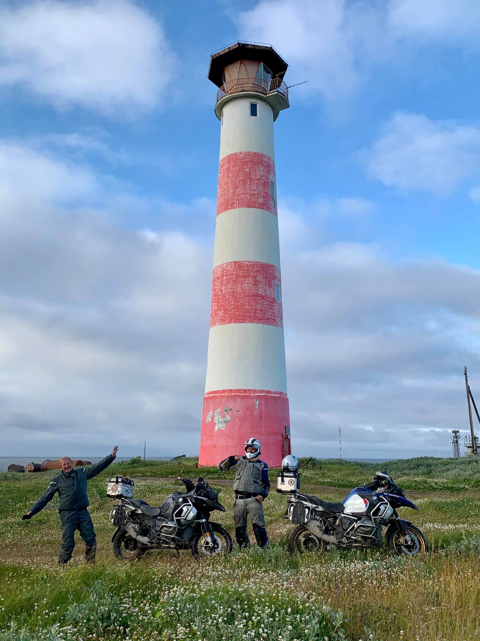
The Rybachy Peninsula is about 80x30 km in size. There are no good roads as well as in the Sredny. There are just several directions of varying levels of passability. The most "decent" ones go along the western and northern coasts to the Nemetskij cape and a little further. There is a lighthouse on the cape itself, which is one of the goals of our trip. The lighthouse is located on the territory of a military unit, so there are a lot of forbidding signs around. And if you drive up to it for taking a picture, be ready to hear from a man in uniform, running to you, everything he thinks about you and your relatives in a strong language (N 69.94724, E 31.940975) In general, there are many military units and facilities in the peninsula and exercises of firing are often held here. Traces of military presence are visible everywhere: abandoned barracks, rusty remains of equipment, operating radar stations, concrete pillboxes and piles of scrap metal are scattered throughout the whole peninsula.
It's really not easy to travel around Rybachy. If you are going here by car, then a prepared jeep will be suitable for this area, but you will go at average speed of not more than 20 km/h.
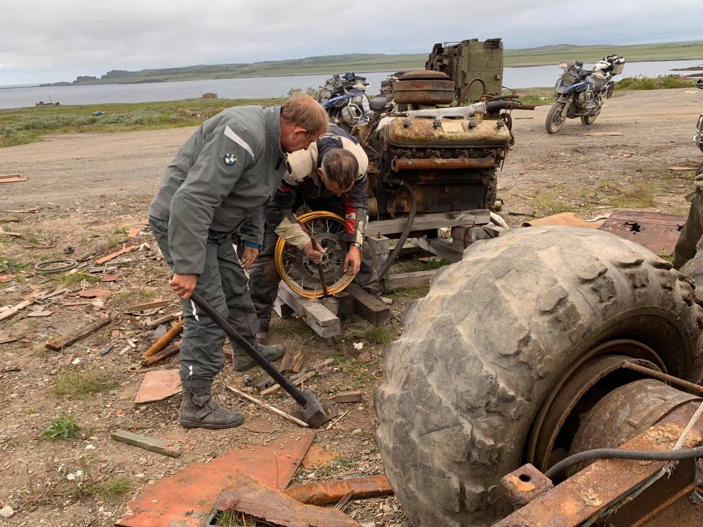
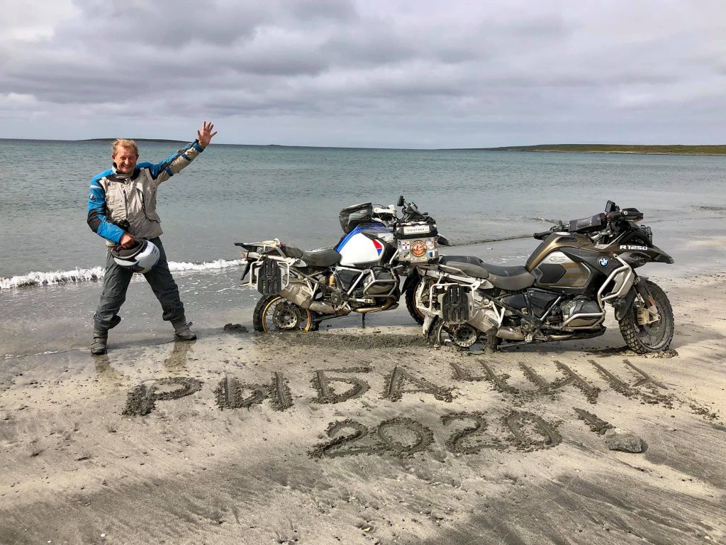
On the very first day the spirit of Rybachy began to collect tribute from us. Some bike mirrors, plastic trim elements and suspensions were broken and on the second day, one of our team members, Alexander, lost the front wheel! When he was descending from a steep cliff, he suddenly ran into a large stone in the grass.
Our attempts to straighten the rim with a sledgehammer (which was kindly provided to us by the sergeant of the auto-unit) didn't make a success. As a result, Alex rode 30 km to the camp through rocks, sand and fords on a completely disassembled wheel.
But the lighthouse was conquered by us!
Rybachy.
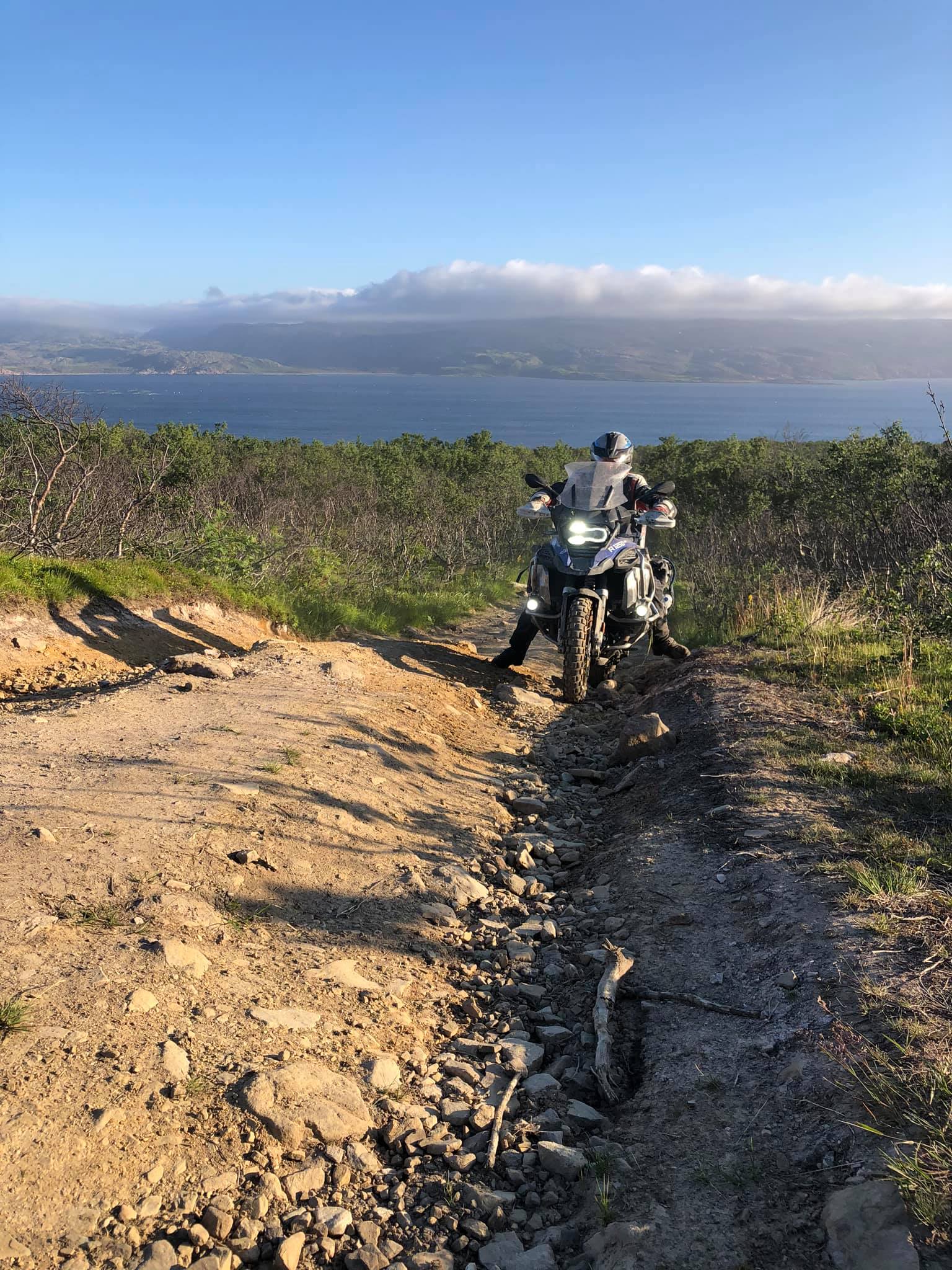
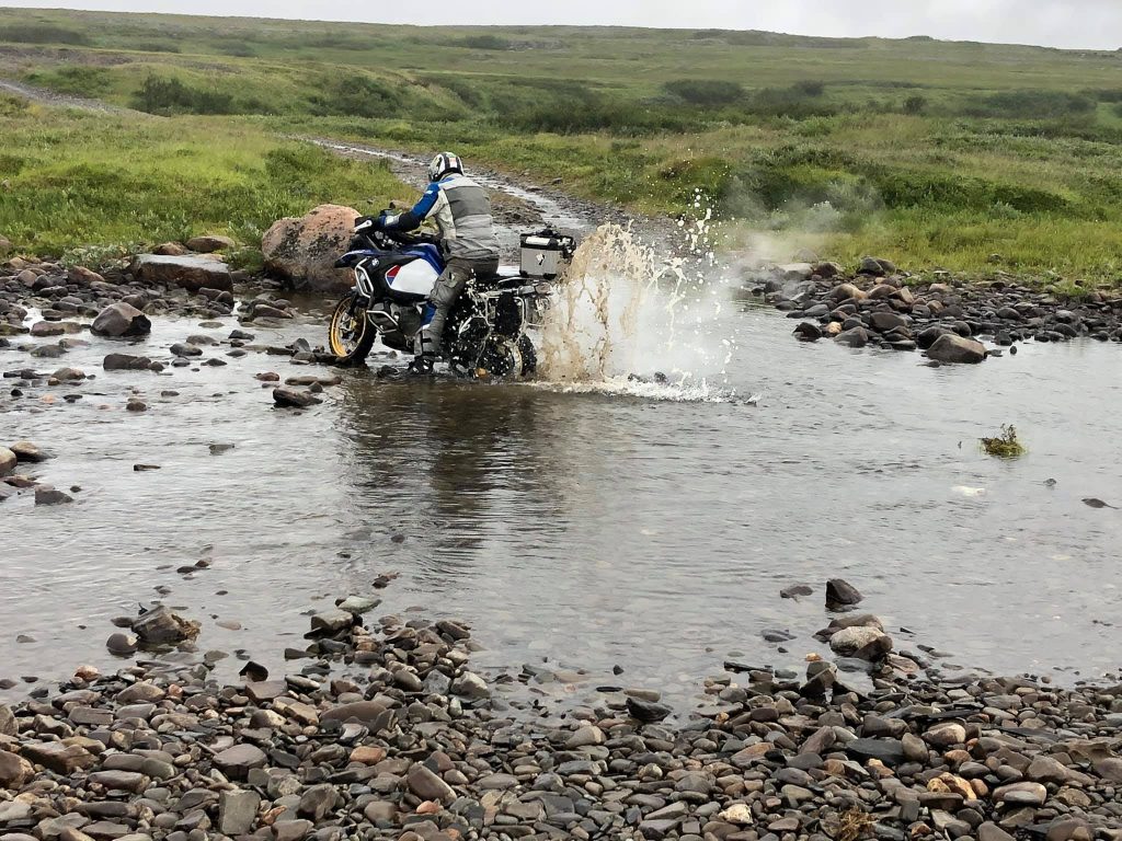
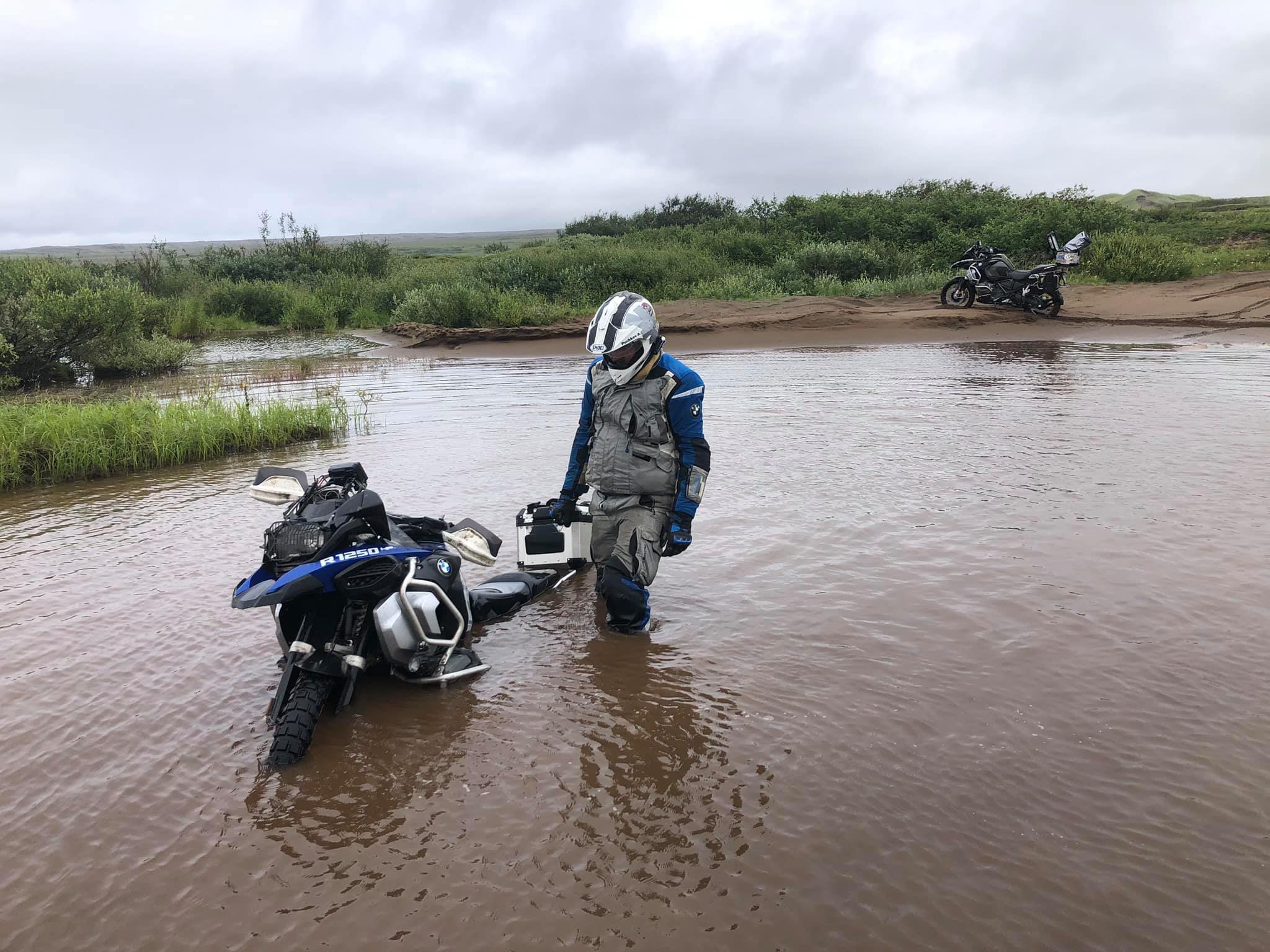
The third day was the most difficult, when the two of us decided to take the most complicated route from the bay Eina in the south of the peninsula to a place with an unusual name Tsypnavolok. Actually, this road of death is considered passable only for all-terrain vehicles and ATVs, so I don't know if anyone has tried to drive along it by heavy motorbike or by ordinary car.
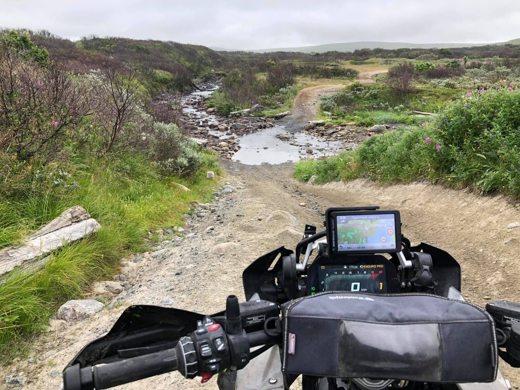
On the way to the Tsypnavolok lighthouse we had to overcome huge deep puddles several dozen metres long. They were similar to lakes and at the bottom of each there were logs and stones (as big as watermelons) hidden under muddy water. In addition, we went through impassable swamps, rocks and rotten bridges. ( N 69.745112, E 33.073704)
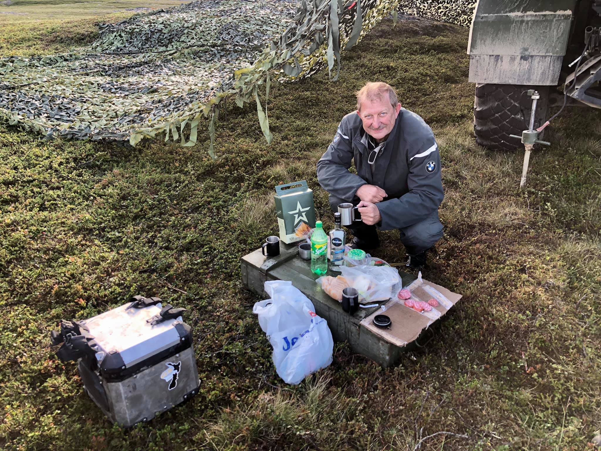
We got bogged down in the swamp, built an improvised corduroy road with sticks, dragged the motorbikes on ourselves... 125 km from the lighthouse and back along an equally difficult route took us 12 hours. First, we were lucky that, at least, it didn't rain. However, it started raining as well soon. The temperature dropped to +8°C and our boots were full of cold water and sand.
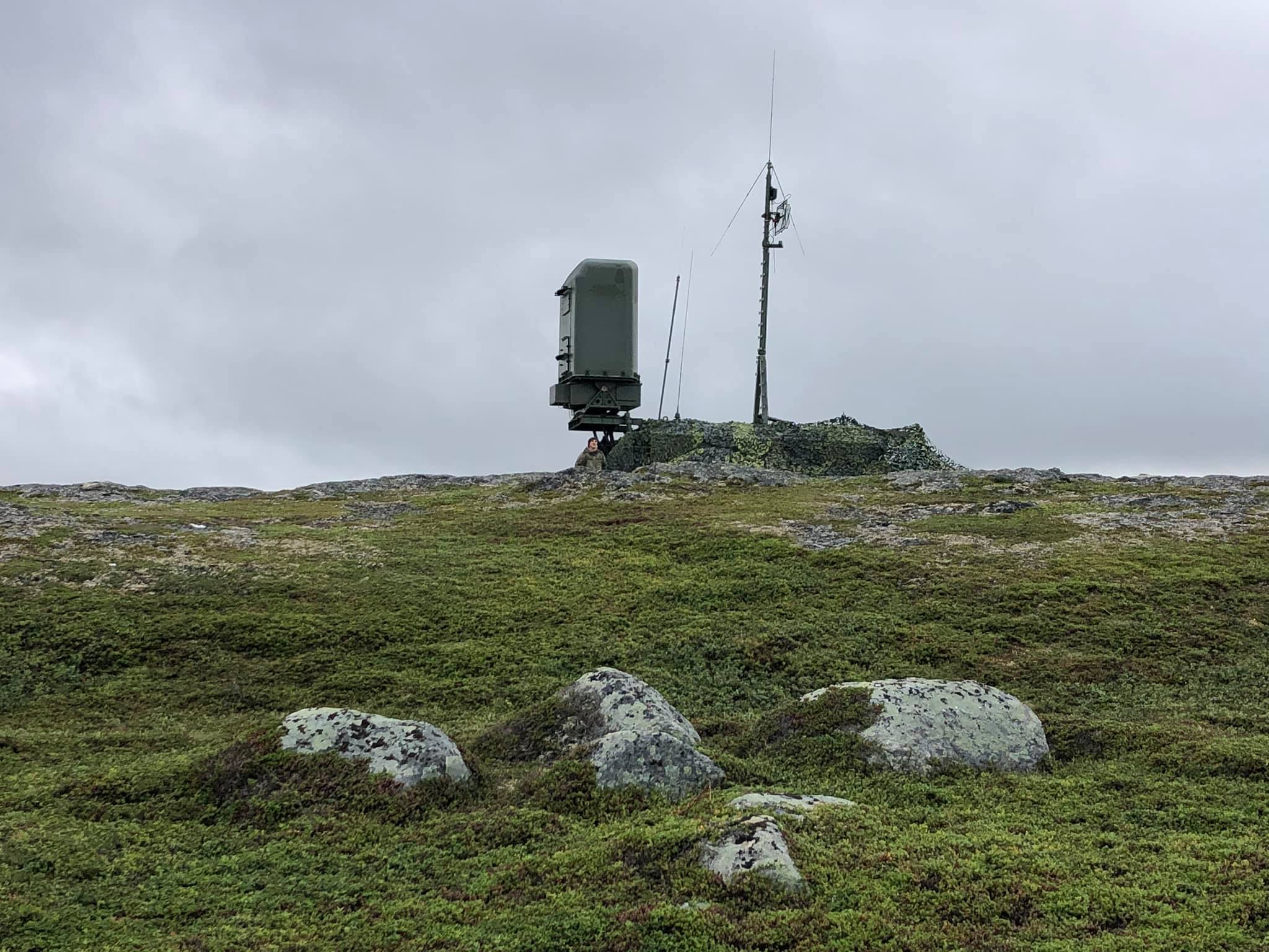
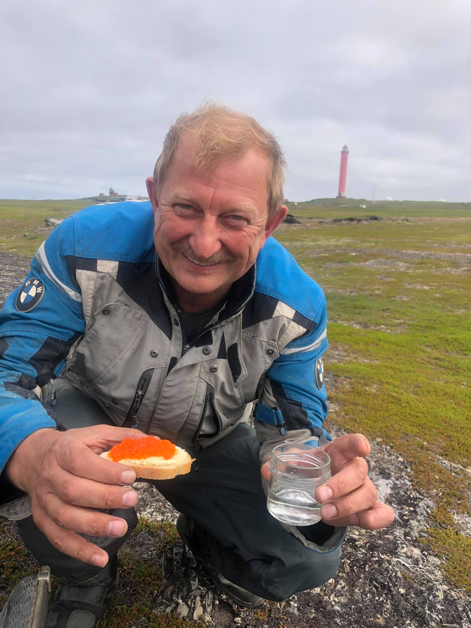
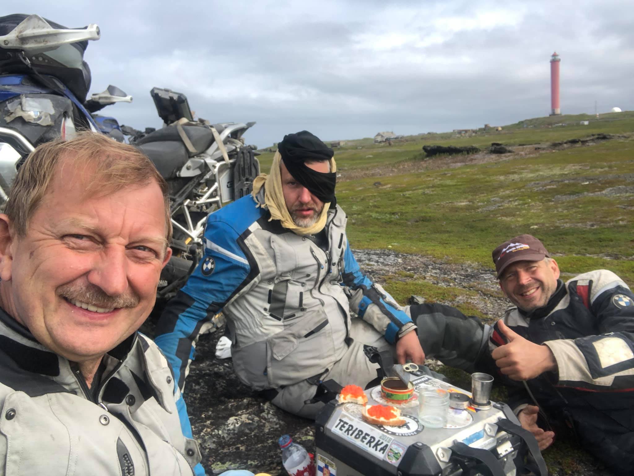
When we almost reached the lighthouse, we saw a huge tractor behind the hill, covered with a camouflage net with an antenna on top. A sergeant came out to us, shared the cigarettes, as ours got wet. We talked about this and that and five minutes later we were already warming up with a bottle of vodka at an improvised table, set on a ZIP box.
I can say that the crew of the mobile radar saved us from cold and starvation. :) They are great guys!
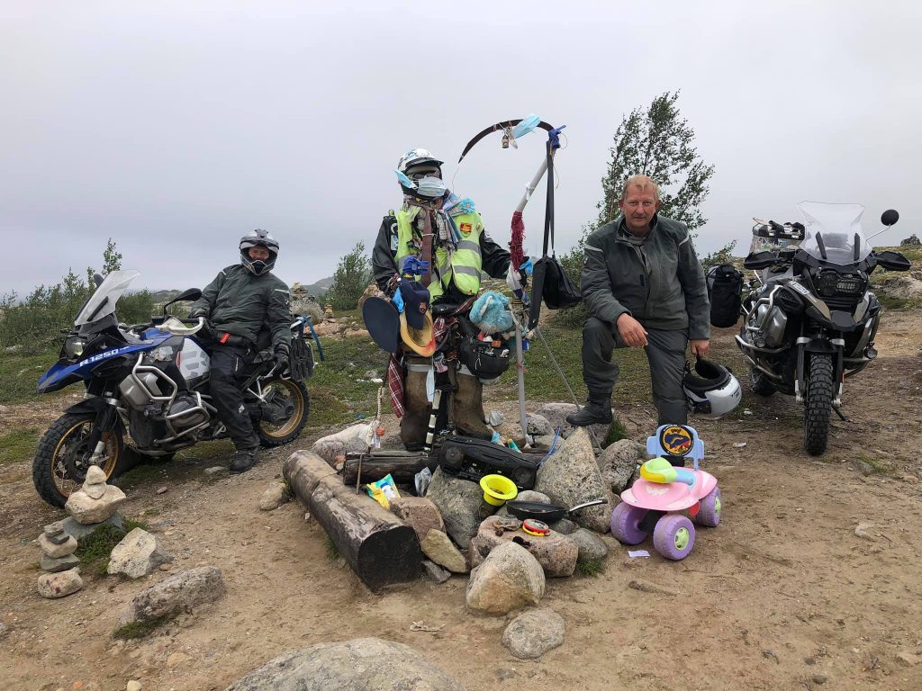
They had been alerted three weeks ago and all this time they had been going around Rybachy, monitoring NATO ships that had entered the Barents Sea. Unfortunately, I may not publish a photo with them.
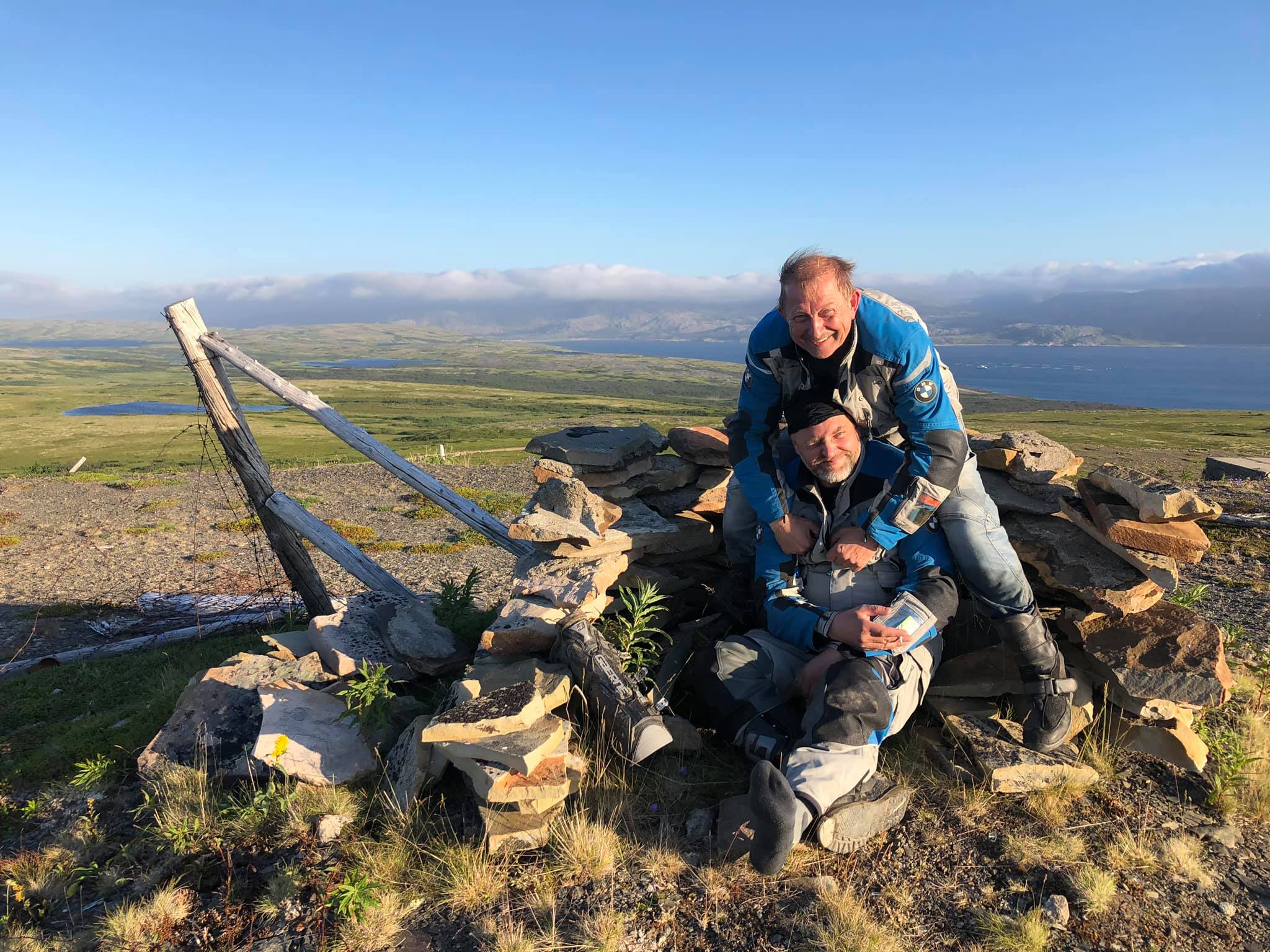
We returned to the camp after midnight.
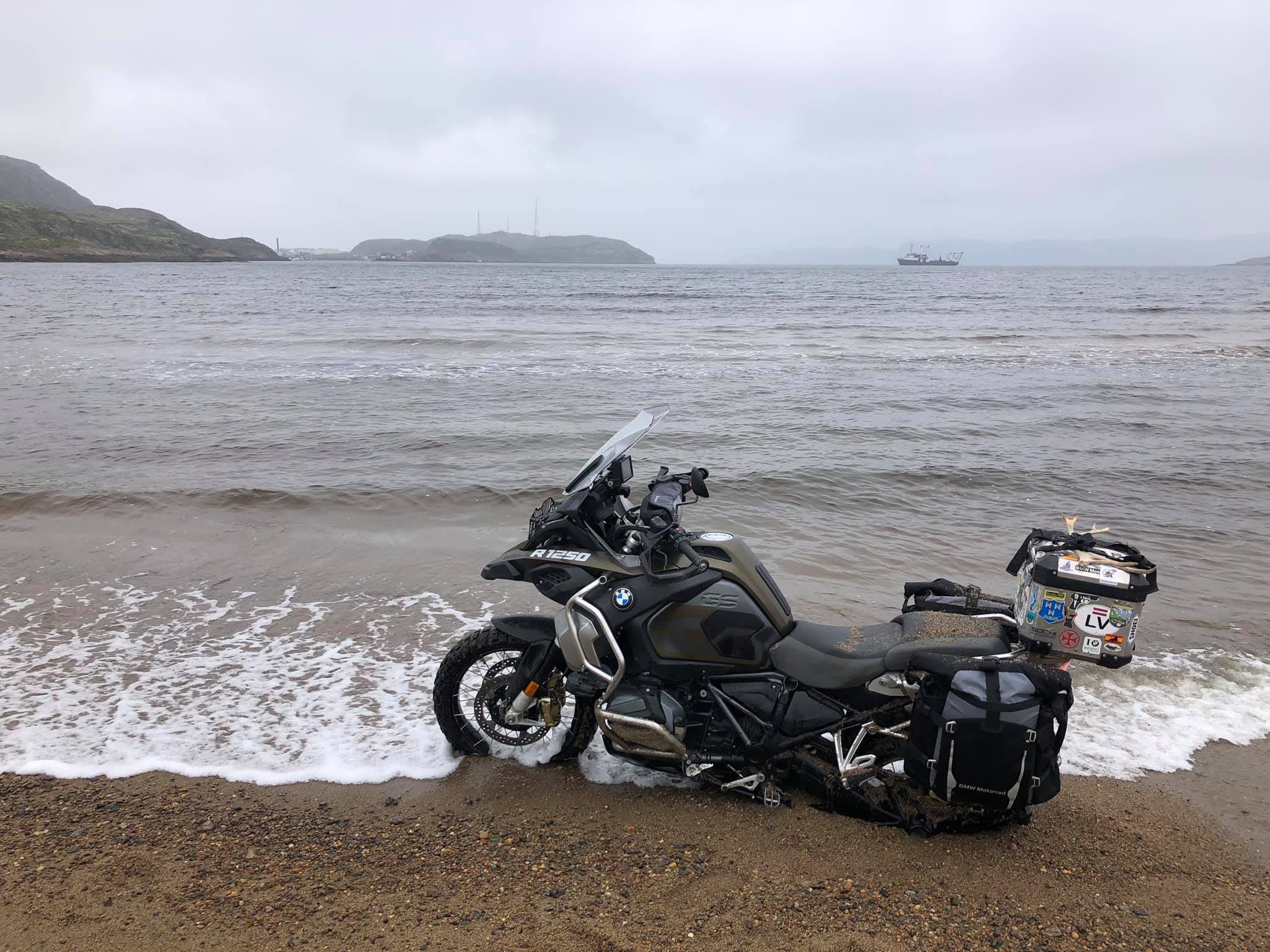
Teriberka. There are many unique and interesting places on the Kola Peninsula. One of them is Teriberka, a village on the shore of the Barents Sea (or the Arctic Ocean, which is basically the same thing).
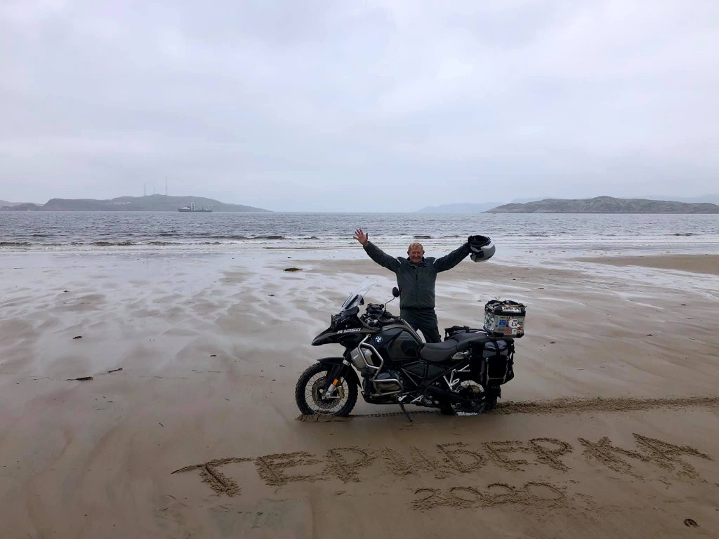
One hundred kilometers from Murmansk along the excellent asphalt road, another 40 km along a broken grader road and we reached Teriberka, which became a symbol of depression and devastation after the release of the film "Leviathan" by Andrei Zvyagintsev in 2014.
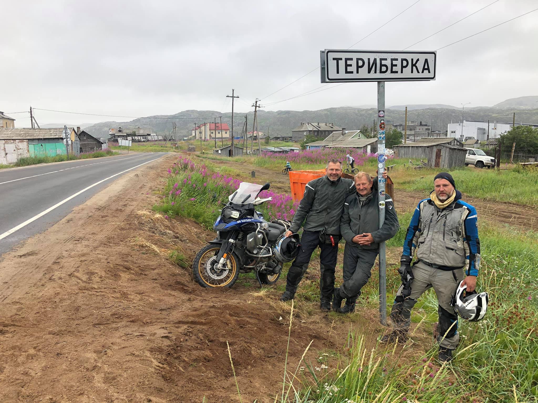
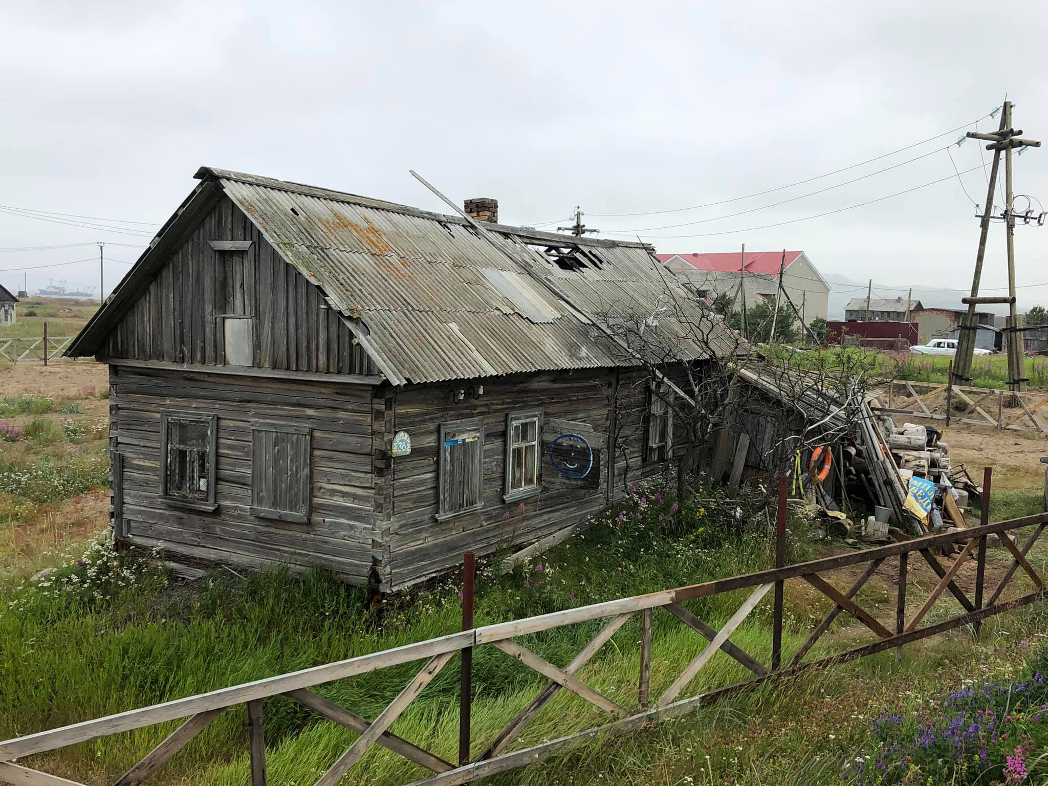
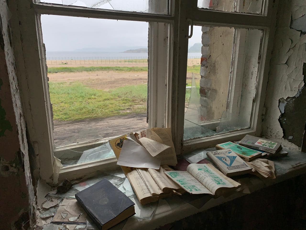
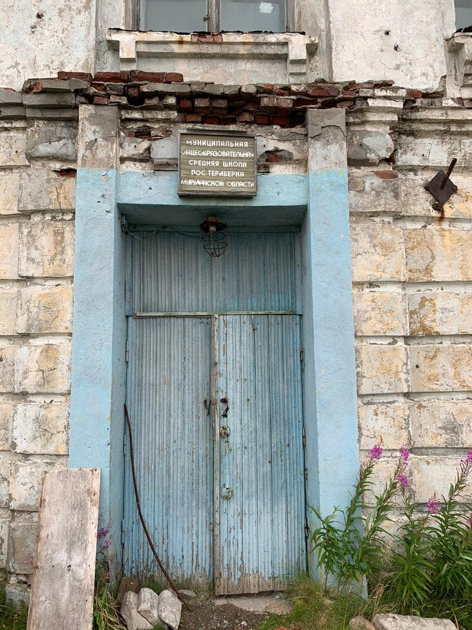
It used to be a pretty decent fishing village with a fish factory, a secondary school and a house of culture. But all the benefits of the USSR civilization fell into decline in the 90s and the village has never got out of this condition since then.
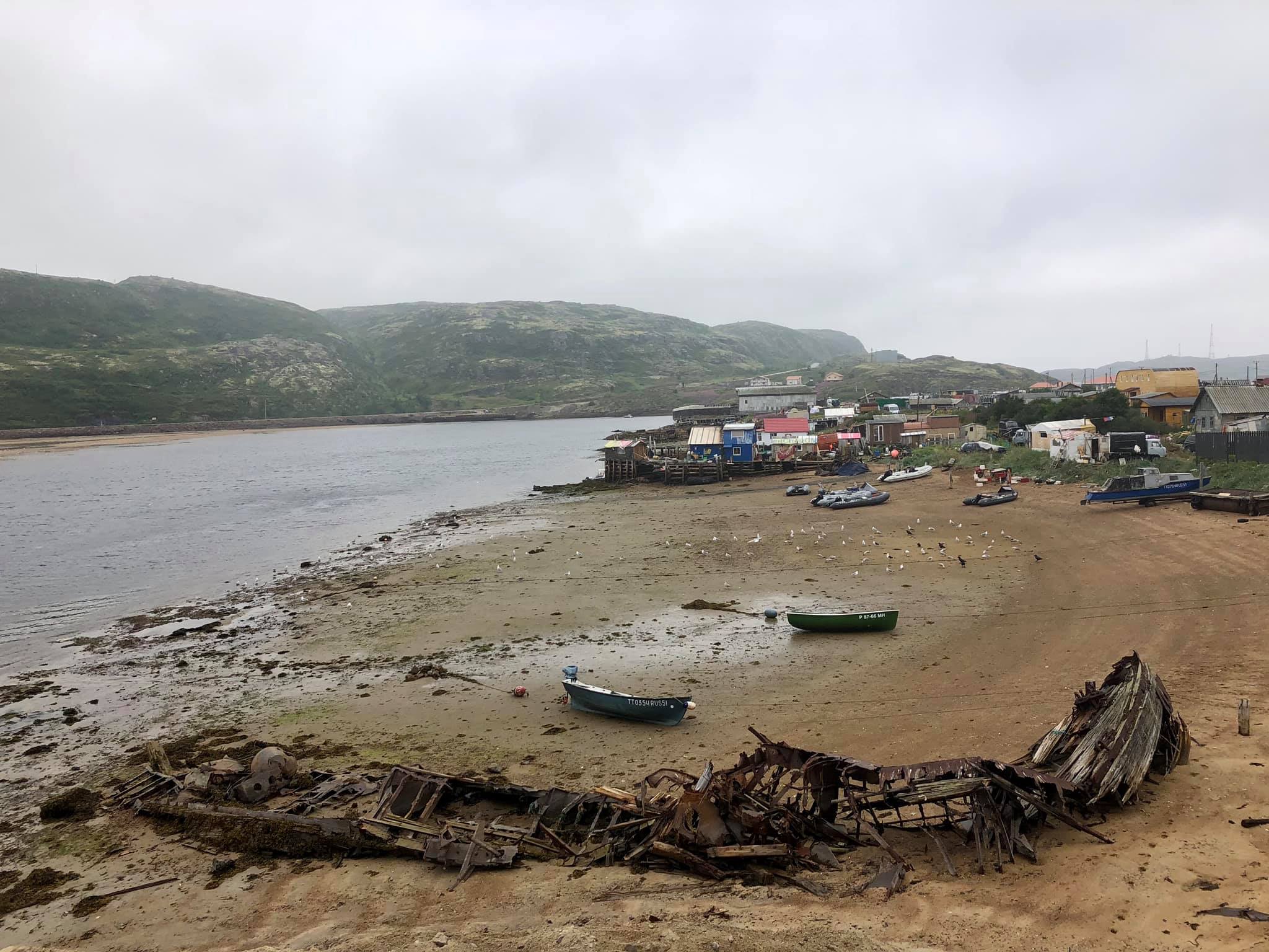
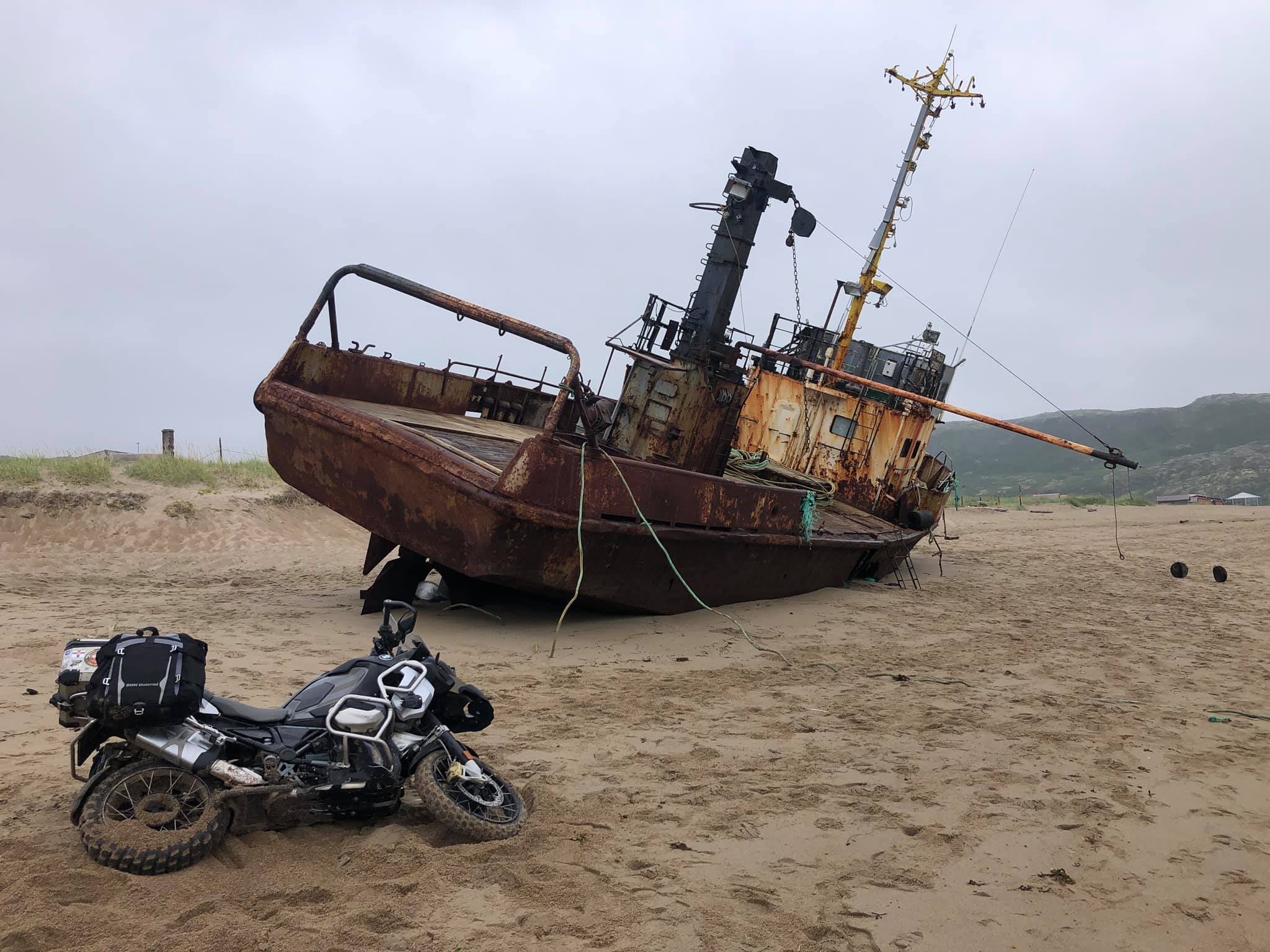
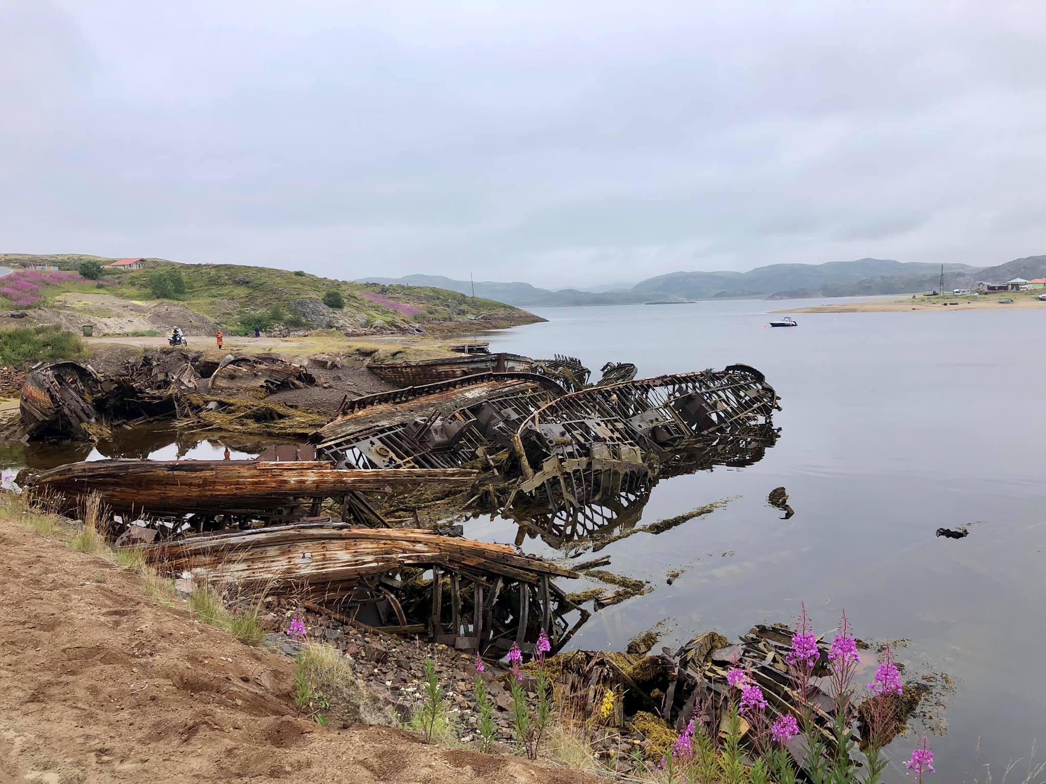
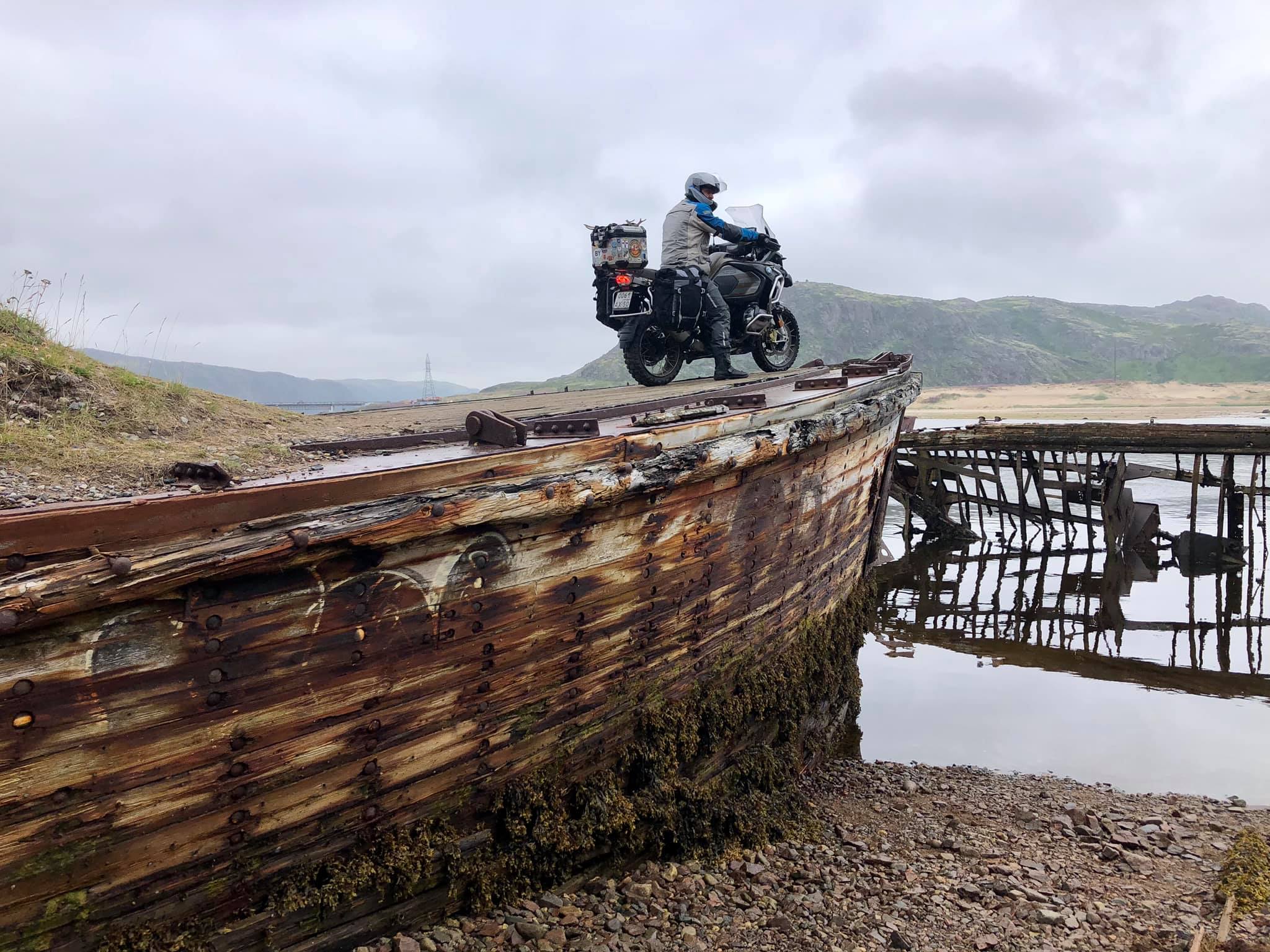
Teriberka made a twofold impression on me. On one hand, wrecked houses, an abandoned school, a rotten pier and the remains of fishing schooners on the shallows (similar to the skeletons of dead whales) create a very sad atmosphere. (N 69.169186, E 35.121957)
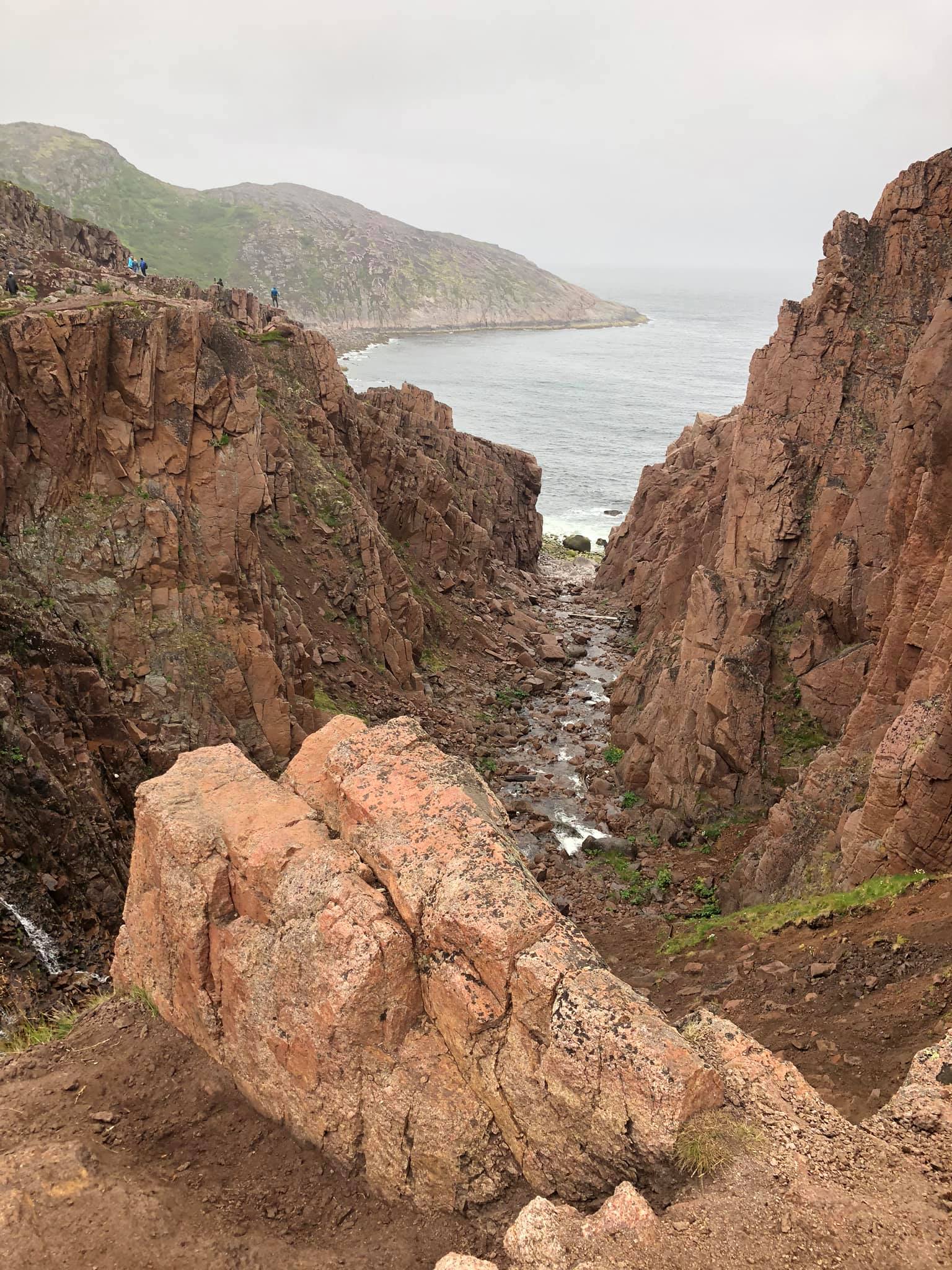
On the other hand, its nature is very colorful and incredibly beautiful. I've seen huge cold rocks and an endless perfect sandy beach, on which during low tide you can drift and race, unscrewing the throttle at maximum.

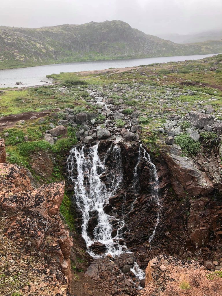
There was a waterfall of amazing beauty and nests of gulls and cormorants on the rocks. ( N 69.204655, E 35.067519)
In recent years many tourists have visited Teriberka, especially from China. They come here in winter to see the Northern Lights, although, certainly, no one can guarantee that it would appear.
In Teriberka there are several quite decent hotels and a wonderful restaurant on the very edge of the seashore. (N 69.168043, E 35.133069)

So if you are going to this area, you don't need to stock up on canned food and bring a kerosene stove with you. You can find everything you need here! :)
comments powered by HyperComments