 Cap-travel.ru
Caucasus 2020. Moto-travel. Part 3


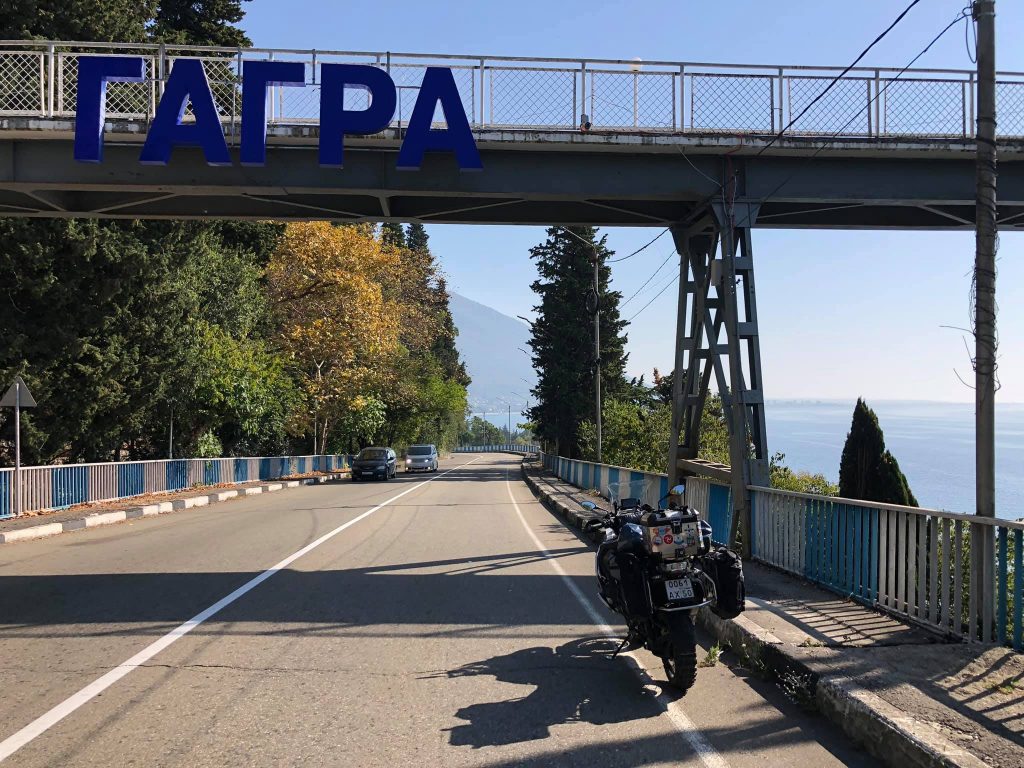


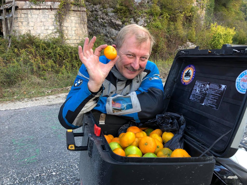
Abkhazia is a land of mandarins, palms, eucalyptus trees, mountain gorges, waterfalls, and warm sea.
In Soviet times, it was an elite resort with grand sanatoriums and vacation homes, where the former bohemia loved to relax. However, even an ordinary person could afford to spend their vacation on the beaches of Gagra, Pitsunda, or Sukhumi.
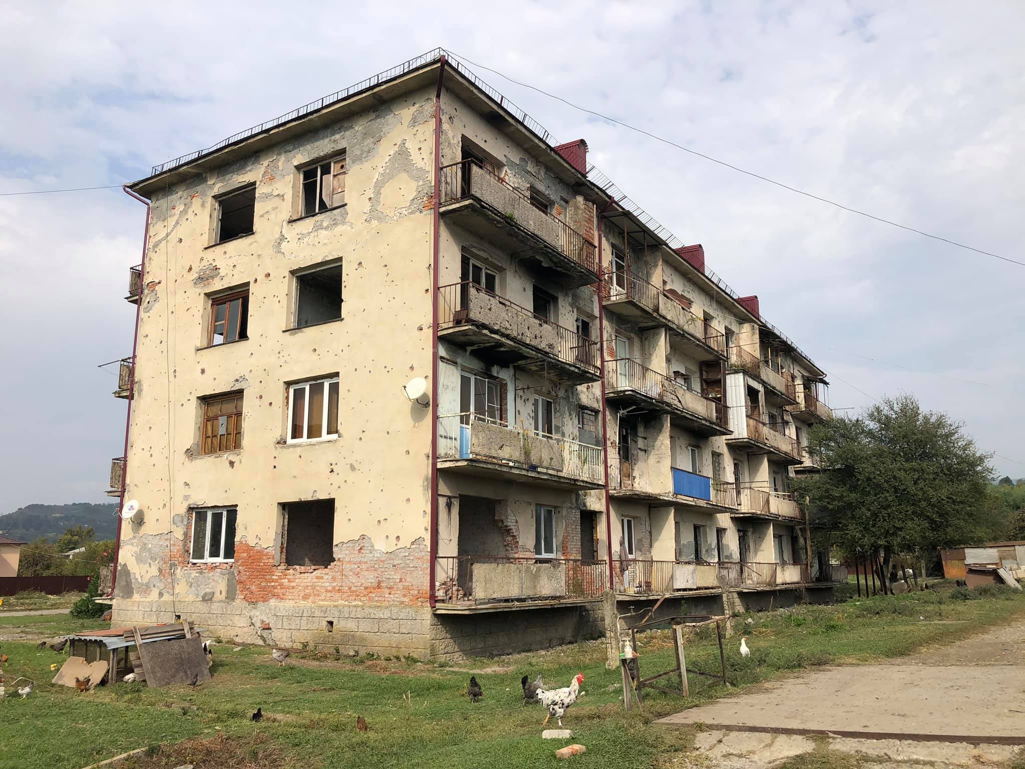
After the war of 1992-93, almost all the infrastructure was either destroyed or fell into decay for many years. Once a flourishing paradise, it turned into one of the most depressing places in the North Caucasus. The war ended 27 years ago, but to this day, numerous ruins, multi-story buildings with holes in the walls from shell hits, abandoned houses with trees growing on balconies and roofs, serve as reminders of those times.
There are indeed some positive changes, and that's pleasing to see. Good roads, clean and spacious beaches, quite decent hotels, affordable cafes and restaurants - all of these can appeal to easy-going vacationers. But the most important reason to visit Abkhazia is its nature! High-mountain lakes, stunningly beautiful gorges, waterfalls, hundreds and thousands of kilometers of mountain roads and trails - a paradise for motorcycle and off-road enthusiasts who love to travel.


I traveled through Abkhazia for two days, but, of course, that's not enough. You need a minimum of a week, or even more, to explore the most beautiful places of this wonderful country.
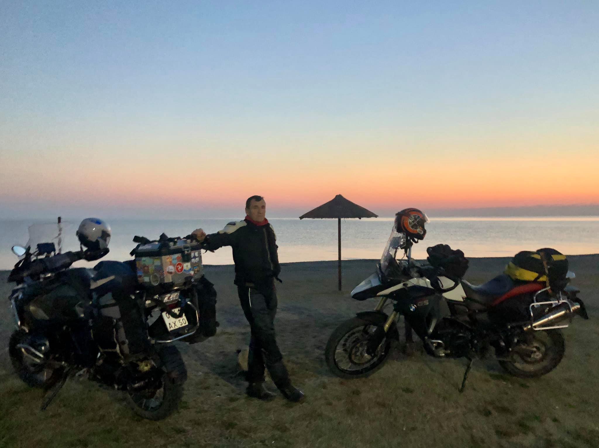
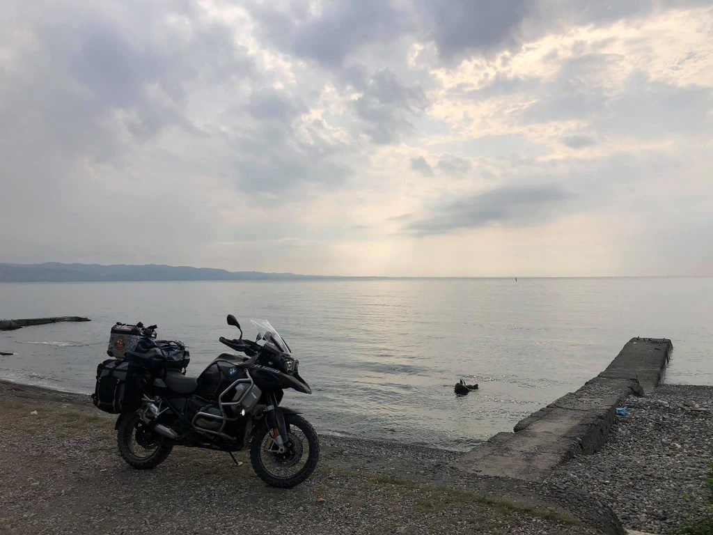
So, I'm flying back home alone, and my motorcycle will stay behind, patiently waiting for me in the yard of one of the cozy private houses right by the warm shores of the Black Sea.
I hope the parting won't be for long!))
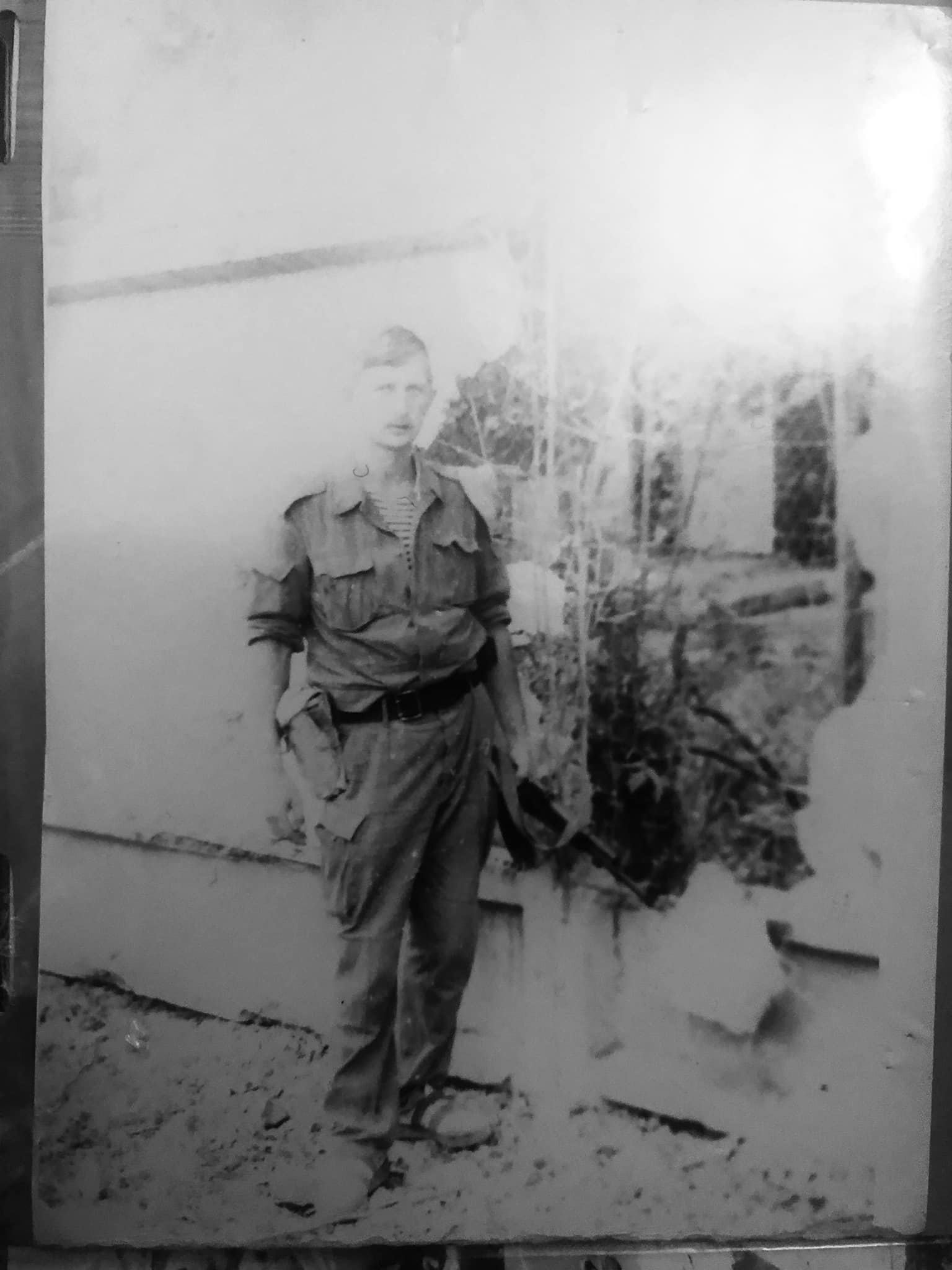
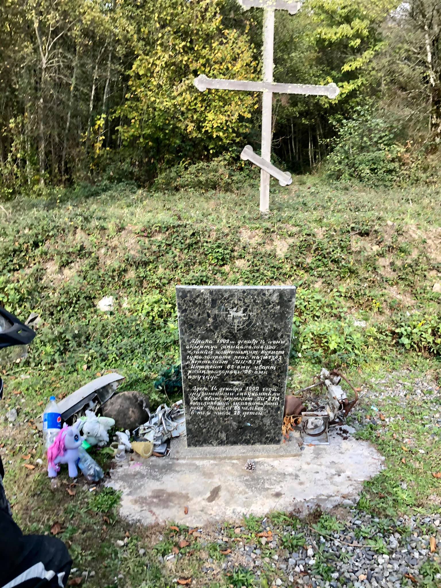
Between these photos, there's exactly 28 years..
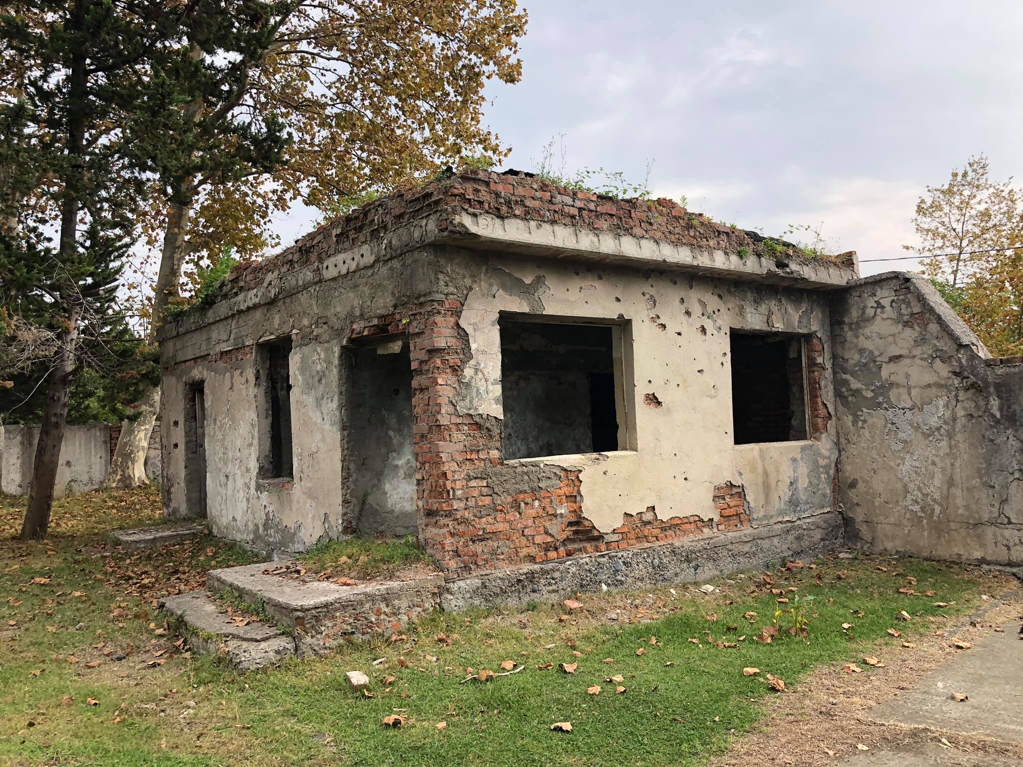
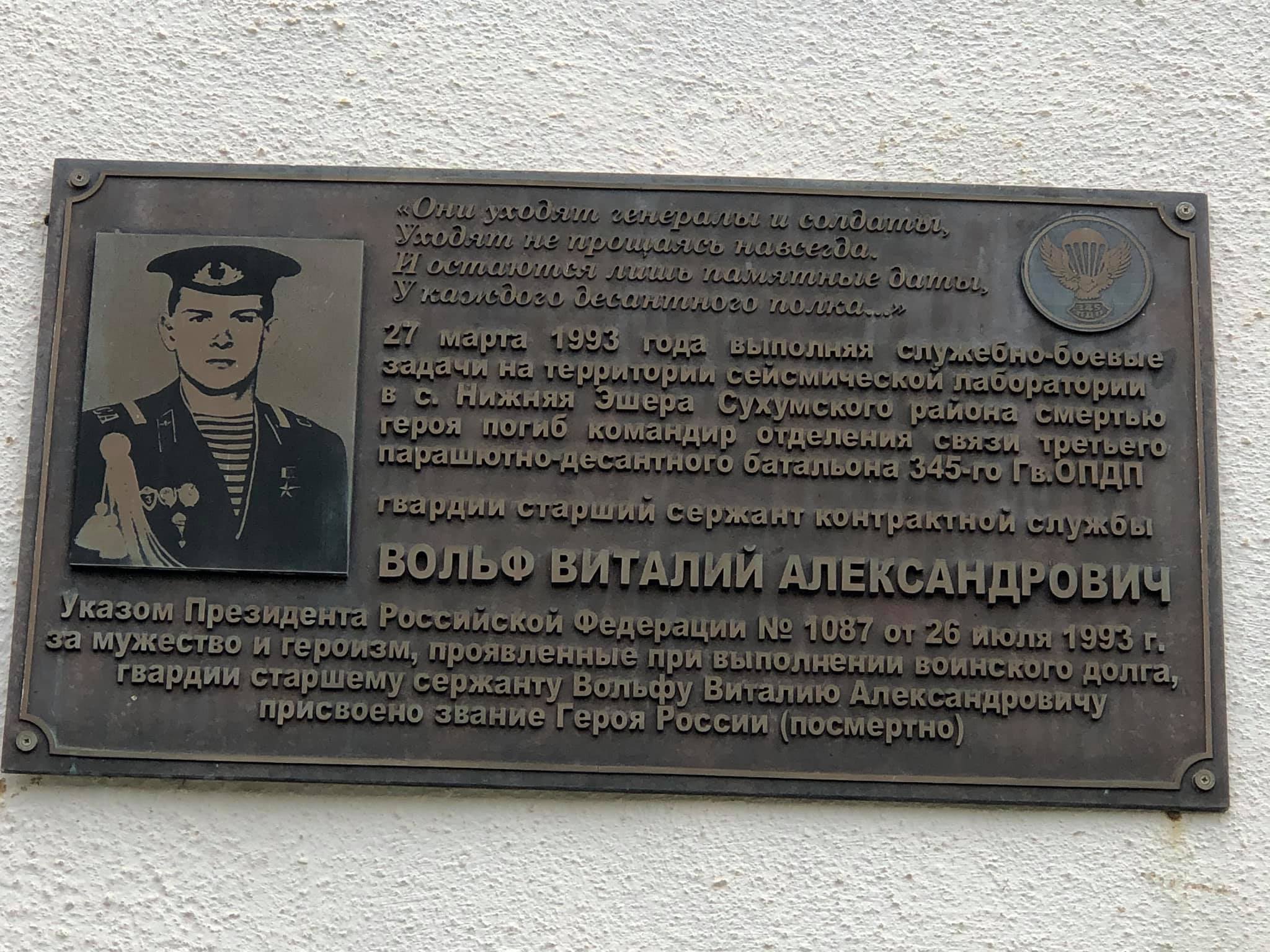
Over a quarter of a century has passed, but the hole in the fence from a direct hit of a 122 mm shell remains untouched.
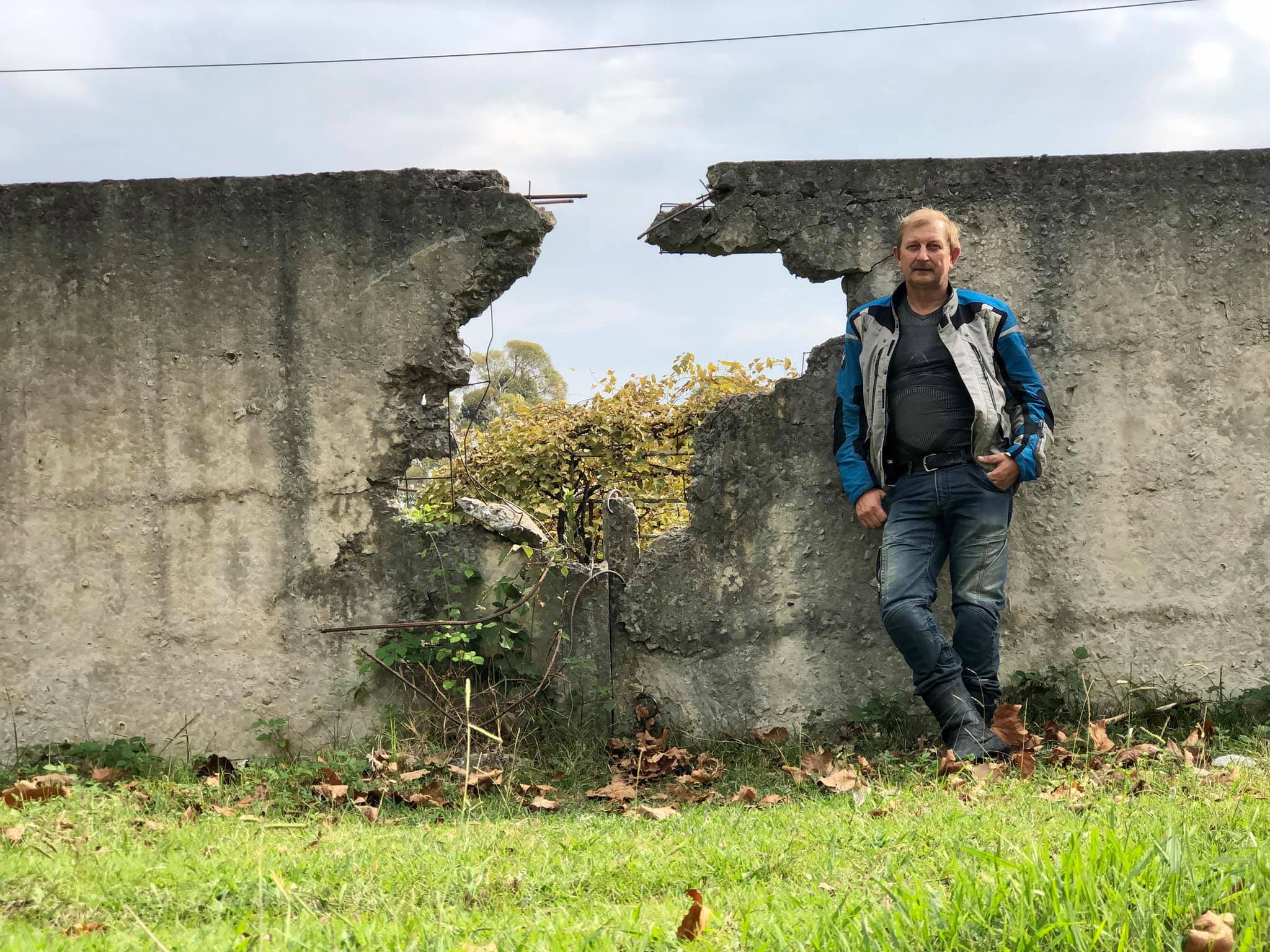
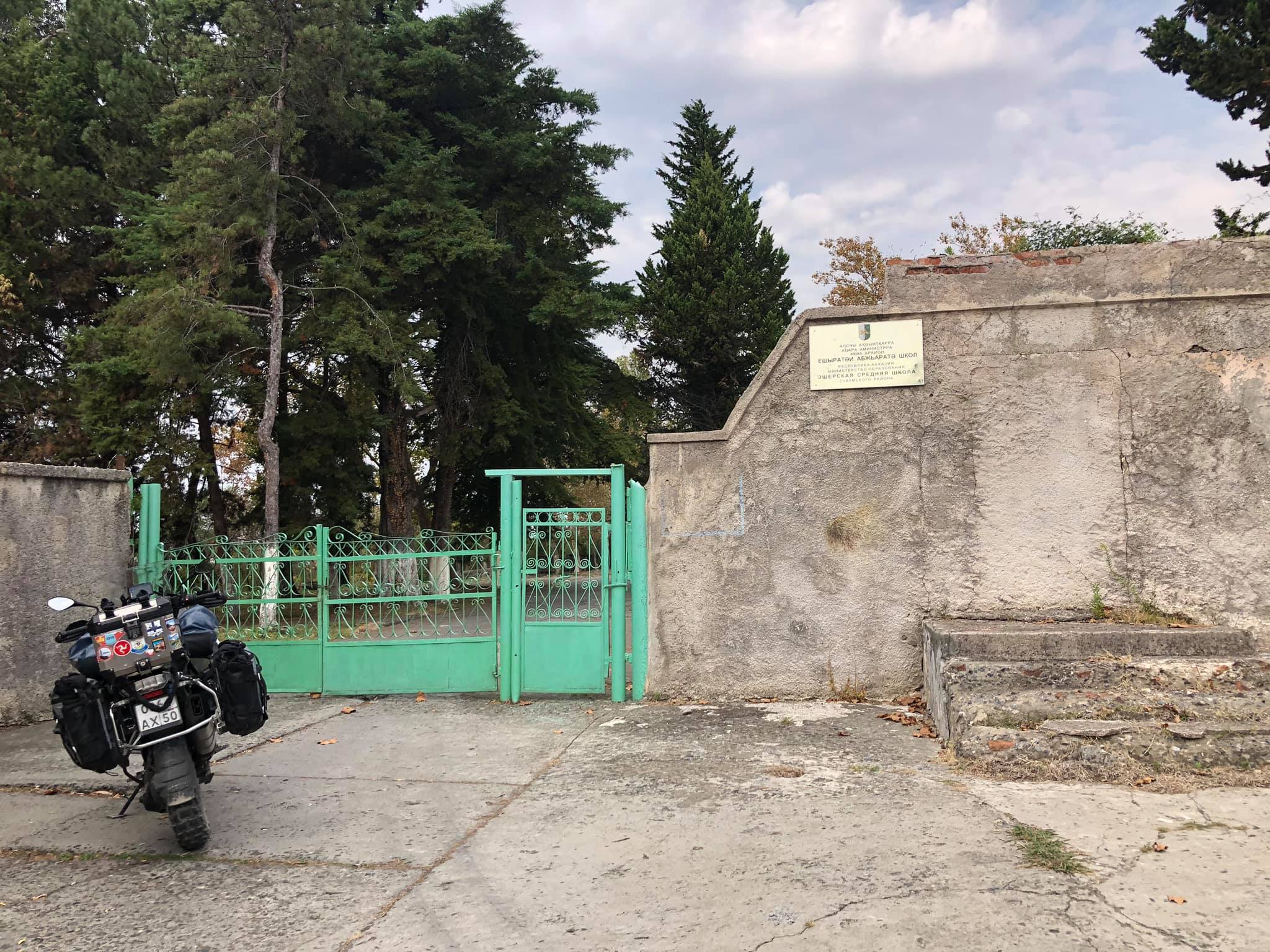
It's not just the hole, but also the broken and shrapnel-ridden checkpoint of the military unit 14098, the burnt private house across the street, the water pump, the medical point, and the soldiers' club... Only the barracks were slightly repaired, and now it's a school. The impact of that event has left visible marks that remain as a reminder of the past.

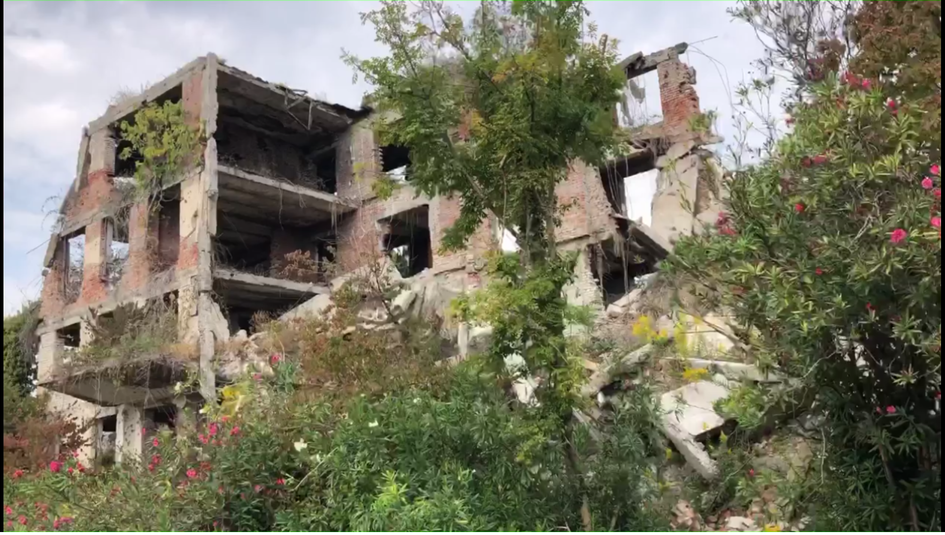
It's heartbreaking to hear about the fate of the famous Escherian middle school, which was turned into ruins shortly before the war started, in late '92. It was unfortunate to become such an obvious landmark for adjusting fire from the other side of the Gumista River. The vantage point from its upper floors provided a clear view of the left bank. The school suffered far worse than the House of Pavlov in Stalingrad, which managed to better preserve its structure. I can still vividly recall September '92, walking through the corridors where the sound of crushed bricks and plaster crunched beneath my feet, and the air filled with the smell of cement and smoke. In the classrooms, tables and chairs were overturned, school textbooks and notebooks lay scattered on the floor mixed with dust and broken glass. Not a single intact window remained, and in the math classroom on the 4th floor, there was a massive hole the size of a human, the result of a projectile impact. When I entered the library, the sight of fallen bookshelves with books devastated me. Hundreds, thousands of brand new books: Pushkin, Tolstoy, Lermontov... all covered in dust and cement. I couldn't help myself and took a few with me, knowing that everything would burn anyway. The memories of those times are haunting and heart-wrenching.
It's quite possible that those three books with seals and inventory numbers that are now sitting on your bookshelf in the bookcase are the only surviving remnants from that school library. They must hold a lot of sentimental value, and it's amazing that they've managed to survive all these years as a tangible connection to your past and the history of that school.
The war was just beginning
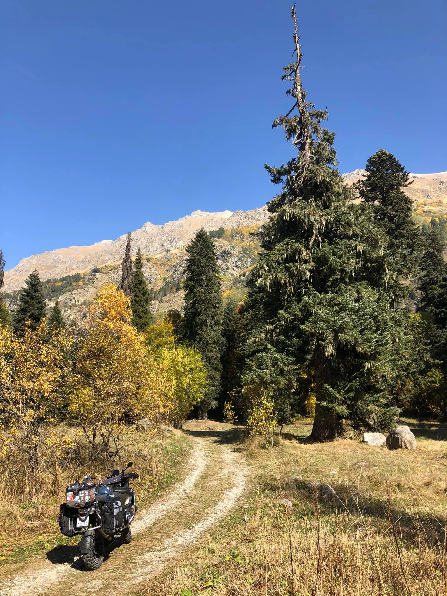
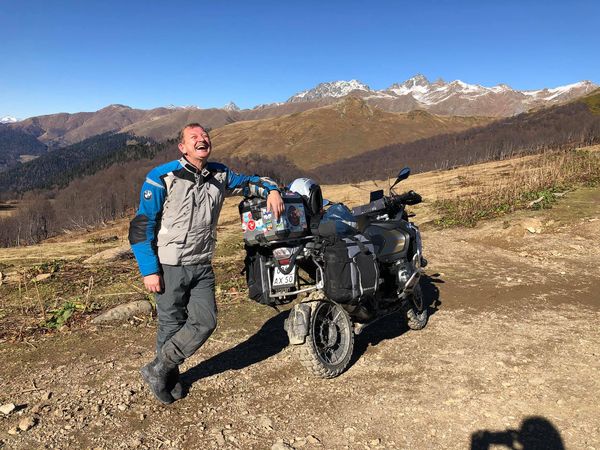
The road to Pskhu
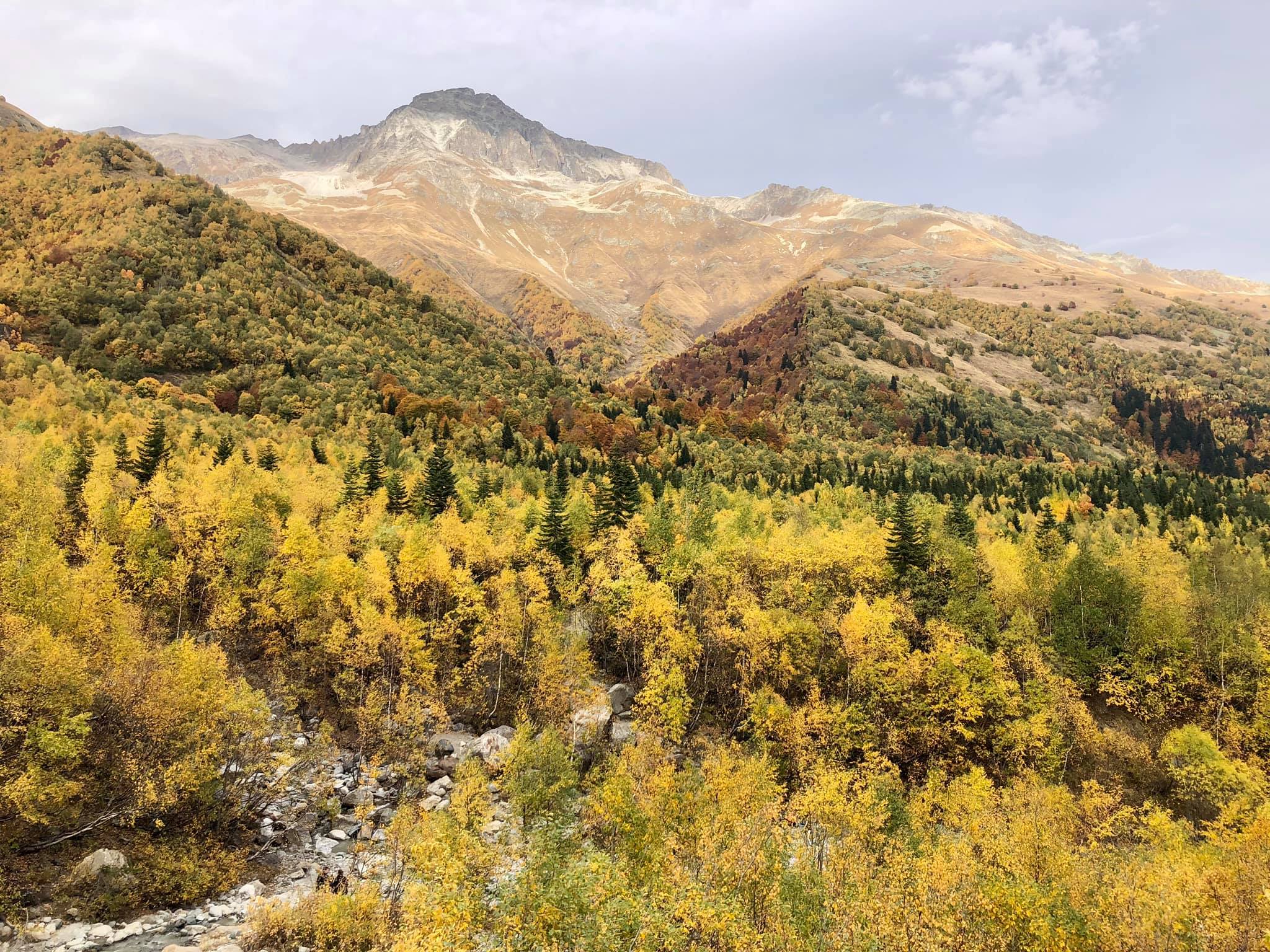
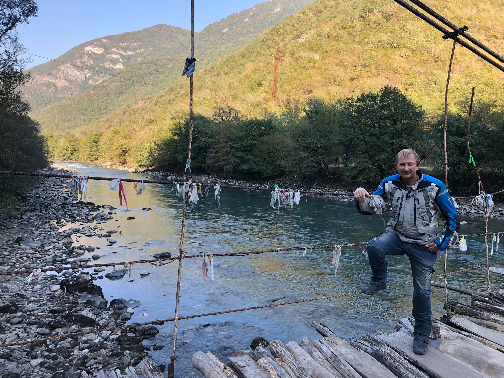
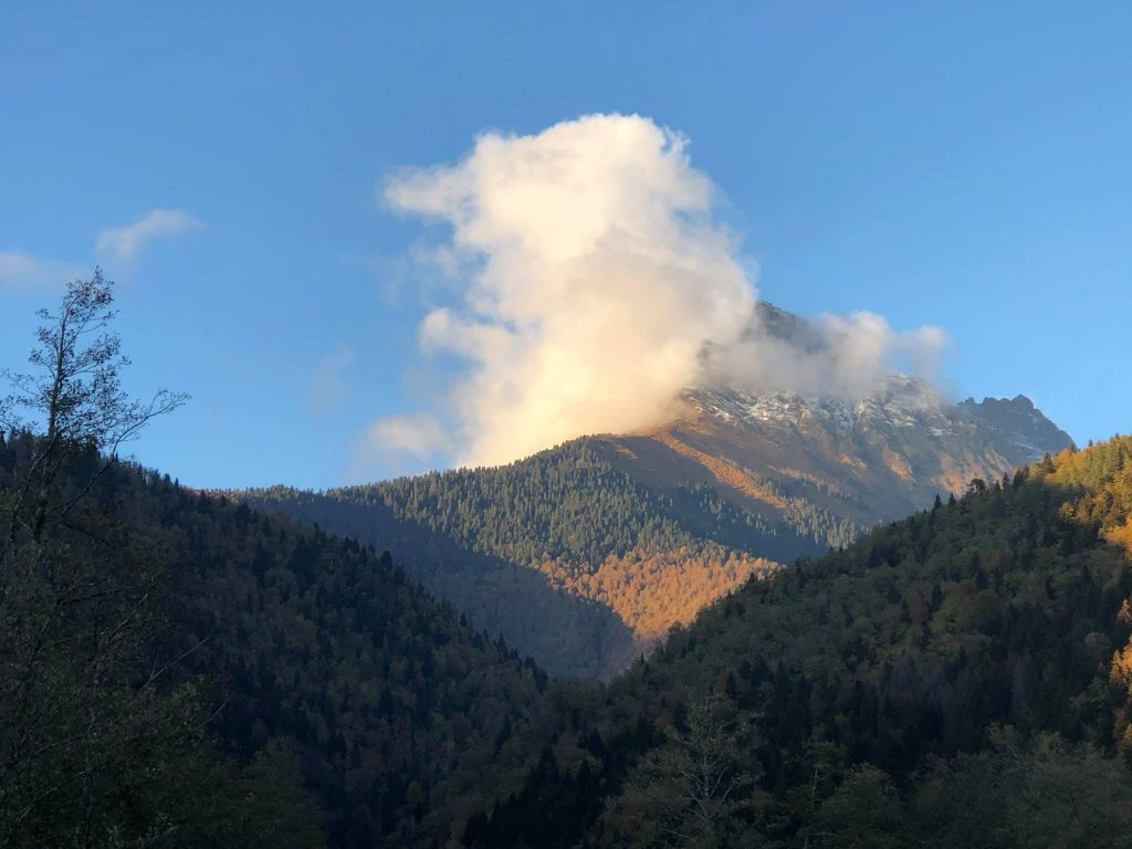
High in the mountains, in a remote area of Abkhazia, between the Main Caucasus and Bzyb ranges, lies the Pskhu Valley, where the village with the same name has been located since ancient times. Getting there by land transport is very challenging, and from November to June, when the pass is covered with several meters of snow, it becomes impossible.
For about six months, the village is practically cut off from the outside world, and the only connection to civilization is through the air. An AN-2 airplane or helicopter comes rarely, mostly upon request from the Emergencies Ministry in emergency situations. The village has its own "airstrip," well, more like a field fenced with wooden barriers. There's a school, a beautiful Orthodox church, and even a small hydroelectric power station - a house with a hydro turbine and a generator from the 1950s, providing the village with electricity.
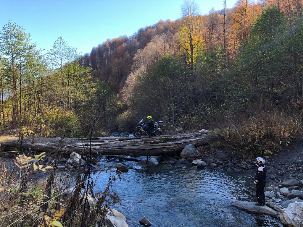
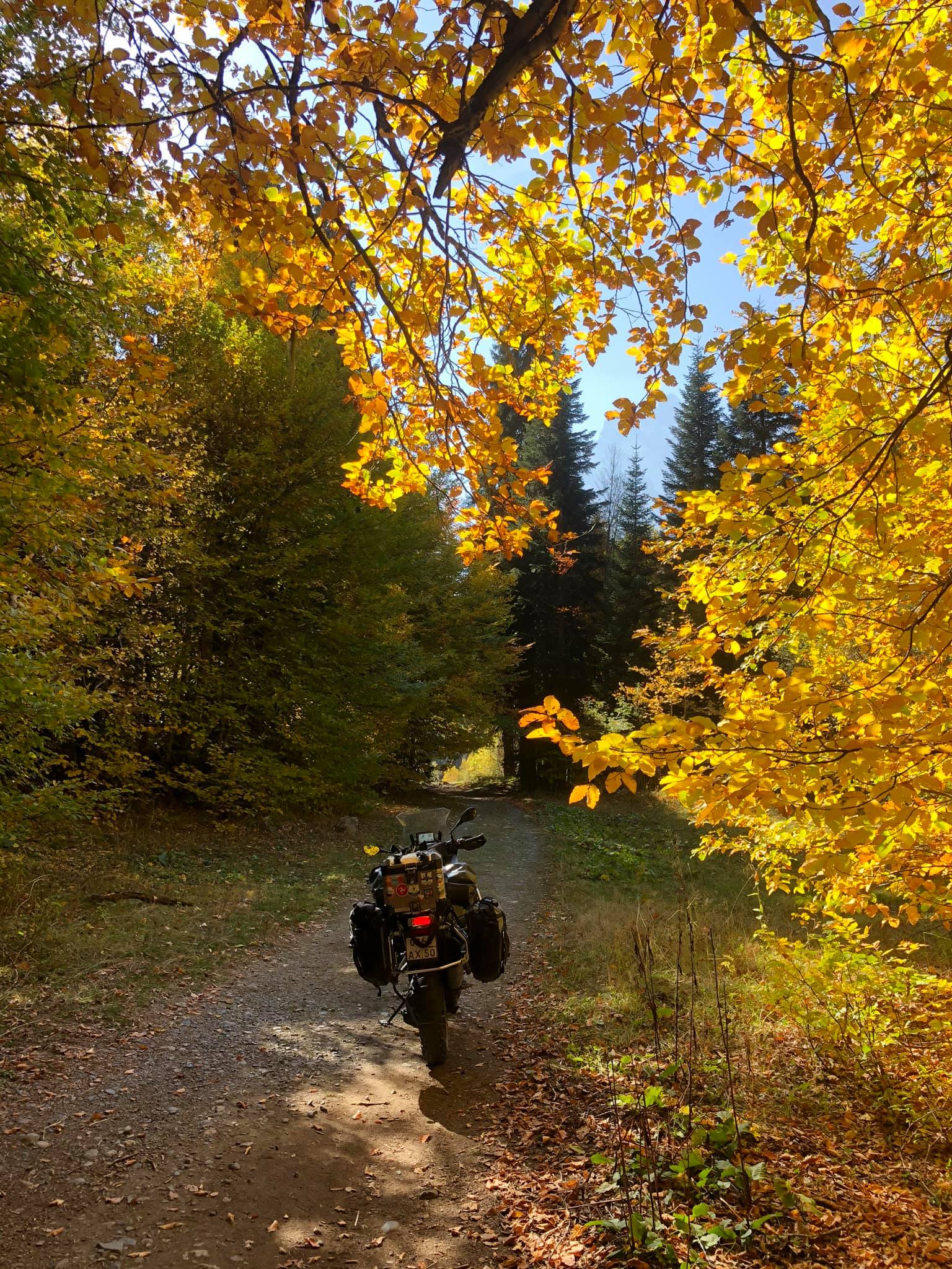
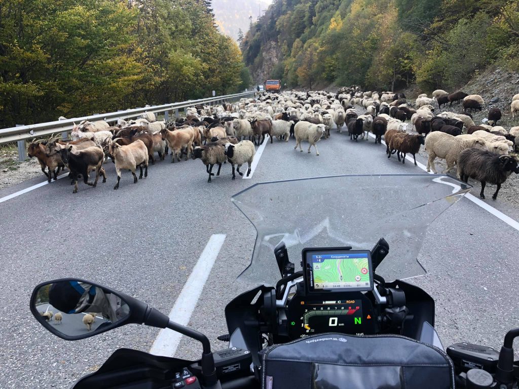
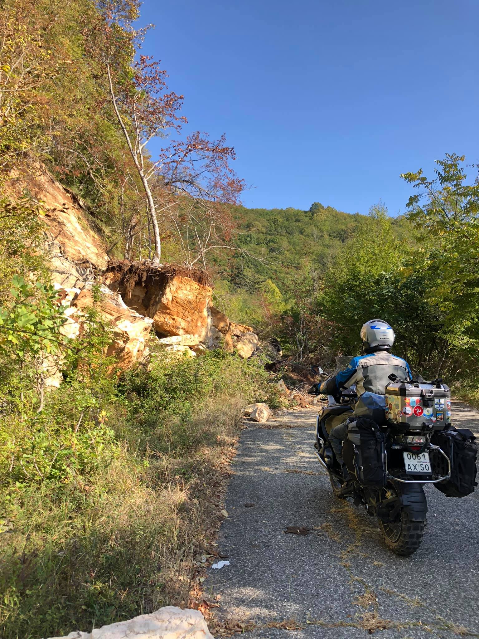
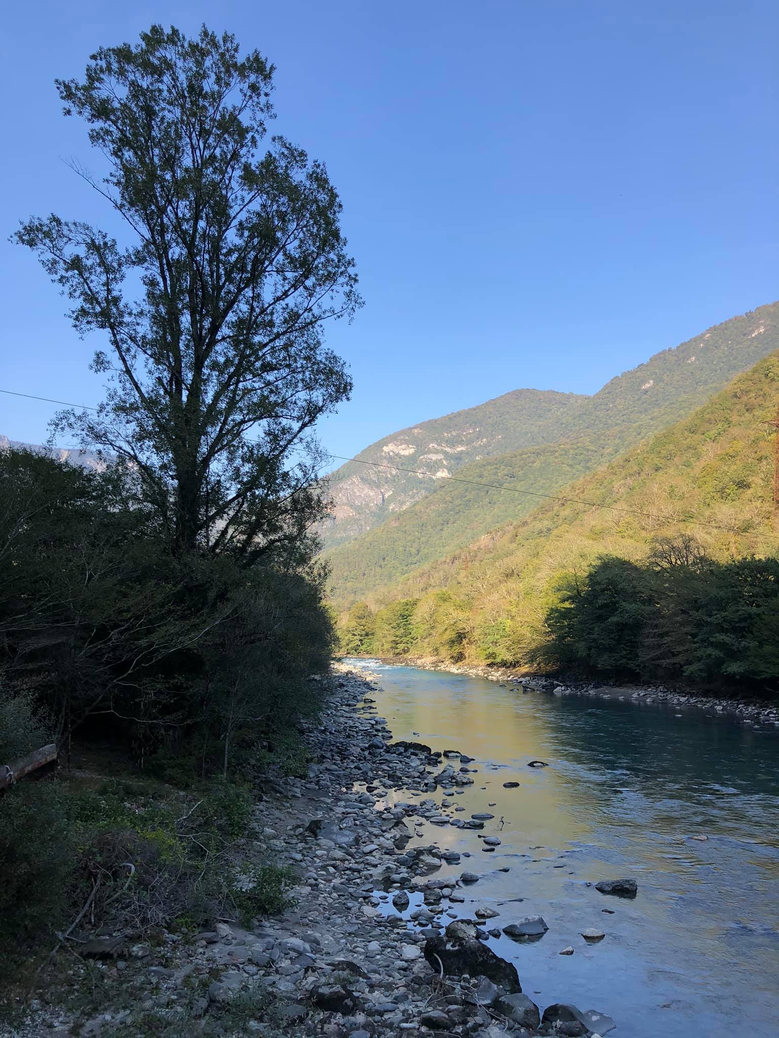
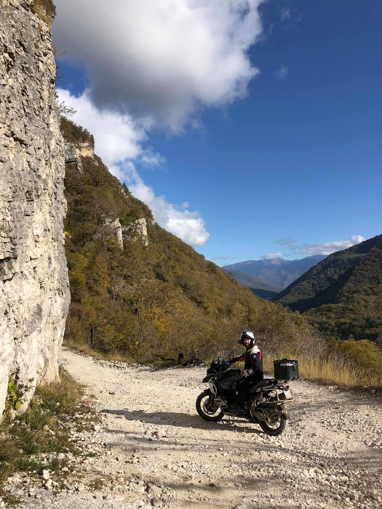
From Sukhumi, the capital of Abkhazia, to Pskhu, it's 150 km, but covering this one and a half hundred kilometers will take a whole day, although the first hundred kilometers to the high-mountain Lake Ritsa will require less than two hours. The road is splendid, very beautiful, and asphalted, winding through the gorge along the Bzyb River, passing through valleys and almost merging cliffs. But the most interesting part of the journey begins afterward, when the broken asphalt transitions into a dirt road that leads to the mountain pass and descends from it with steep and winding serpentine paths made of stones.
We had to conquer about ten river crossings on this forty-kilometer stretch of the journey. It's been a while since I've ridden on such challenging roads. Slippery stones, mud, puddles, deep crossings, icy ascents and descents on the northern slopes of the pass, and rocks, rocks, rocks... It seemed like the motorcycles wouldn't endure this torment, but the BMWs, unlike the Honda Africa Twin that happened to join our group, proved to be up to the task! Poor Honda suffered quite a bit and looked like a street-fighting stray dog. In the end, its footpeg broke off, and we had to replace it with a wooden stick.))
At the summit of the pass, the temperature didn't rise above 5 degrees Celsius at noon, and at night, the streams running in the ruts froze, turning the road into icy slopes.
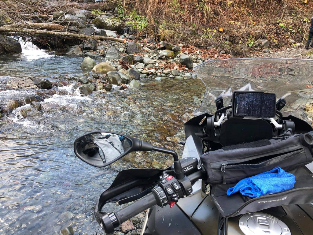
We were lucky; the weather these days is sunny, but last week, there was up to 30 cm of snowfall here. Fortunately, the water in the rivers has receded, and we managed to cross all the river crossings on our bikes. Not always smoothly, but without any serious losses.
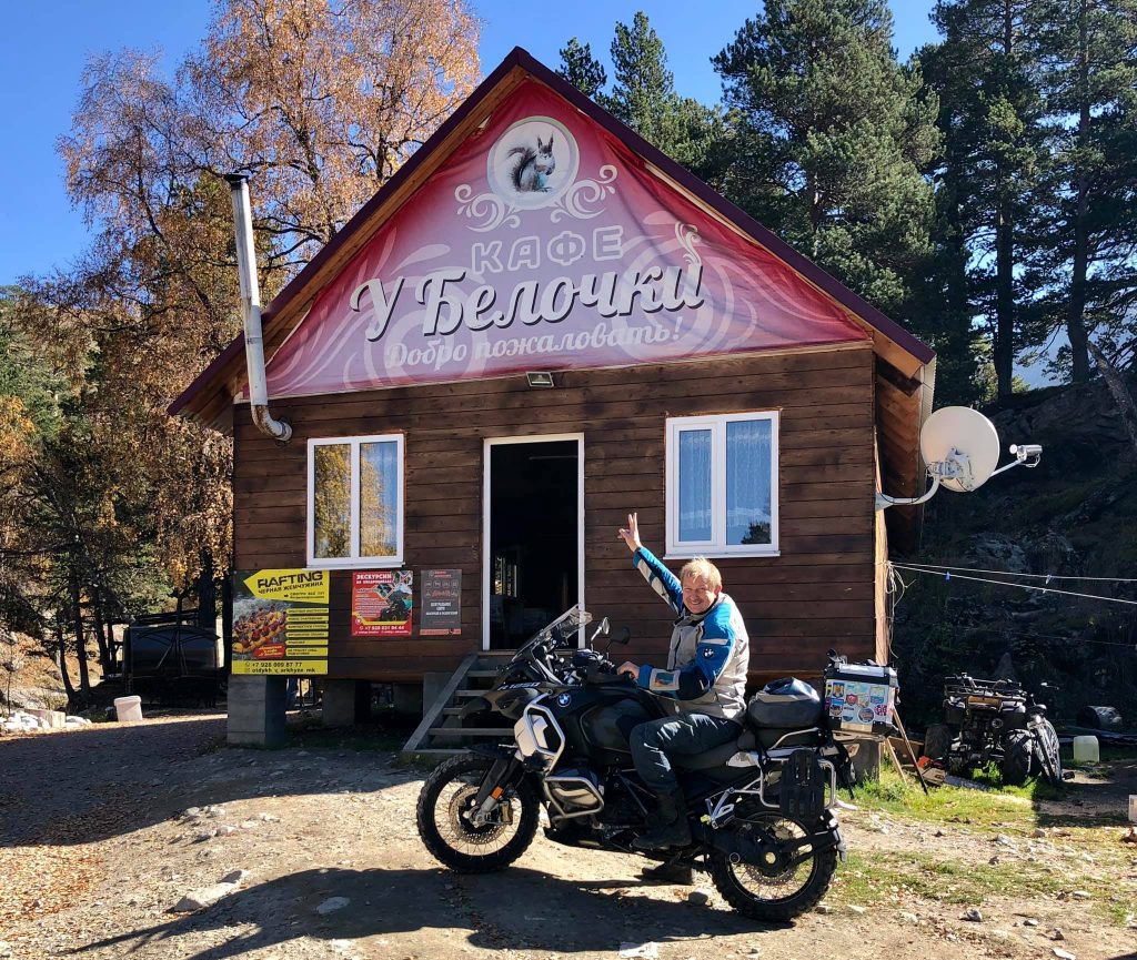
We arrived in Pskhu an hour before sunset and settled in for the night in a wooden guesthouse without heating, but it had beds, a bathroom, a stove, and an electric kettle.
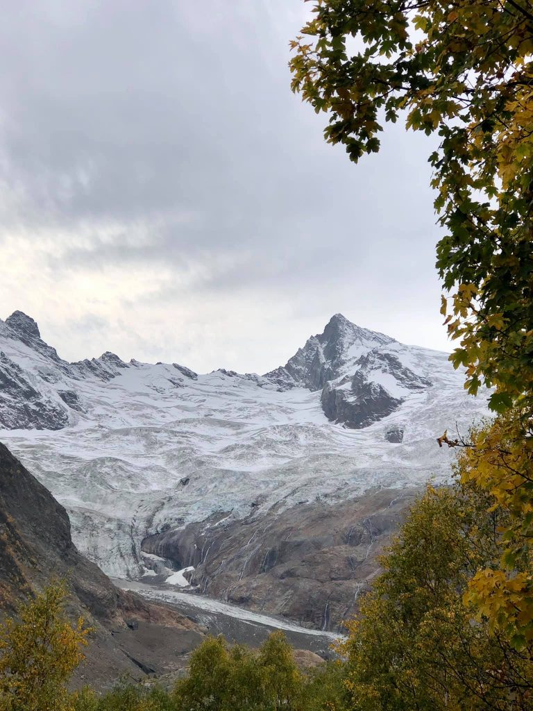
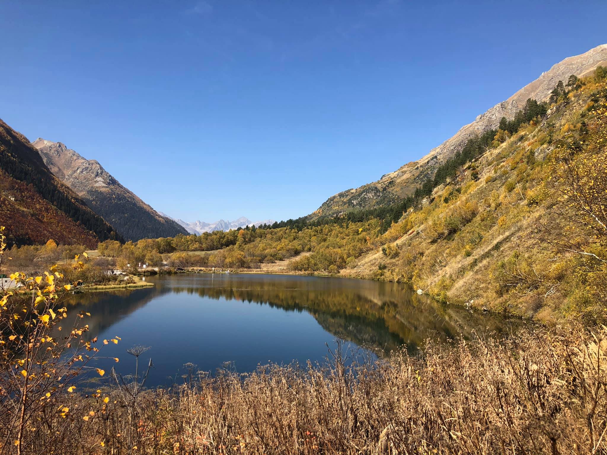
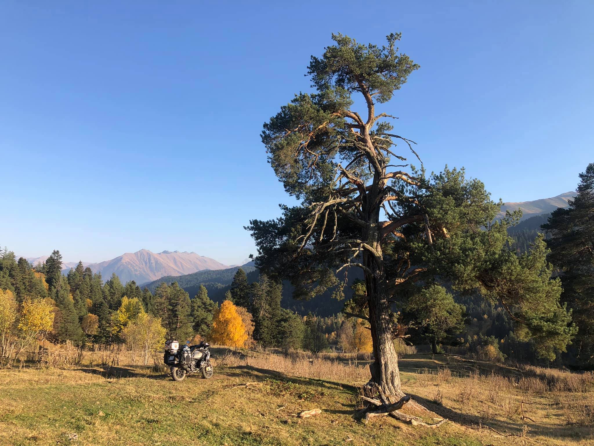
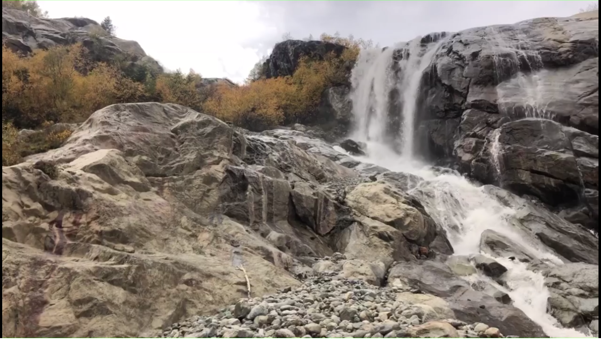
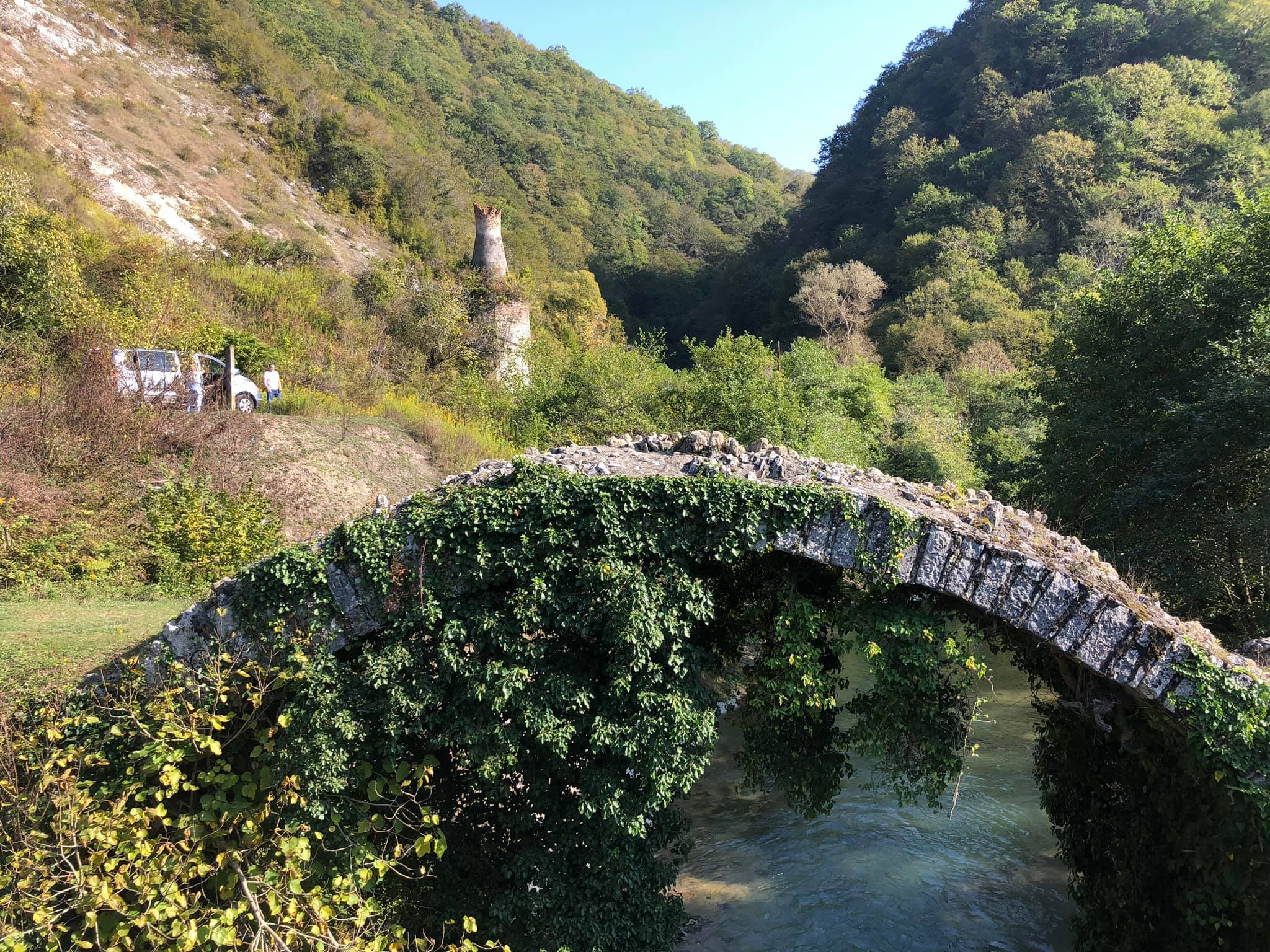
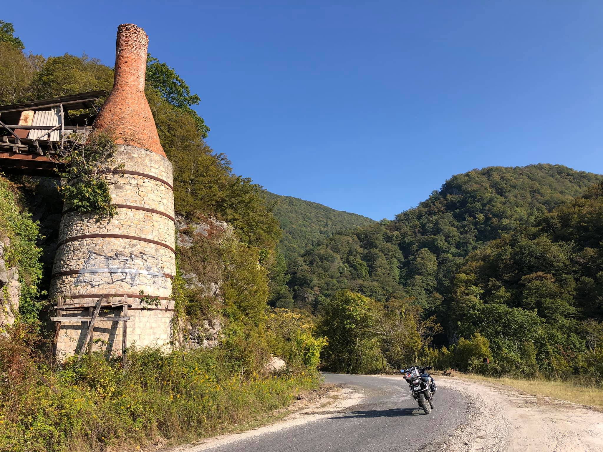
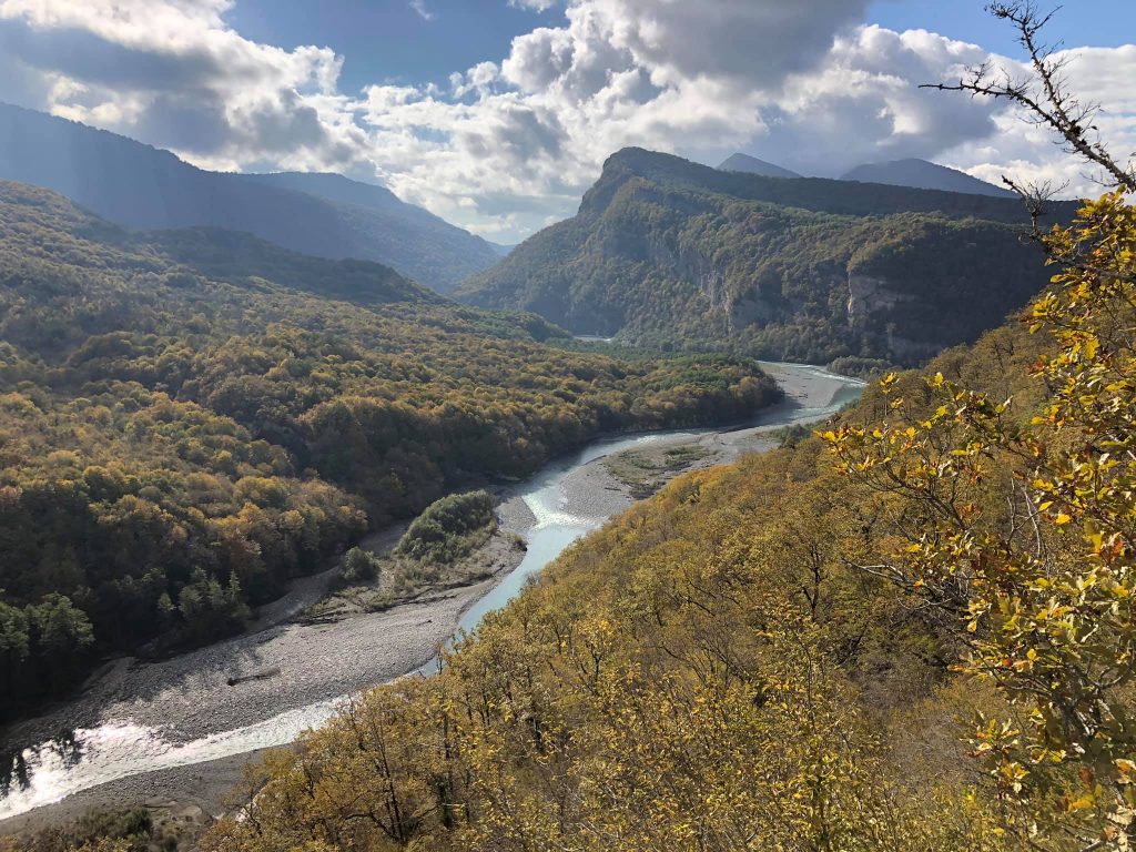
The Kodori Gorge may not be the most beautiful in the Caucasus, but it's probably the longest and seemingly endless!
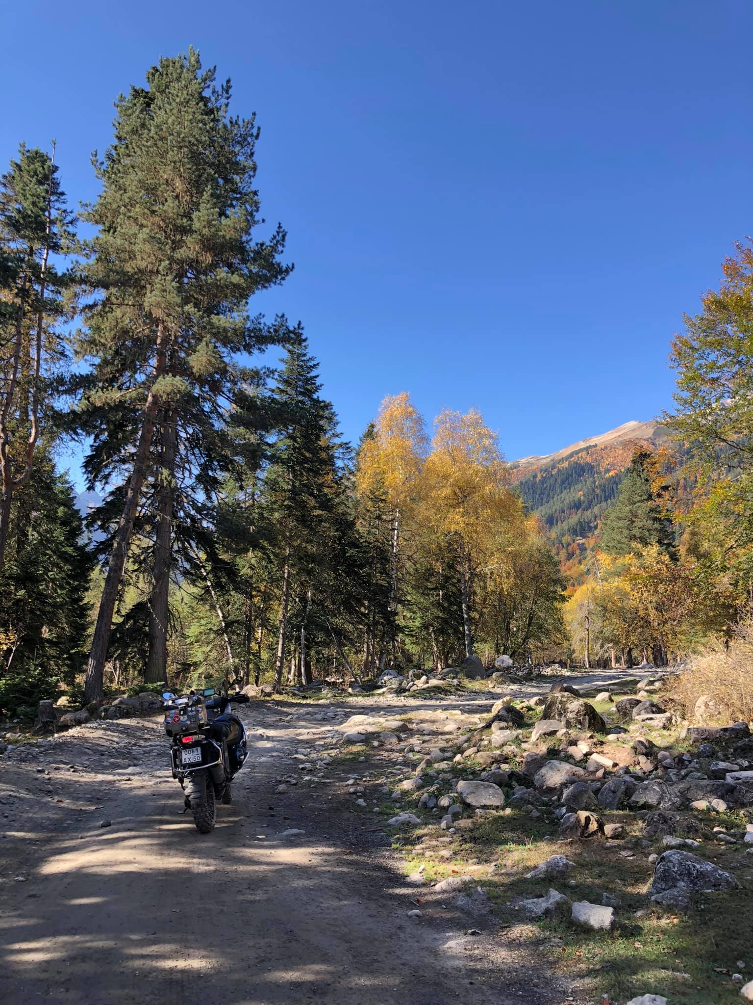
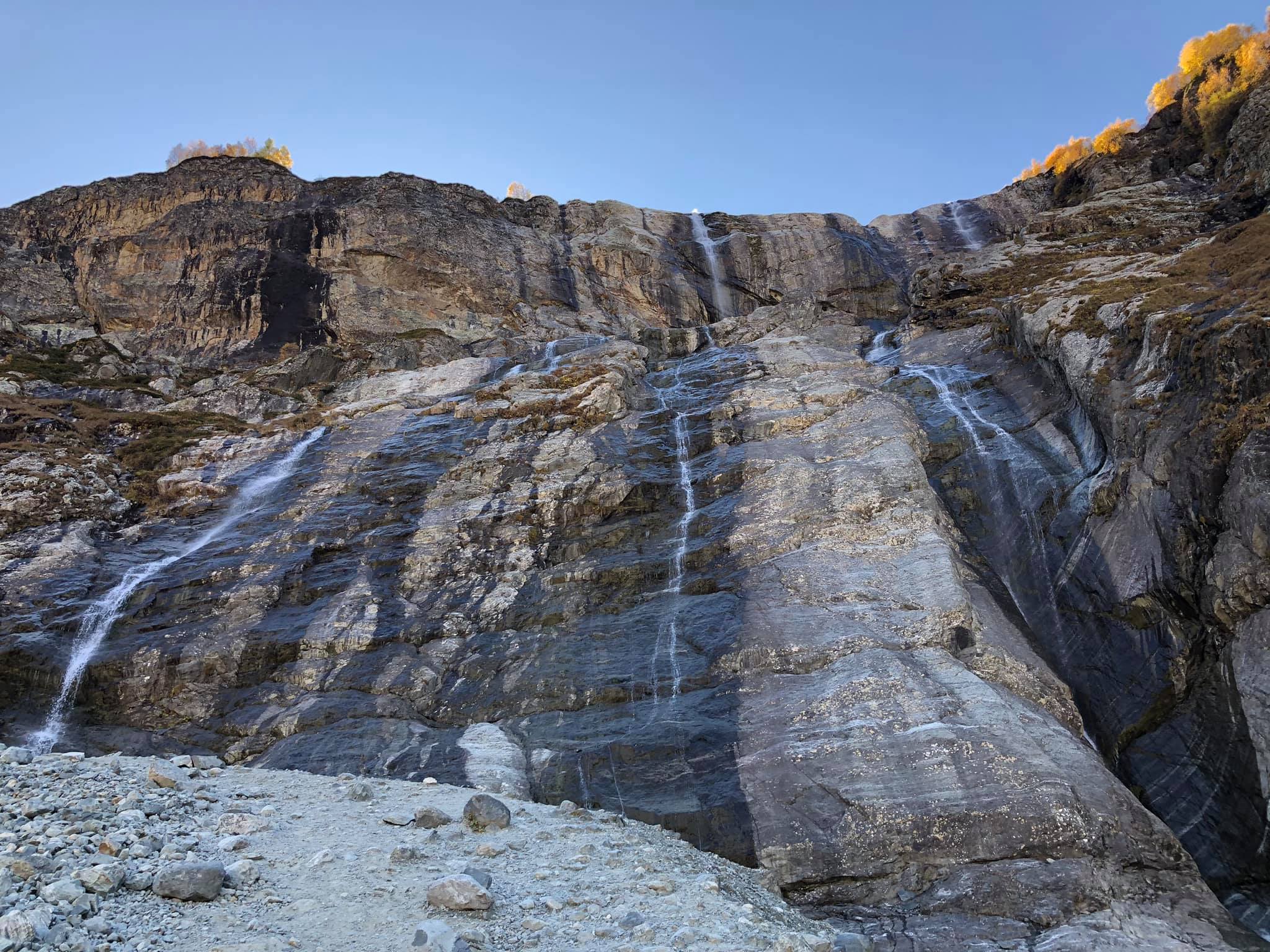
Although there's plenty to see here. In the lower part, there's the stunning Olgin Waterfall (N 43.012233, E 41.225903) and the vast Shakuransky Canyon (N 43.028519, E 41.329656). In the upper part, there's a very beautiful road carved into the cliffs along the Kodor River. The road is not easy, especially in the upper part of the gorge. I haven't encountered so many puddles anywhere else, except maybe on the Rybachiy Peninsula!
In reality, the last 30-40 km, we were driving by emerging from one deep puddle and diving into another, and our average speed dropped to 20 km/h. That's how we "sailed" to the village of Azhary. Ahead, in 10 km, there are snow-covered peaks of the Main Caucasus Range, and beyond them lies Dombay. The old Military-Sukhum Road leads there, which is currently closed for passage.
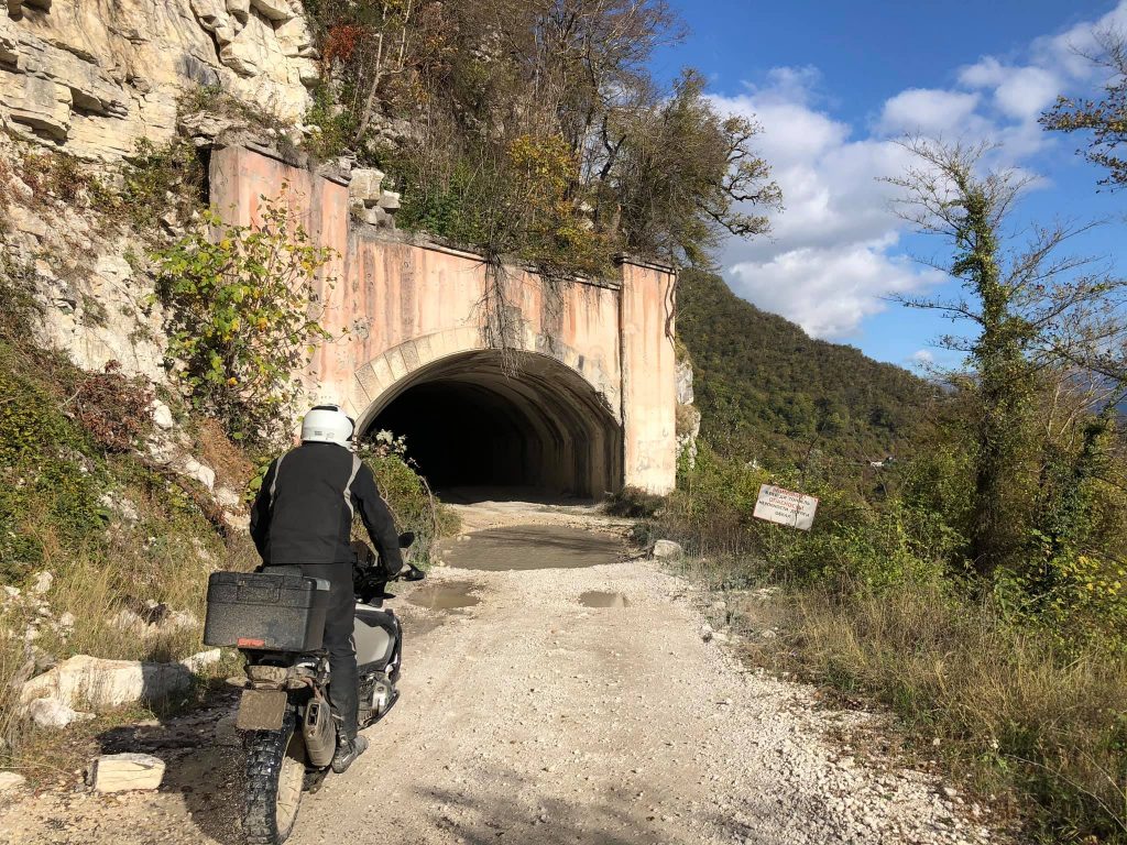
Well, getting to the upper part of the Kodorskoye Gorge is not that easy, to be honest. Between the two tunnels, you'll come across a border checkpoint (N 43.030982, E 41.372829), and if you don't have a special pass from the Abkhazian Security Service, you'll have to turn back.
Yes, the Kodorskoye Gorge has been associated with many tragic events in recent years. Until 2008, the upper Kodor Gorge was under the control of Georgia and heavily fortified with military equipment and armored vehicles. In 2001, it was also a base for a Chechen militant group led by Ruslan Gelayev. The region has seen its share of conflicts and instability, adding to its complex history.
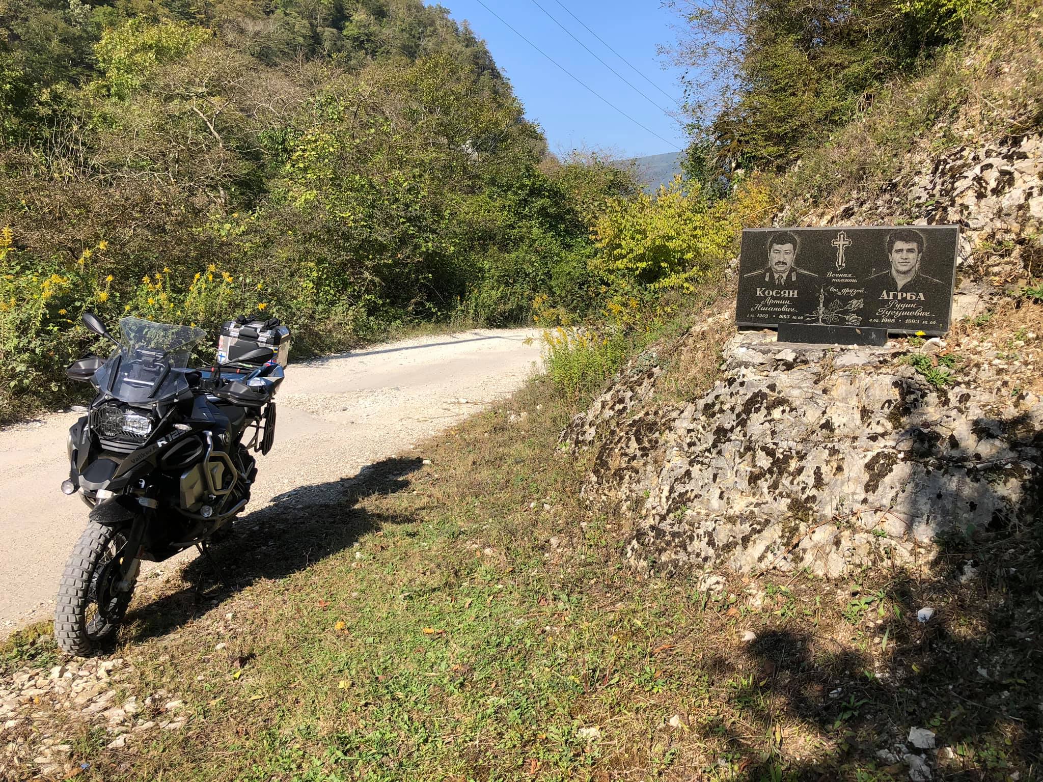
It's a sad reality that the population of the upper Kodor Gorge, mainly consisting of the Svan people, a minority group in western Georgia, was significantly affected by the 2008 Russo-Georgian military conflict in South Ossetia. After the conflict, most of the Svans left their homes and moved to Georgia. Even the Georgian military forces had to hastily leave the area. As you traveled through the villages, witnessing abandoned houses, graves, and memorials of those who lost their lives during the 1992-93 war and subsequent clashes, it must have been a poignant reminder of the region's turbulent history.

On the way back, we were traveling in complete darkness. The puddles seemed visually larger and deeper, and the rocky ascents and descents even steeper!
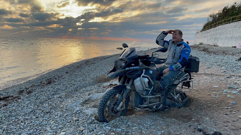
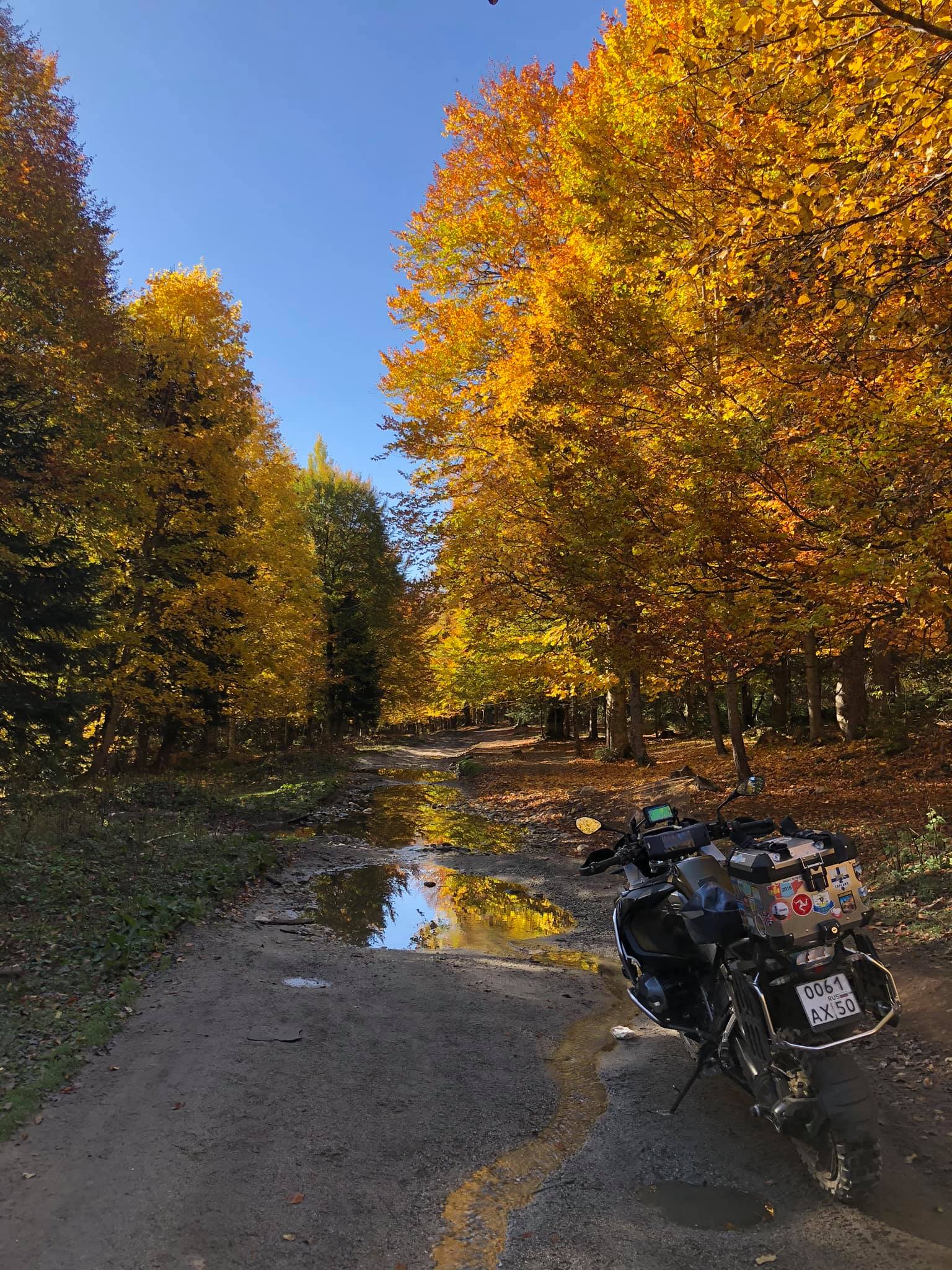
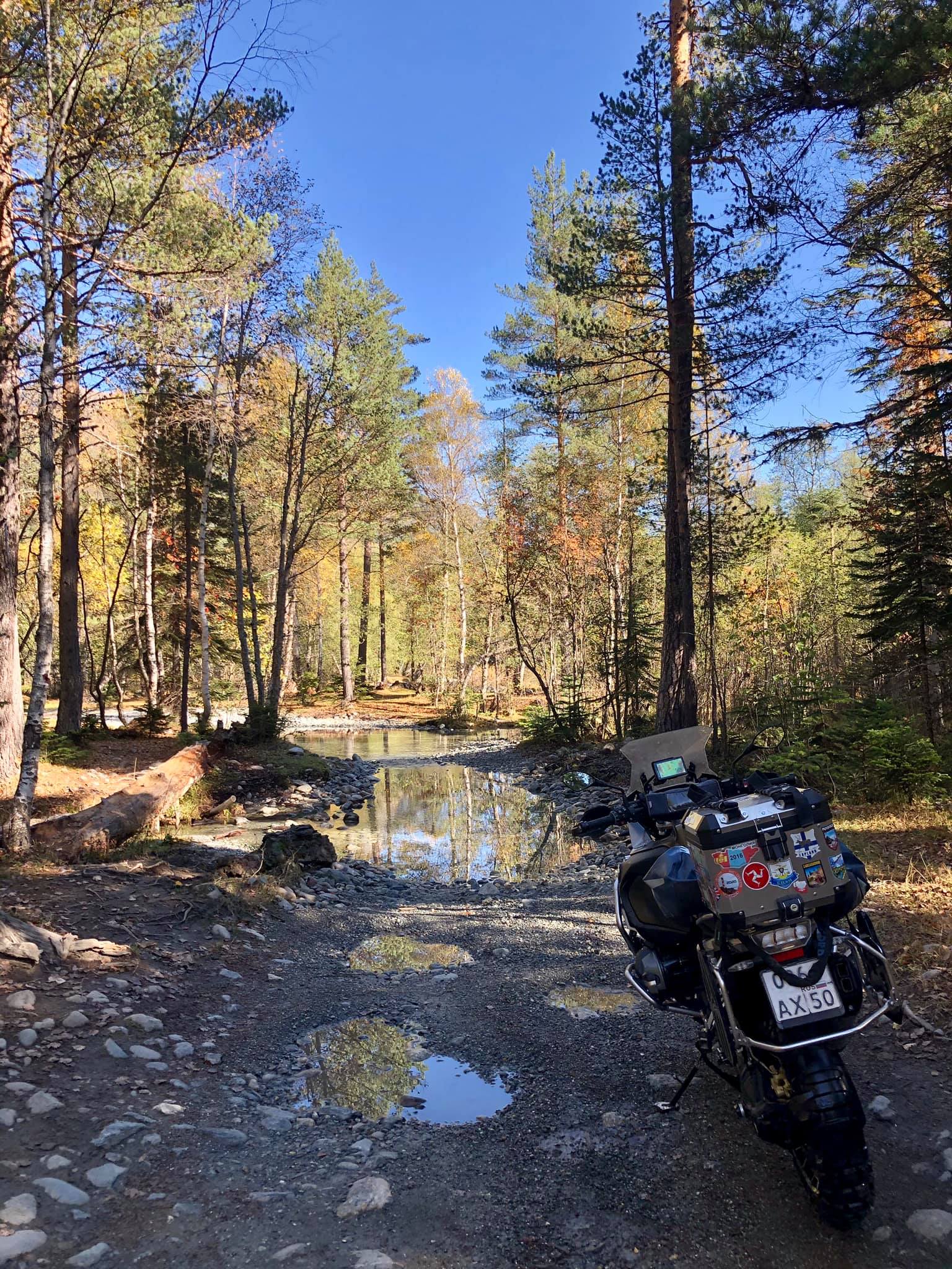
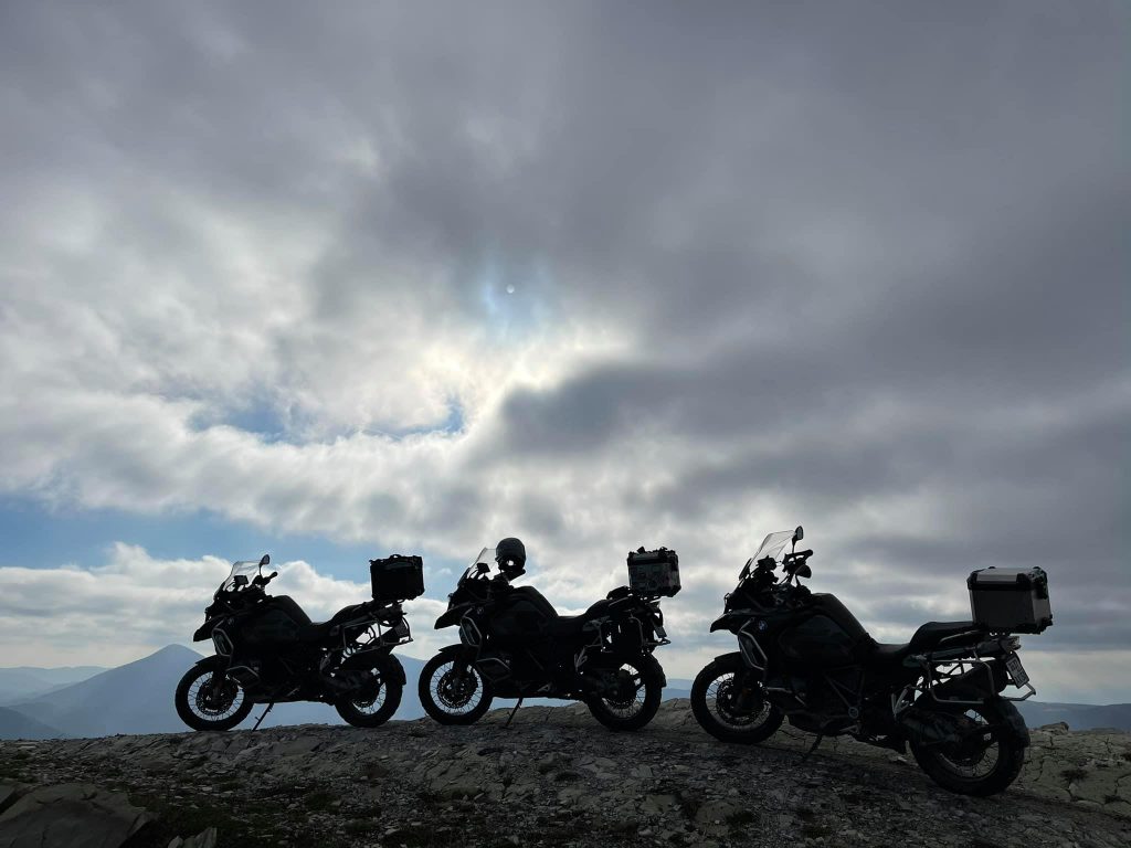
So, my big journey across the North Caucasus and the south of Russia is coming to an end. Yesterday morning, we set off from Sochi, and by the evening, we reached Gelendzhik. Three hundred kilometers under the rain with temperatures of 5-7 degrees on wet and slippery serpentine roads – not the most exciting route.
Today was an amazing day! I never thought that the surroundings of Gelendzhik would have such beautiful mountain roads and trails! Together with friends from the BMW Motorrad Club Russia, we rode just a little over a hundred kilometers, but what incredible kilometers they were!
It had it all - steep rocky climbs and descents, mud, sticky clay, forests, deep puddles, snow, and in the end, we descended several kilometers along the riverbed right to the sea.
The mountains here aren't very high, but the views are breathtaking! Next year, I'll definitely come back here, but this time on a lightweight enduro bike. For now, let's continue exploring the local attractions.
Tomorrow, we'll try to reach the huge cargo ship that was washed ashore by the storm.