 Cap-travel.ru
Across Altai by enduro motorbike. June, 2021
Artybash, the Altai mountains, Teletskoye Lake
Well, finally we reached the genuine Altai. The one where you see snow on the top of the mountains, stormy rivers overflowing their banks, feel pure air, enjoy picturesque roads surrounded by the rocks on which some tall pine trees grow!
And Teletskoye Lake is a culmination of the day. It's sunset. We are sitting at the veranda of the restaurant & cozy hotel "Aru-Kel's Manor", sipping the beer and watching the perfect mirror-like surface of the lake surrounded by mountains.
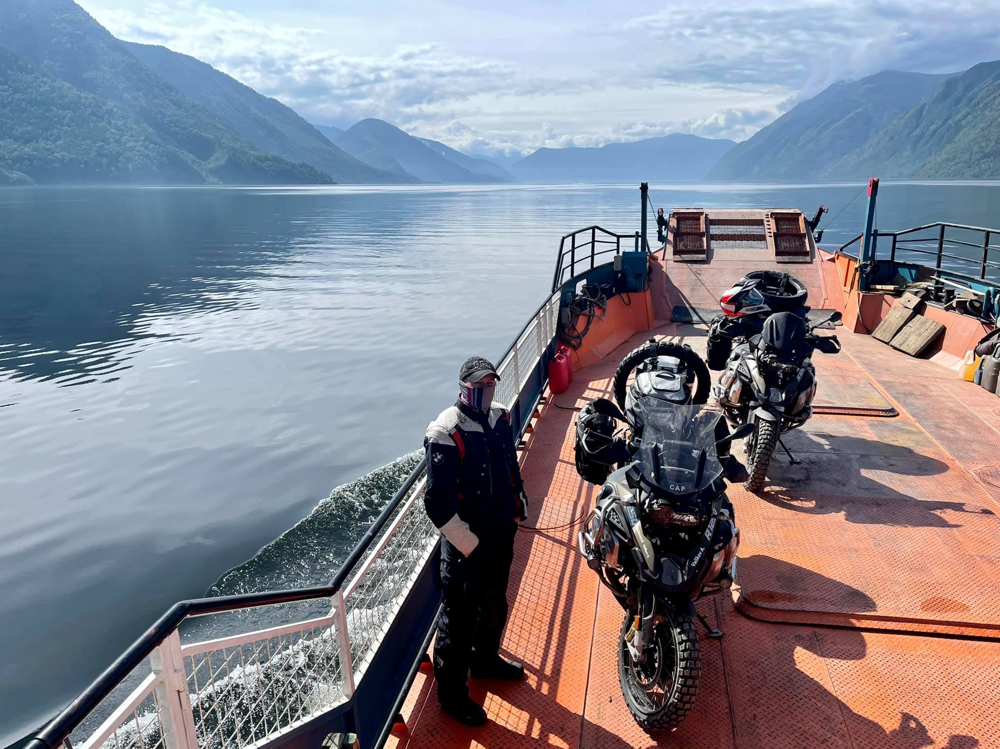
Tomorrow at 5 a.m. we are boarding our motorbikes onto the ferry and continue the journey by water. In about four hours we are to cross the lake from north to south (it's about a 70 km distance) and keep on the Altai mountains exploration.
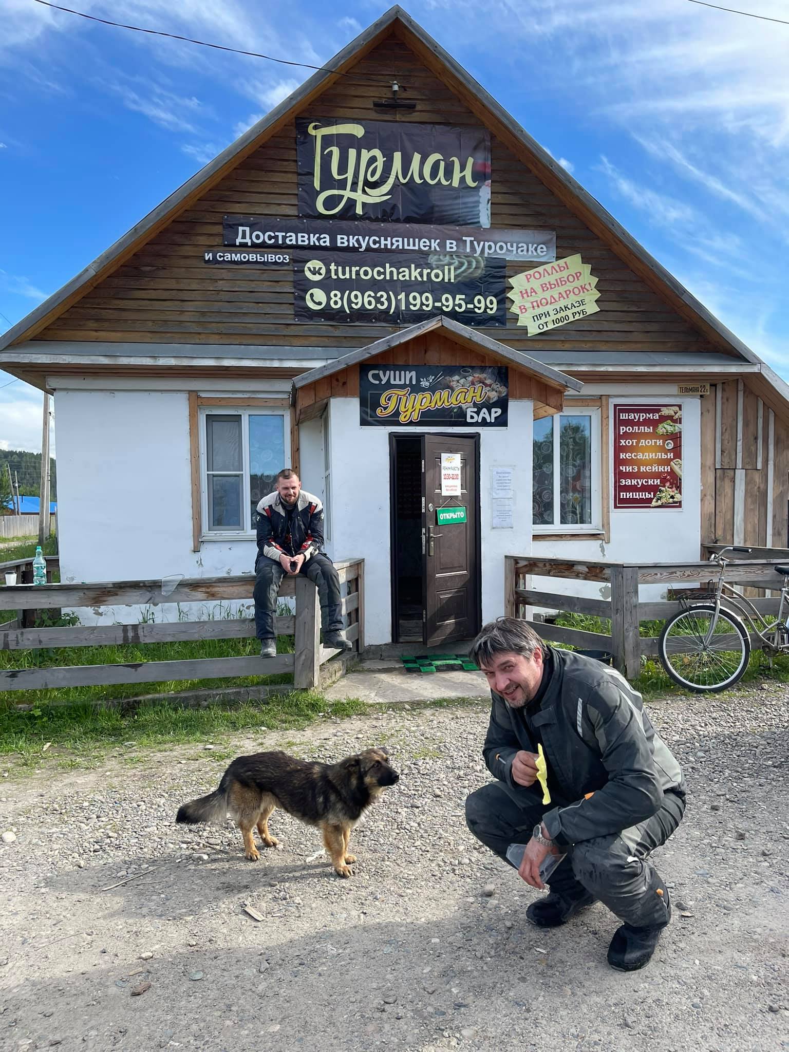
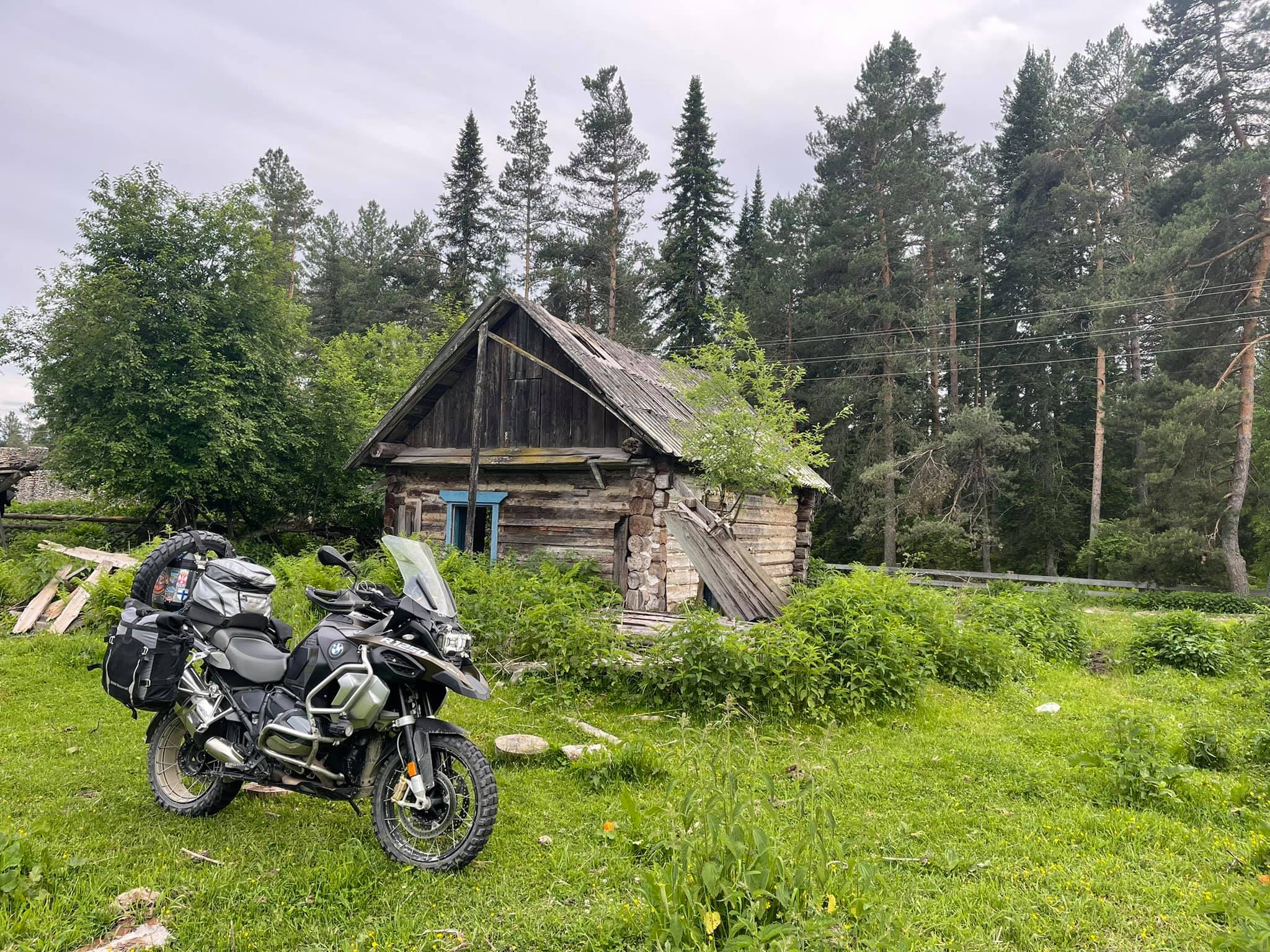
Our today's route is: Novokuznetsk → Sheregesh → Tashtagol → Turochak → Artybash.
This is the river, named "Swan". What a beautiful name!
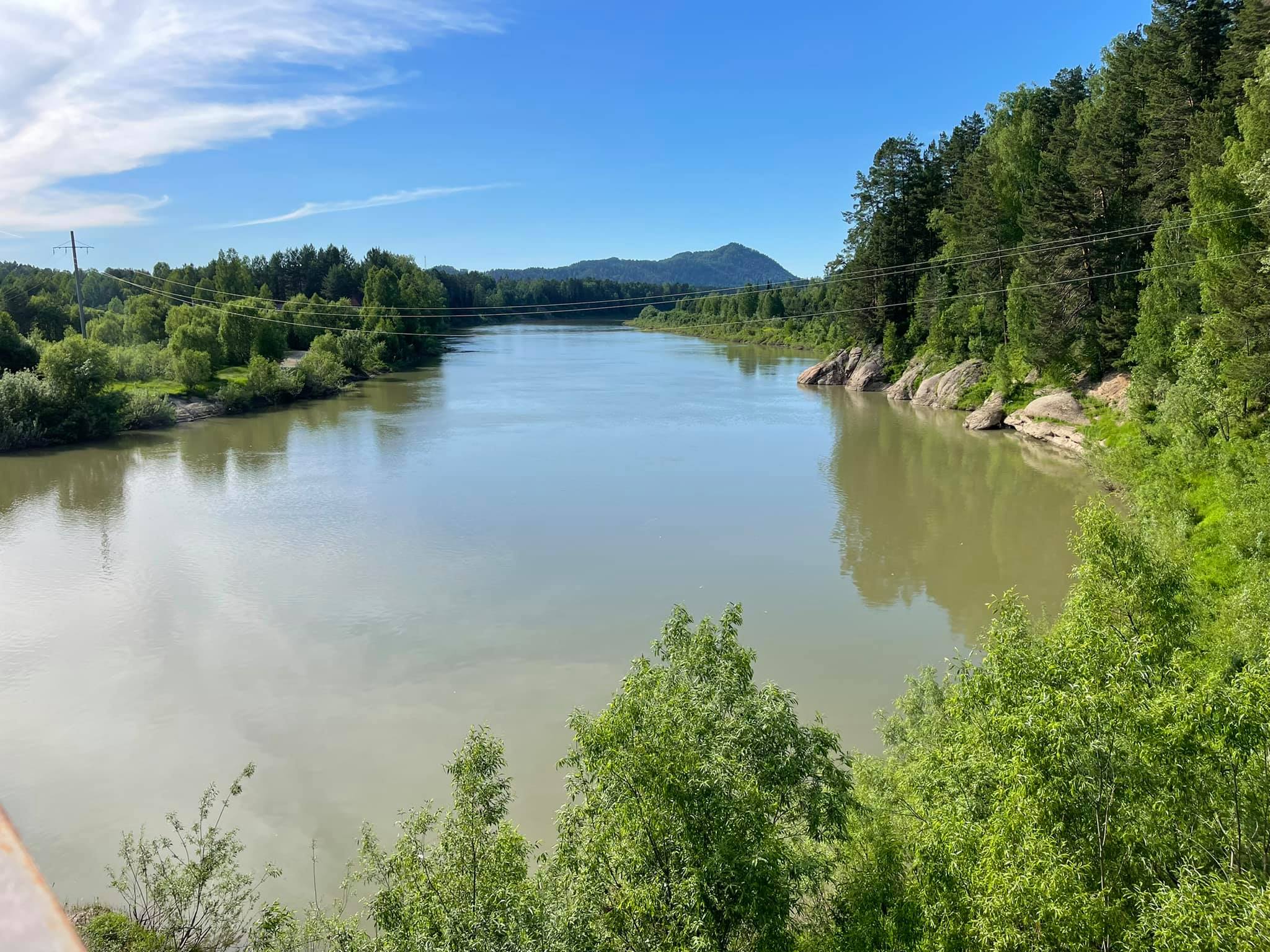
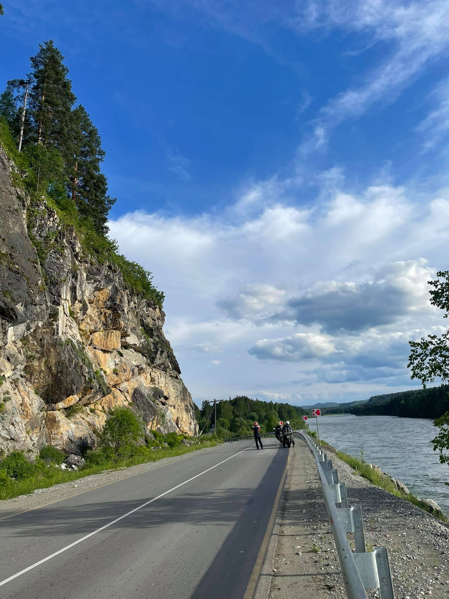
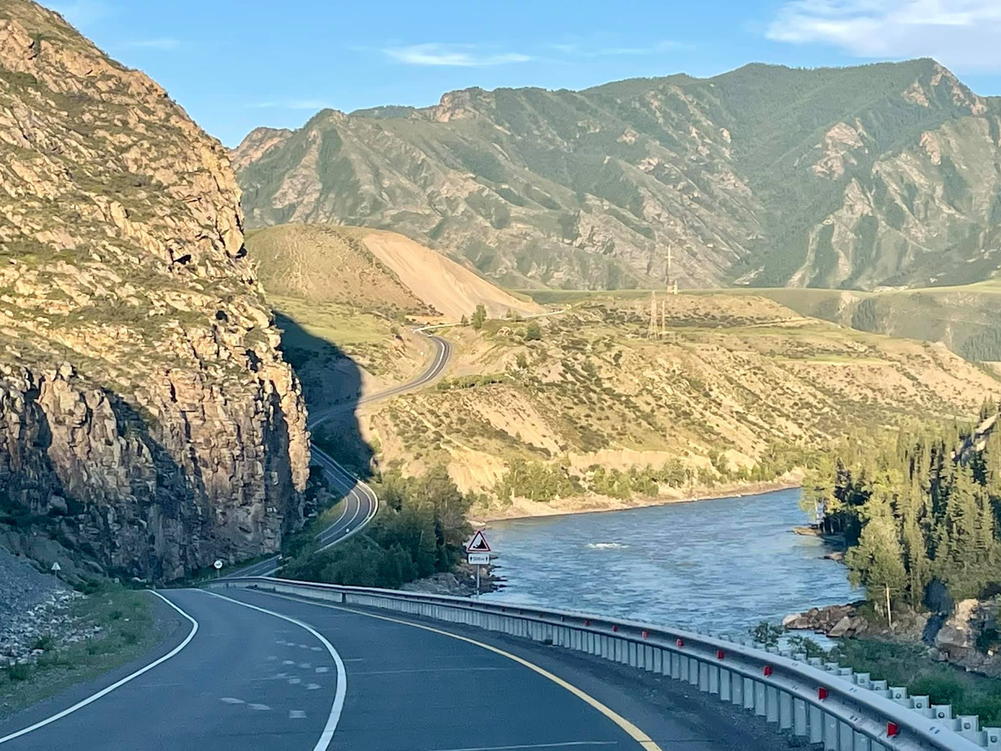
We are riding along the right bank of the Biya to Teletskoye Lake. 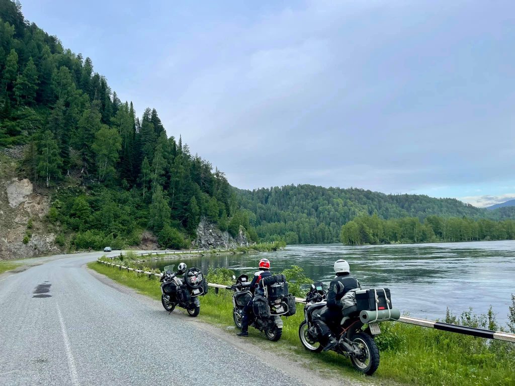
Is that Lake Como? Lake Garda? Not really, this is Teletskoye Lake!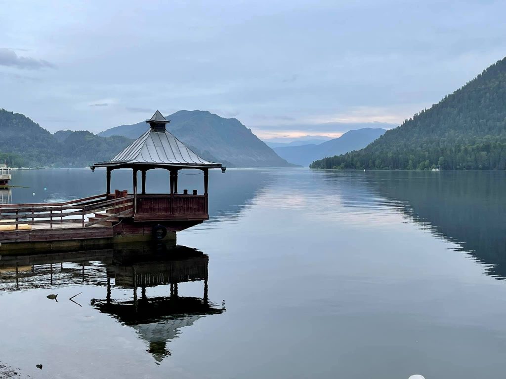
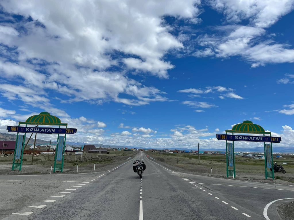
Kosh-Agach
There are two routes to cross the Altai from north to southeast.
The first one starts in Gorno-Altaysk and goes
along the R256 highway (Chuya Highway)
to the village Tashanta. There is a checkpoint and a borderline to Mongolia. You will experience a very beautiful road, good asphalt, stunning views of rocks, mountains, Katun and Chuya stormy rivers. This route is recommended for everyone and by all means of transport.
The second route is for those who want to ride not only along the asphalt, but also along the off-road, ground tracks and mountain serpentines. A section of it needs to be passed by ferry across Lake Teletskoye. This is the road from Gorno-Altaysk to the village Artybash. You will also pass by the village Kebezen, then reach the opposite shore of Lake Teletskoye by ferry and then there will be the village Balykcha, Chulyshman River and the Katu-Yaryk pass on your way. Keep following the ground tracks up to the village of Aktash and then you will appear to be on the Chuya Highway again.

Feel the perfect calm and complete silence on Lake Teletskoye. You can hear only the rumble of the ferry's engine and the sound of waves diverging to the sides.
On the opposite side we docked directly at the shore.
This is the view of the village Artybash from the lake.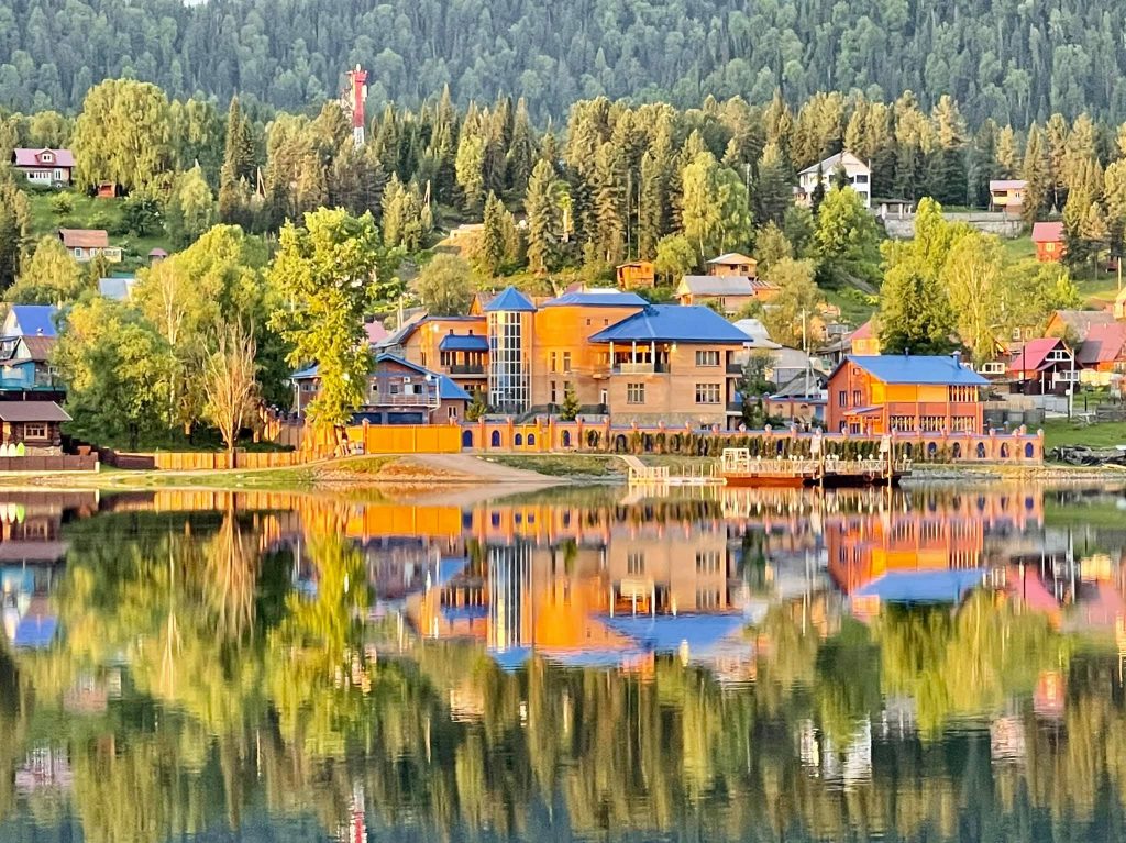
The second route is interesting too. And if you choose it, you will surely not regret it! Just enjoy the amazing beauty of Teletskoye Lake, which is full of crystal clear water that you can drink by scooping it with a bucket directly from the boat. The lake is surrounded by mountains and rocks, from which the fabulous waterfalls flow in torrents. And you will remember the splendid views from the top of the Katu-Yaryk pass for the rest of your life!
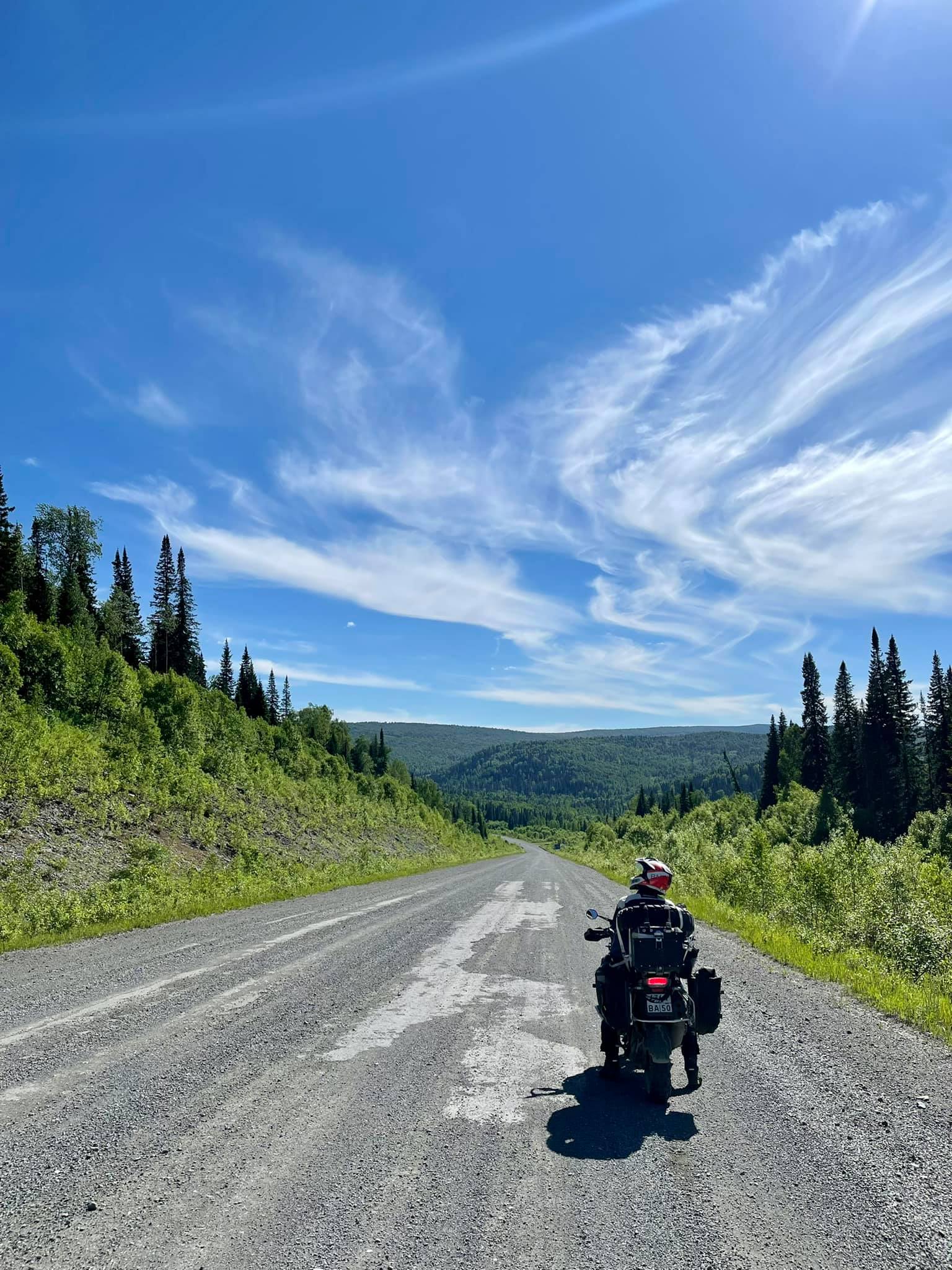
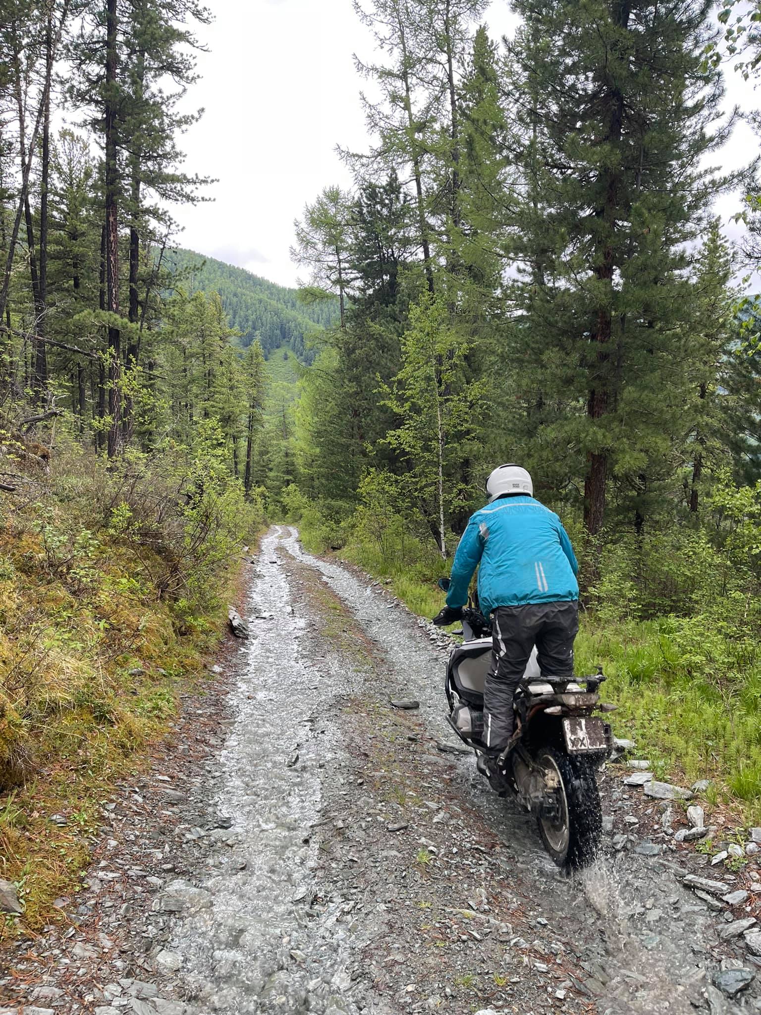
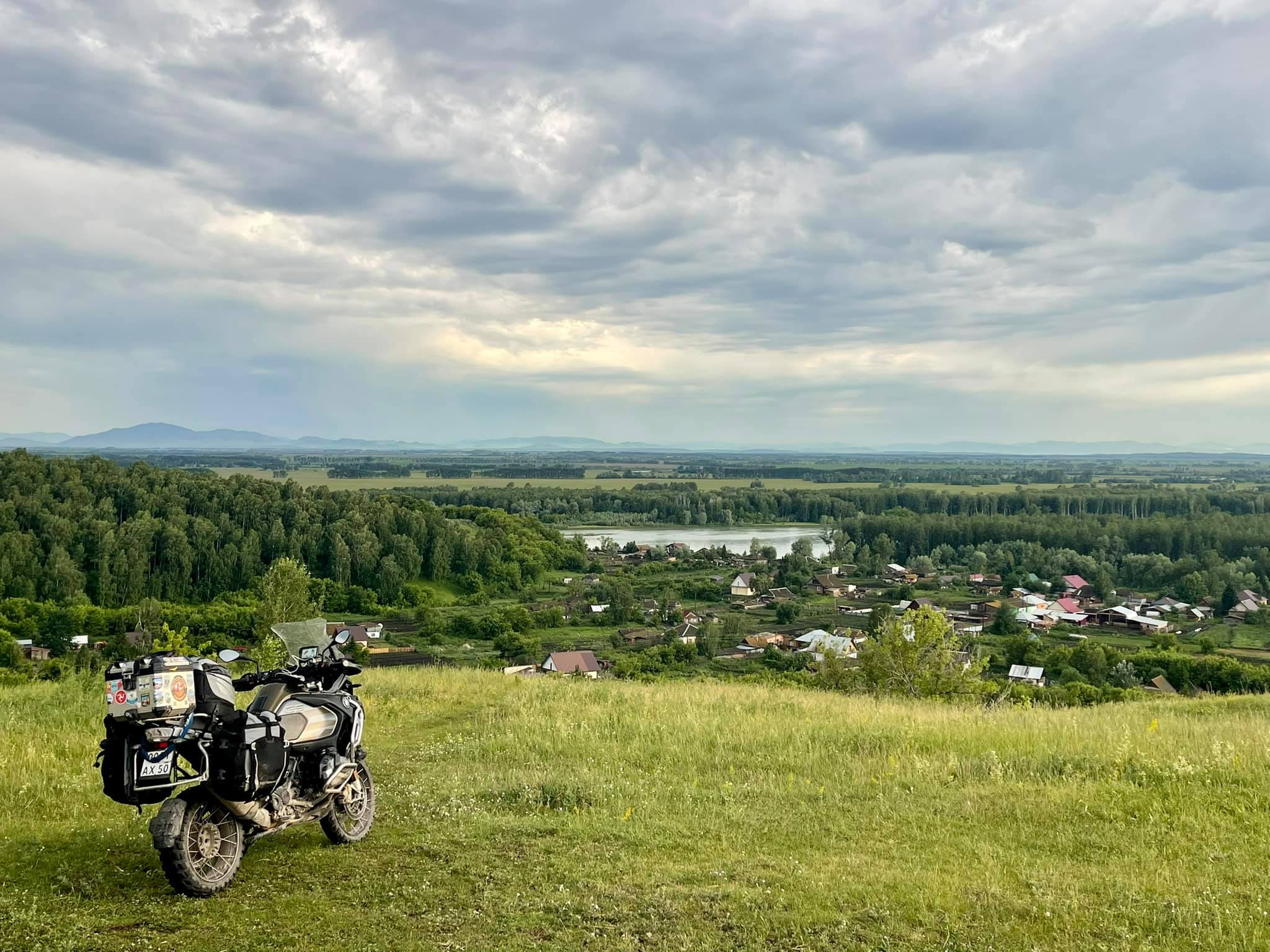
This time we didn't go by the standard route, as we left Novokuznetsk and went by the ski resort Sheregesh, by the village Turochak, by Teletskoye Lake and finally reached Artybash. Actually, I had to ride about a hundred kilometers along a dusty gravel road.
Having negotiated in advance with the captain of the brand new, clean and even cozy ferry "Sapphire", we loaded our motorbikes and departed from pier number 1 of Artybash village at 5:30 a.m. Five hours later we docked at the opposite shore of the lake, at the mouth of Chulyshman River. This water trip (including the docking at a secret facility, where the ferry brought huge bags of black soil to) cost us 5000 roubles per person, and so did the motorbike. In my opinion, it is quite a fair price. By the way, the length of Lake Teletskoye is more than 70 km, and its width is 2-3 km on average.
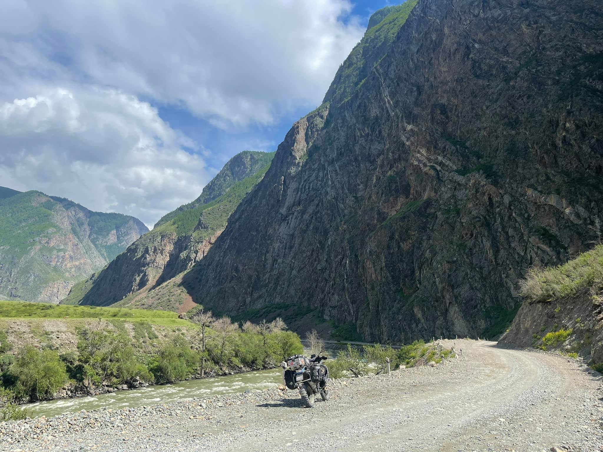
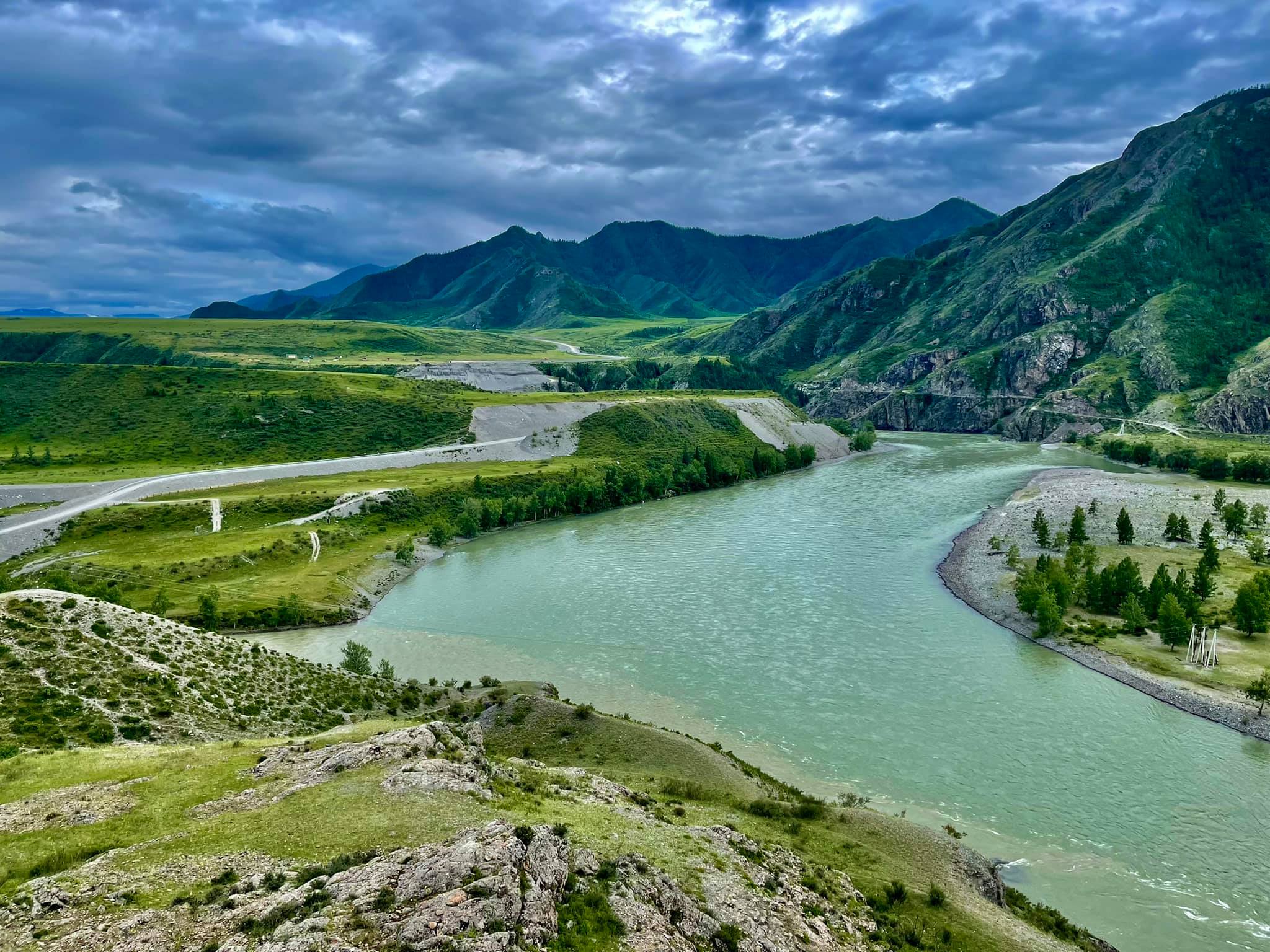
The photo is taken on the high bank of Chulyshman River.
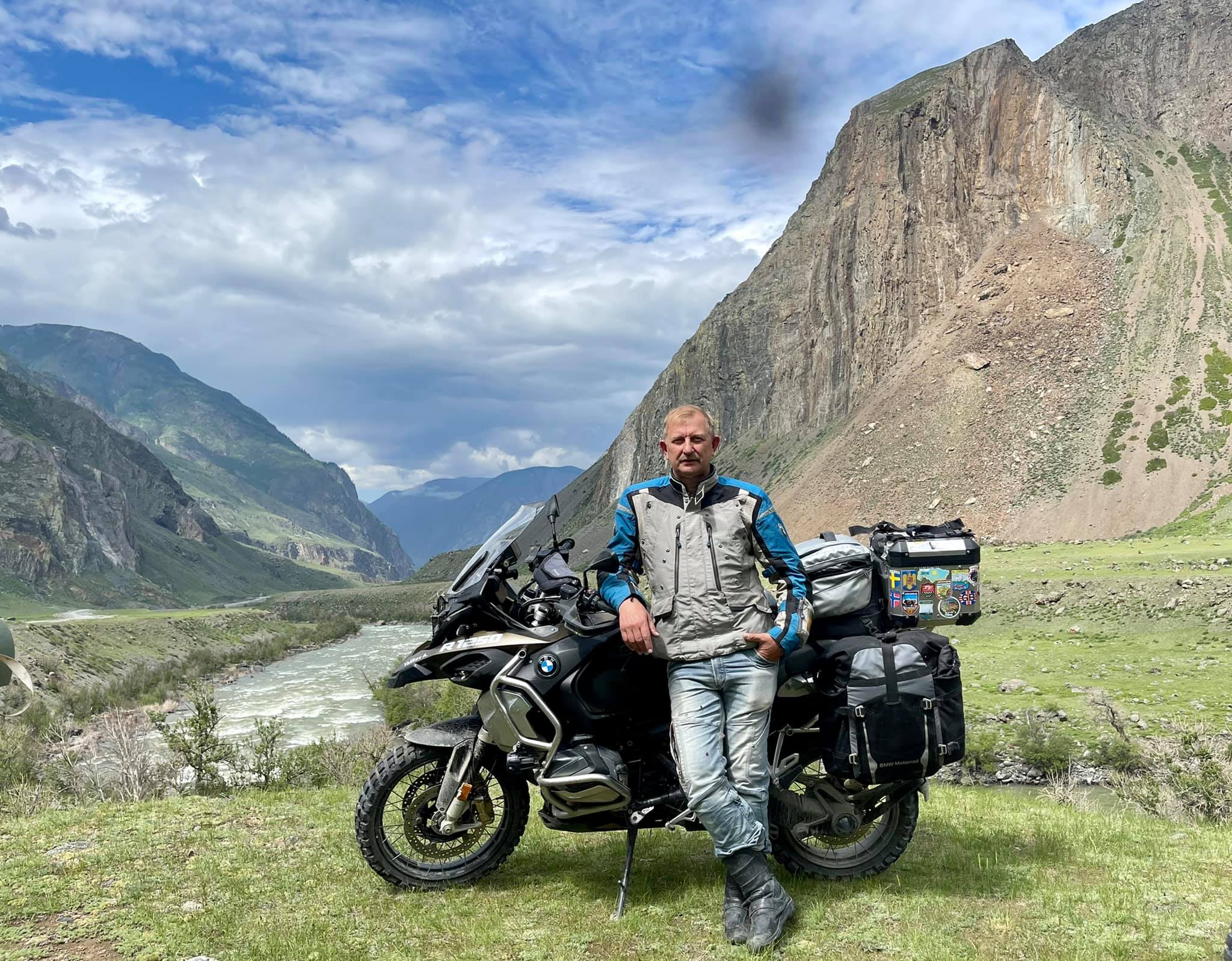
Then there was an 80 km distance of a very beautiful ground road along the Chulyshman River and we climbed a steep, rocky serpentine to the Katu-Yaryk pass. I've done this for the third time but I never stop admiring the beauty of this fantastic place!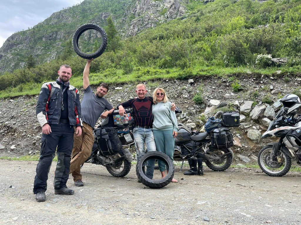
And this is an unexpected meeting with our friends from Irkutsk, Dima Yaskin and his wife Veronika! It's just incredible how the roads bring travellers together!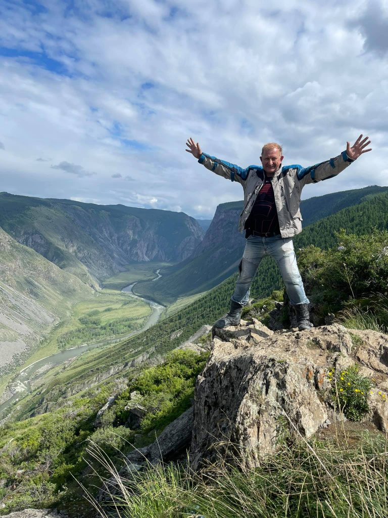
That's what I can call happiness!
We have been traveling around Altai for less than a week but already got enough impressions for the rest of the year.
The images of the adventure in our memory are so vivid and diverse that the brain no longer builds them into a temporal and logical sequence. Every traveller can relate to this state of mind. After 3 or 4 days in a journey one simple question, "What is the date (or day of the week) today?" would puzzle a person and his or her brain would start feverishly recalling those daily routine tipping points… but would not find any of them and become confused.
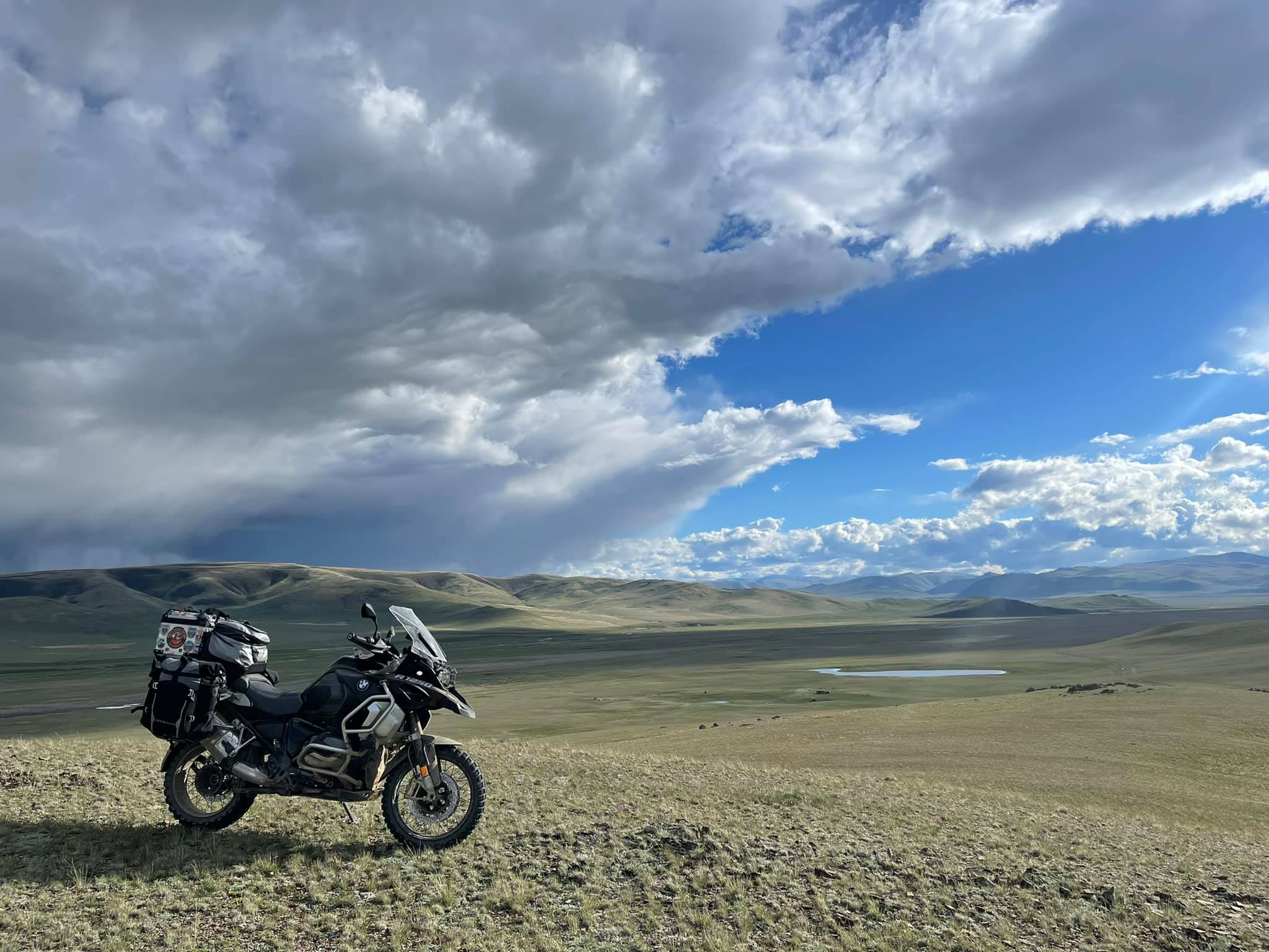
The beginning of the path.
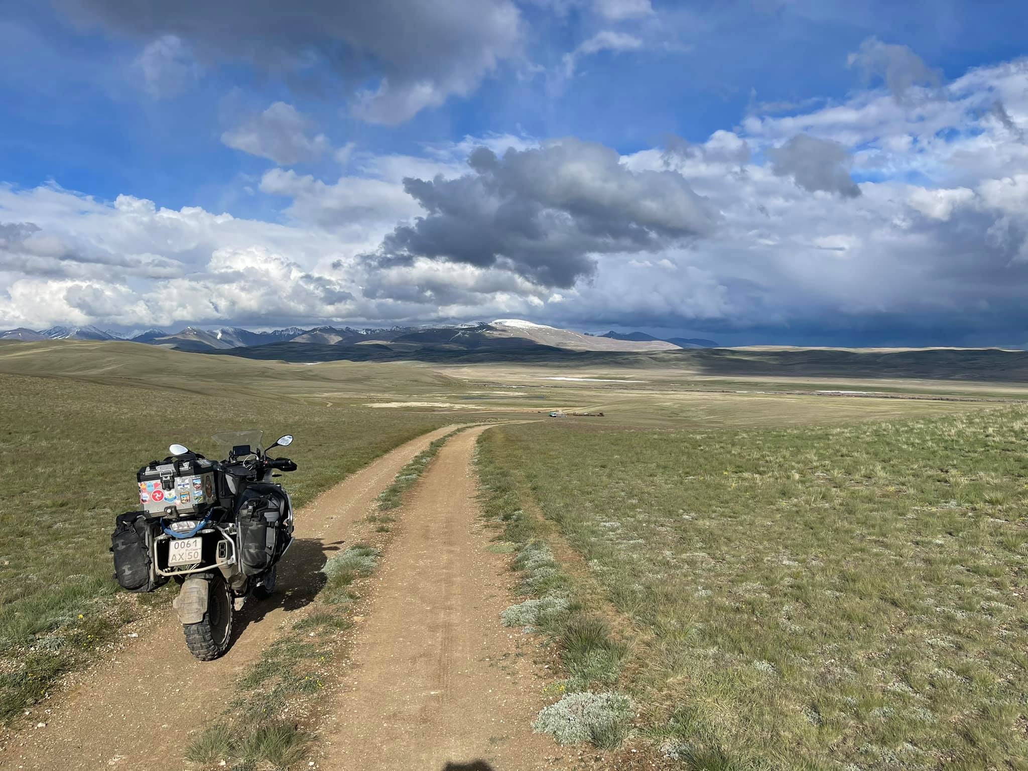
A 100% Mongolian landscape.
The road leads to an abandoned mine.
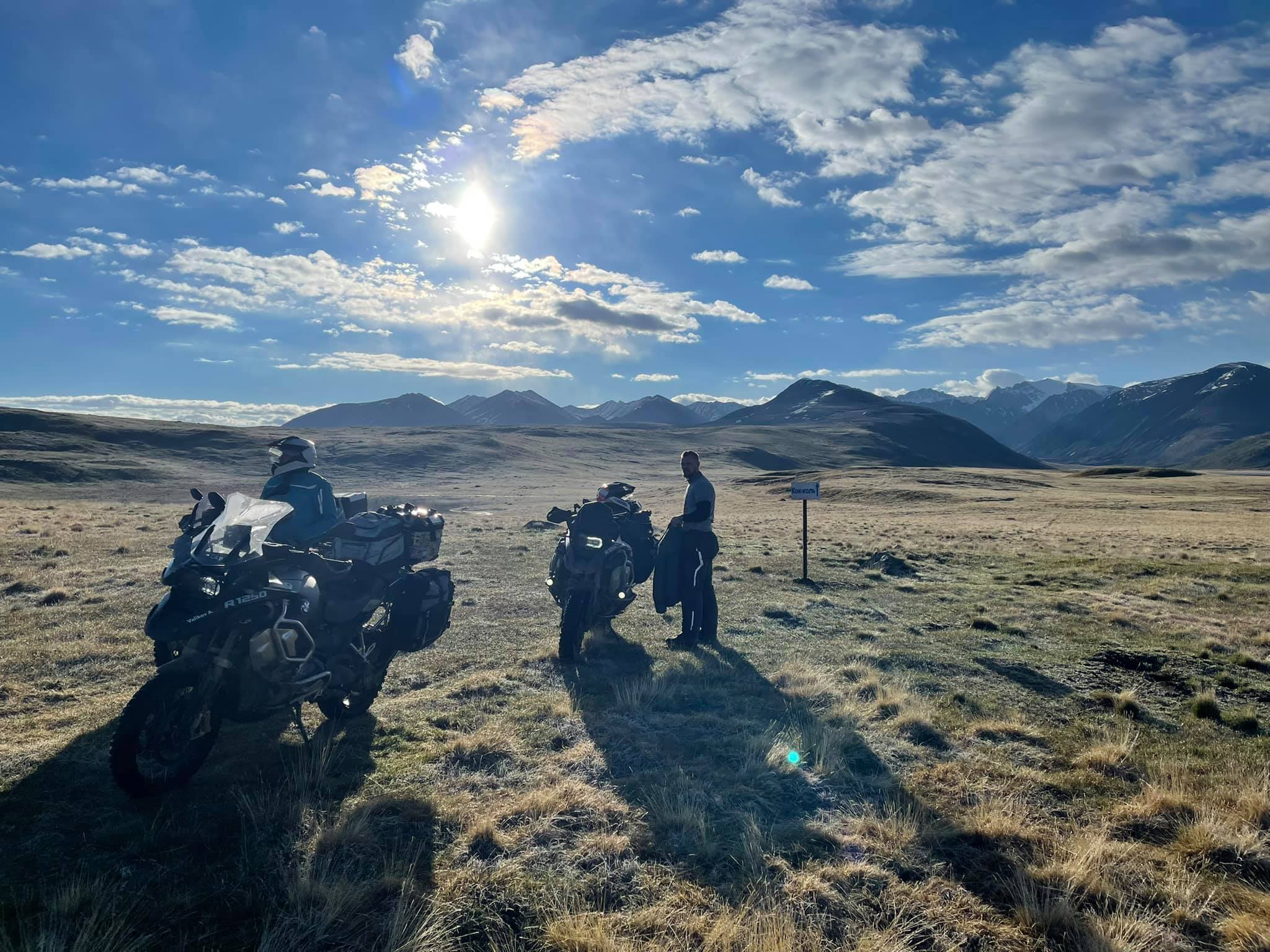
Yesterday in the village Kosh-Agach we met another group of our friends travelling around Altai by UAZ and motorbike. During the lunch in a cafe it was decided to go to high-altitude lake Naryn-Gol (49.82155, 89.543415), where the Kok-Kel campsite is located near the border with Mongolia. And we could stay overnight there. The plan seemed exciting to us, but no one knew the way to this lake (and there wasn't any, in general). There wereabout only several rough ground ways. The one who has ever been to Mongolia will understand what I'm speaking about.
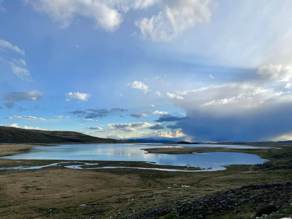
Lake Naryn-Gol. 2640 m above sea level.
We had been wandering along these roads for several hours until we came to the right way. It turned out to be quite difficult to pass though. Rains and bad weather had turned the ground road into a swamp. We had to drive along the tops of the hills overgrown with plants and surrounded with stones. As a result, our friends, who supported their spirit with vodka and beer from time to time, got lost in the vast expanse of mountains and gorges. The UAZ was stuck in the swamp, and a friend on a motorbike went towards the Mongolian border and disappeared completely from the phone reception.
The morning did not bode well.
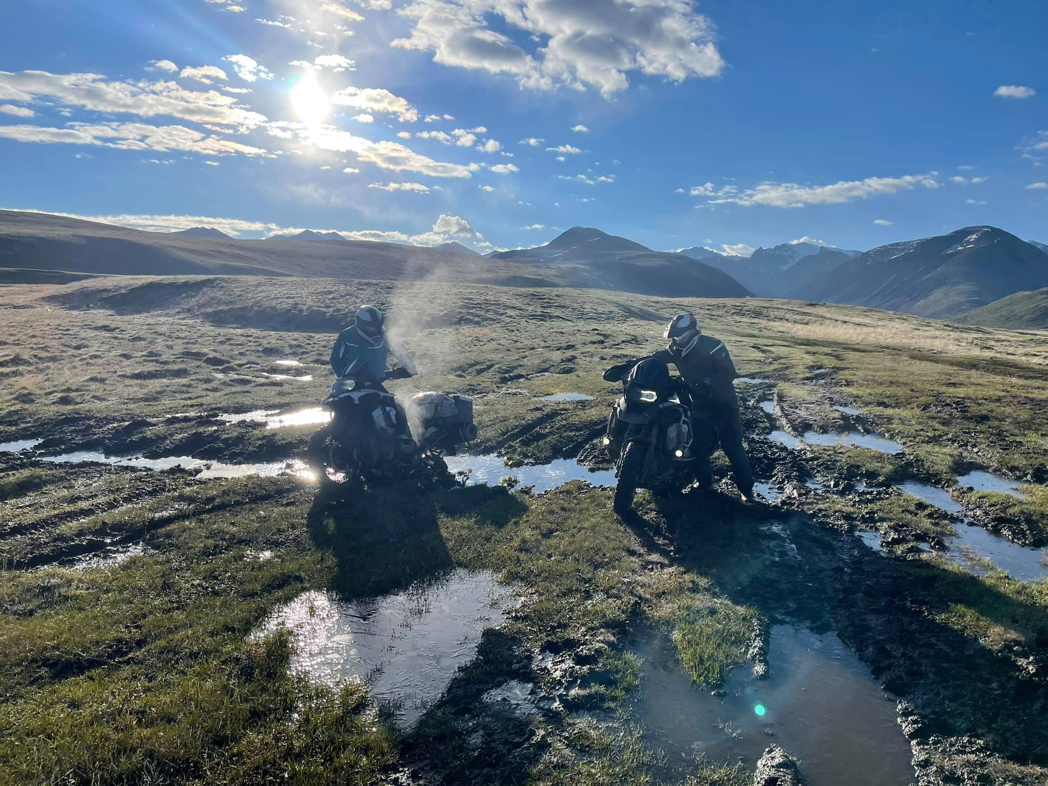
The road to the lake looks like just the swamps, one after another. Now it is an early morning. We are looking for our lost friend.
Lake Naryn-Gol at 5 a.m.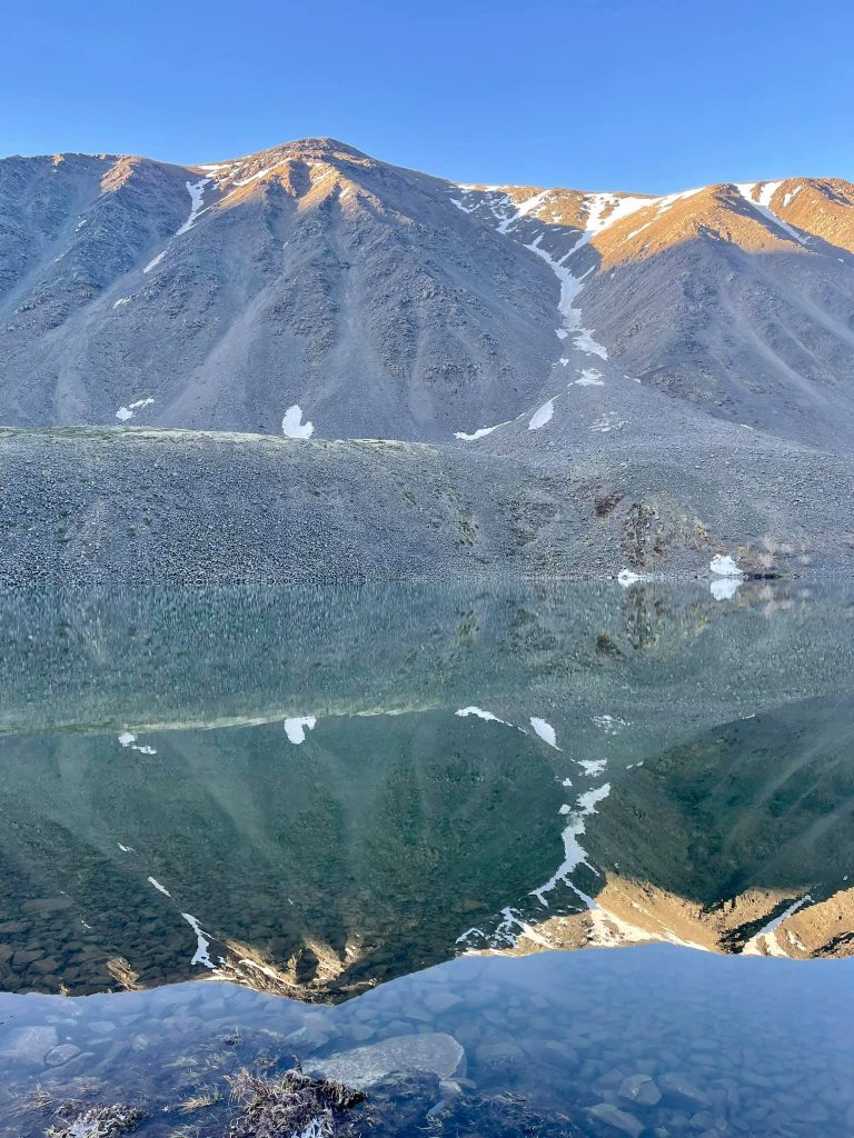
When it got dark, the three of us reached the camp (a few wooden houses on the shore of the lake surrounded by huge snow-covered rocks). We are 2670 m high. It has become cold. The temperature dropped below zero. But the phone reception was resumed. Actually, we were not waited for in the camp and there was no one except for two locals, a husband and a wife. They were living here and guarding the whole camp at the same time. The attempt to save the UAZ ended after midnight and at 5 a.m. we went looking for our friend. He got in touch at 7 a.m. It turned out that having finally lost his way, he decided to spend the night in some barn at an abandoned sheepfold. And in the morning he went the reverse way. We met in the village Kokorya (49.913733, 89.001228), from where the asphalt road already begins.
 To sum up, both the day and night were very interesting and intense.
Anyway, the lake is so beautiful! And the waterfall there is huge. Unfortunately, we did not have much time to watch it and enjoy all the beauty that surrounded us. ;)
The Chuya Highway
According to the National Geographic magazine, the Chuya Highway is the only road in Russia that has been included in the list of the ten most beautiful highways in the world. And I totally agree with them! :)
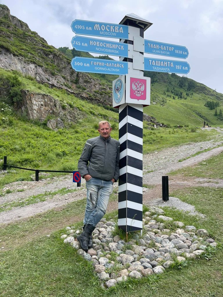
Today Chuya Highway is a modern, almost perfect highway 953 km long that goes from Novosibirsk to the border with Mongolia (Tashanta village).
The picture was taken on our way back from Kosh-Agach to the north.

The landscapes look like posters!
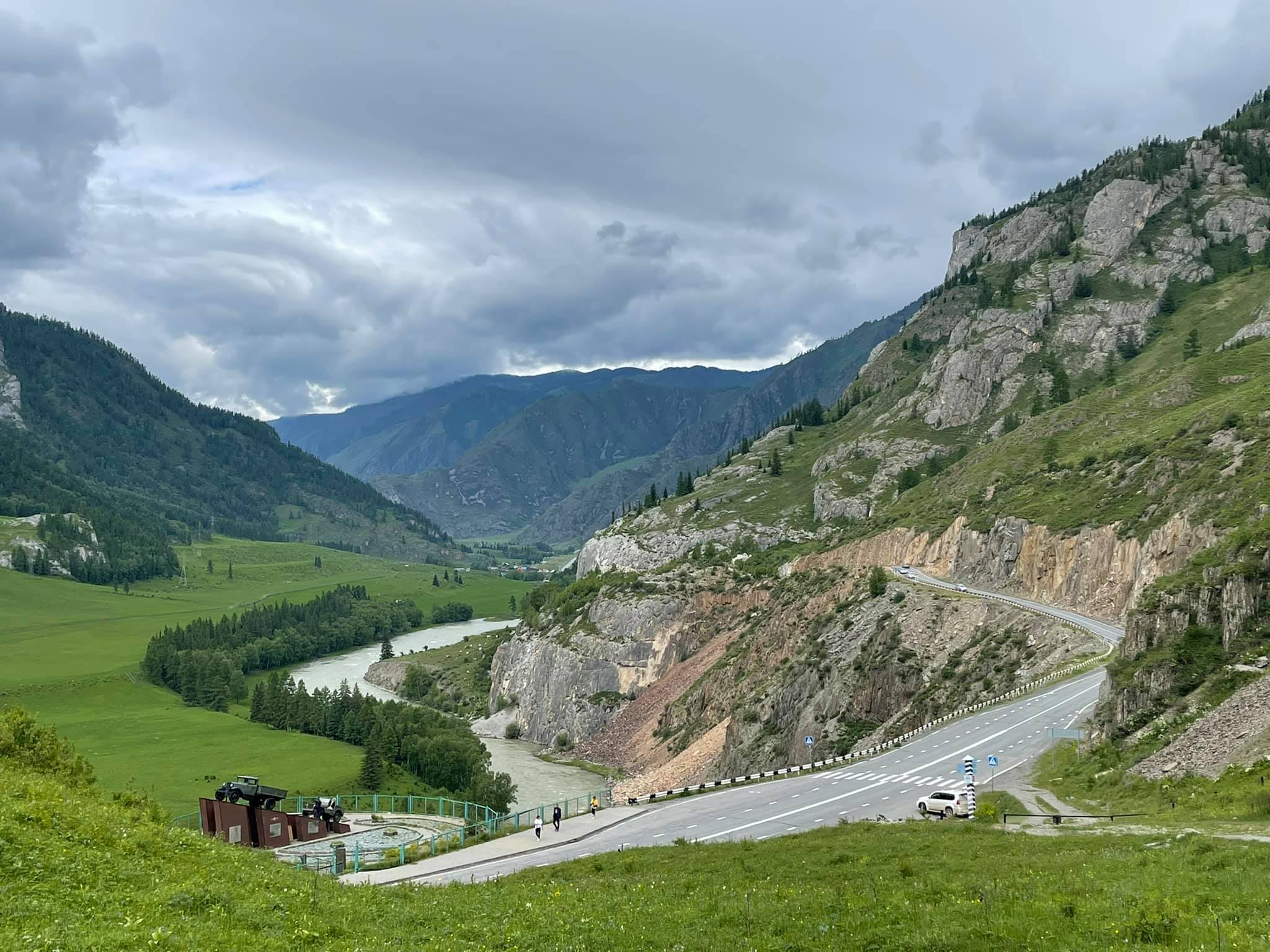
But the most beautiful part of it begins after Gorno-Altaisk. You will experience more than 400 km of a different and very picturesque road with smooth curves, sometimes going through the rocks. It runs first along the stormy Katun river, which waters are of emerald colour, then becomes a serpentine rising to one pass, then to the second one. There are descents, ascents, then Chuya River appears on the right and mountains appear on the left. Keep it that way up to Tashanta, where Chuya Highway ends with a border with Mongolia, which, unfortunately, cannot be passed now.
 The Chuya Highway is great, but the auto-service (and the service sphere in general) leaves a lot to be desired.
Having driven from Kosh-Agach to Gorno-Altaysk along the Chuya Highway, I decided to turn back. A gorgeous track and nice weather was such a pleasure! :)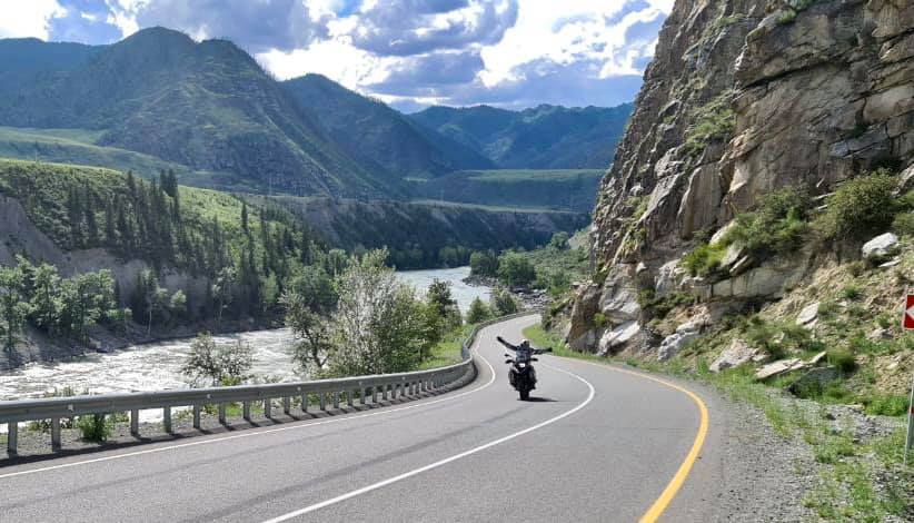
There are no problems with fuel as there are a lot of petrol stations. But there are few hotels, cafes and restaurants. The Altai mountains are not like the Alps or the Pyrenees. The closer to Mongolia, the more beautiful nature is and the harsher people are.
We have chosen this place with a stunning view of the Katun River to stay overnight .
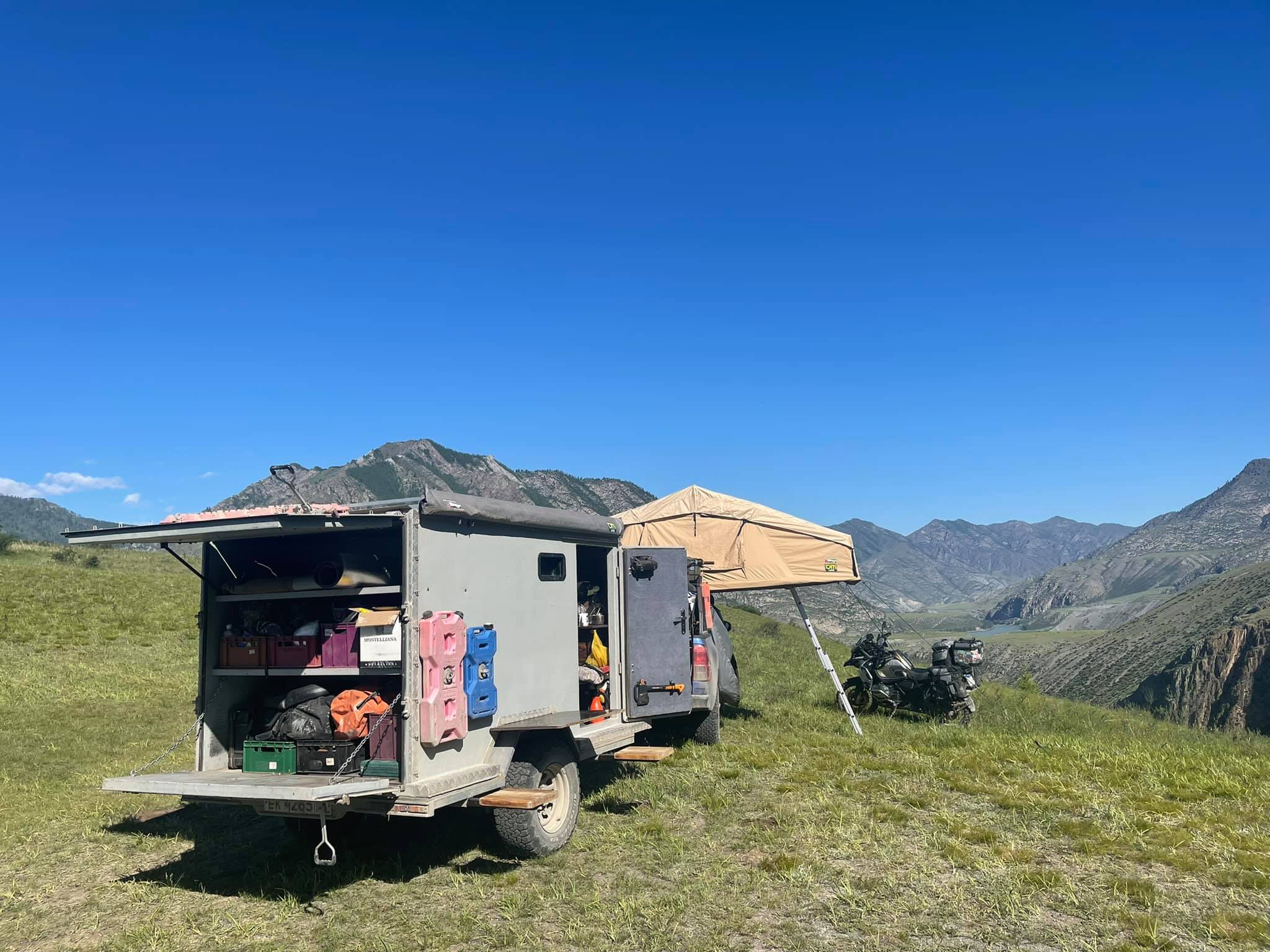
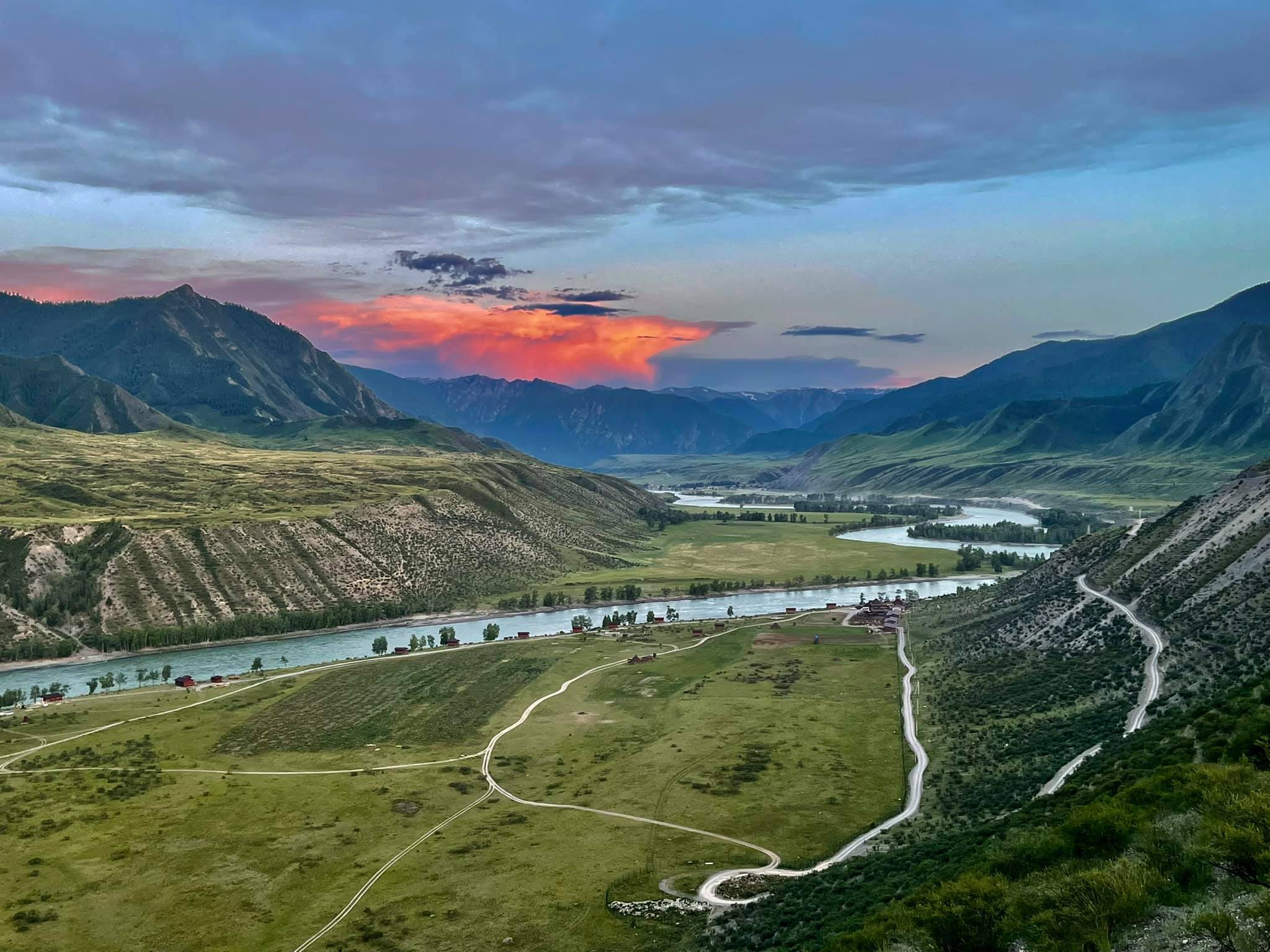
In recent years some things have been changed for the better. Small cafes are being opened, recreation centers are being built (usually they look like wooden houses with all the conveniences in the yard and a shared shower). But during "the dog days", they are fully packed so don't forget to take a tent-sleeping bag set just in case. And for those who like to be alone in nature sometimes, it is even recommended. Unlike in the European resorts, here you can camp almost everywhere. And it's really cool! The feeling of waking up early in the morning, pulling the tent flap and seeing the blue ribbon of the river below and the white peaks of the mountains on the background of the rising sun is so special!

This is Katun on the right and the mountains on the left. Such a beauty!
Although sometimes I would not reject the opportunity to pull back the curtain (instead of the tent flap) in some cozy room of a decent hotel with the same view.
"The most interesting part of the journey begins where the asphalt road ends".
That's it! We finally have arrived. Just the snow fields are ahead. And this is the radio repeater in the village Aktash.
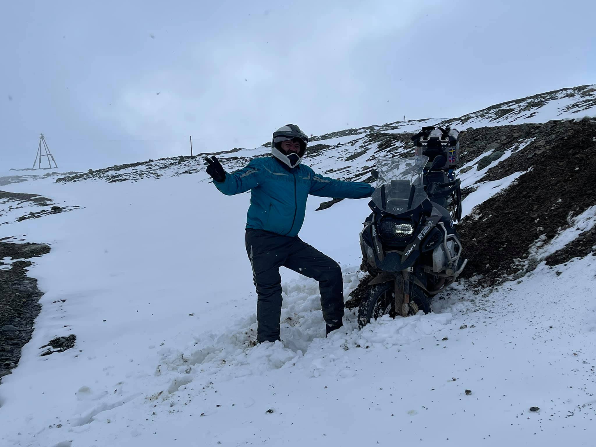
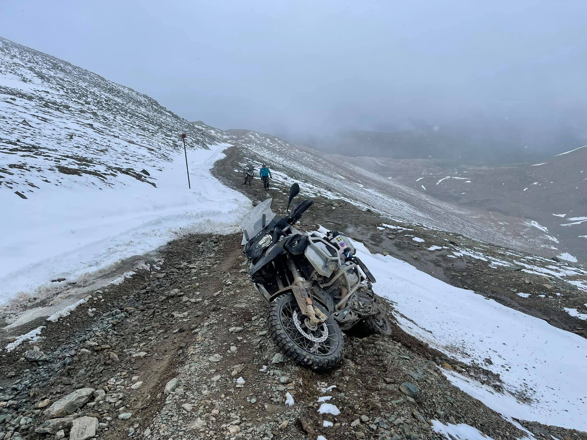
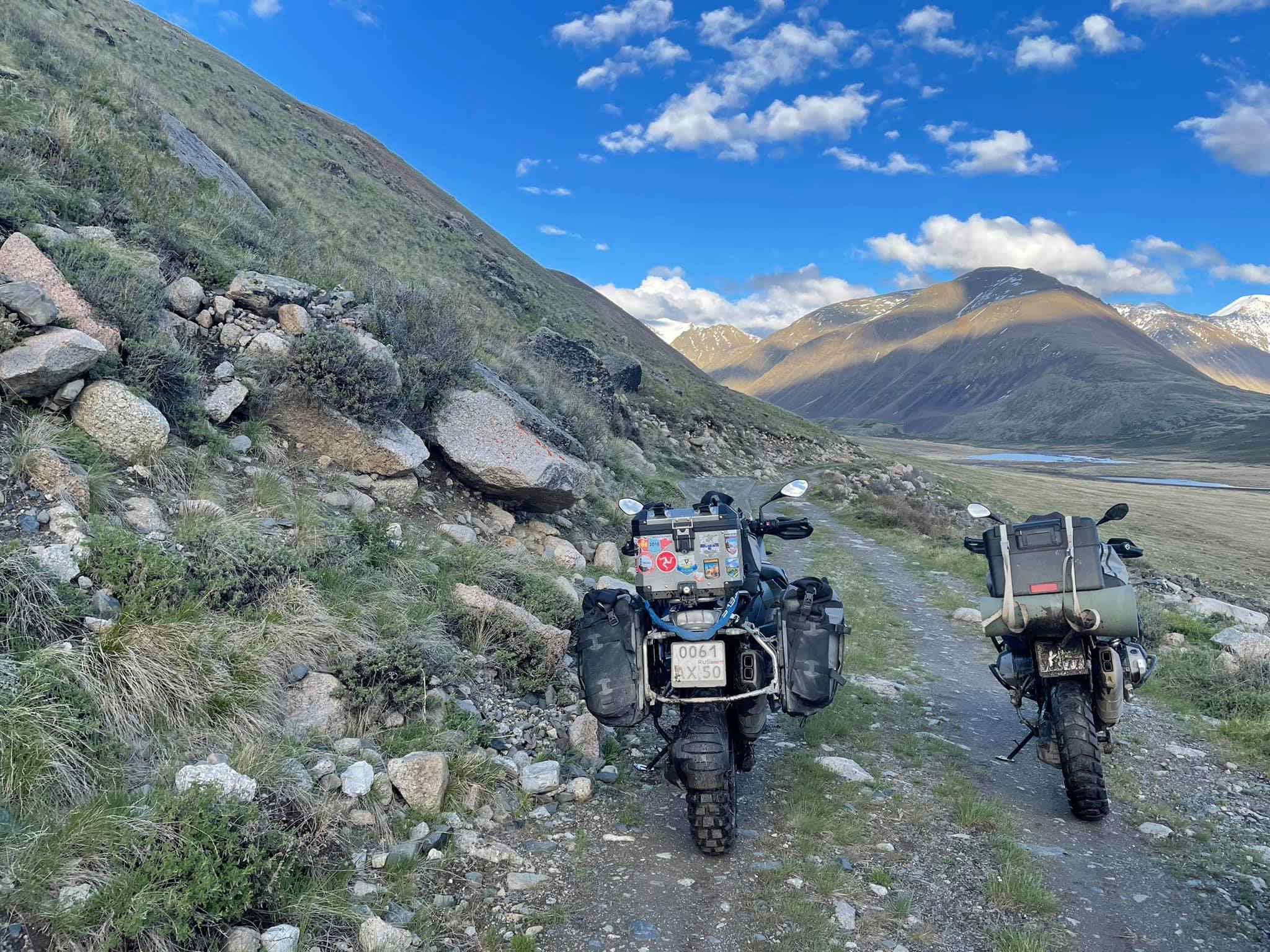
This well-known quotation is true for Altai as well. Undoubtedly, the Chuya highway is gorgeous, but there are still hundreds of kilometers of beautiful roads, mostly unpaved, which run into the mountains and gorges, winding along the banks of numerous mountain rivers and streams. Almost all of them lead to high-altitude sheep fields or to technical structures such as mines or phone reception towers.
There are some popular places where you can get even by car if you aren't afraid of testing it. You can book an excursion by UAZ or just walk but, in my opinion, the best way is to ride a motorbike, of course! :) But only if you have sufficient off-road driving experience and an appropriate motorbike.
The road to the second radio repeater is full of such fords. There are about a dozen of them on the way to the top.
Here are some places of interest:
— A ground road from Lake Teletskoye ( 51.364908, 87.746362 ) to the Chuya Highway along the valley of the Chulyshman River and through the Katu-Yaryk pass (50.911646, 88.216368) and the village Ulagan. (50.632076, 87.956269). There you'll experience the magnificent road and stunning views from the top of the pass. The complexity of the route is below average.
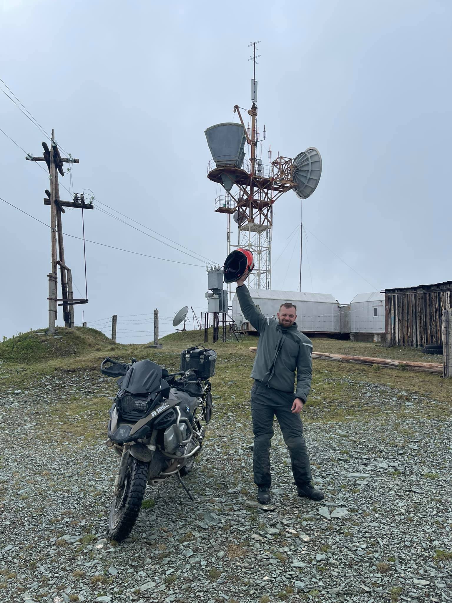
— This is the radio repeater at the village Aktash. ( 50.339921, 87.748553 ). 3000 m high. The ground road is covered with stones and washouts. Then there's a serpentine and a very beautiful view from the top.
The complexity of the route is average.
—This is the radio repeater (50.288691, 86.969613). One more exciting route starts at the village Akbom. It goes from the Chuya Highway first along the valley, then rises to a height of 2300 m in a fantastic stone serpentine. There are many shallow fords. In rainy weather the valley is very dirty and slippery. The complexity is average.
— The route to the alpine lake Arukem (50.615444, 85.759943) from Karakol village. It's a good ground road, but there is a very hard section for heavy motorbikes as there are large sharp stones, dirt, tree roots and swampy areas on it. The ascent to the lake is steep and slippery in rainy weather.
The complexity depends on the weather. After the rain it becomes above average.
— The ground road to the pass, which is 1820 m high. You'll see the view of the valley. (50.551512, 86.717118) The route starts from the village Malaya Inya (50.452797, 86.666746) There are washouts, streams and stones on the road. The complexity is average. In addition, we met a moose and a roe deer there.
— The trail from Inegen village (50.322242, 86.694069 ) to Tungur village. (50.161009, 86.306533). That's a very interesting route along the bank of the Katun River with amazing landscapes. But there are dangerous narrow sections along a steep slope, rocks, fords, etc. The complexity is high.
I've mentioned just a few of the routes, so if you like off-road, you can go for it and add your own tracks to the list for sure.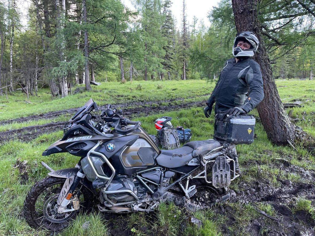
On my way I ran into a little swampy area.
The Srostki village
Somewhere halfway between Gorno-Altaisk and Biysk there is rather a big village Srostki. At first sight, it is an ordinary village and there's nothing remarkable in it except for a new lovely temple of red-yellow brick that stands out against the monotonous background of one-storey wooden houses.
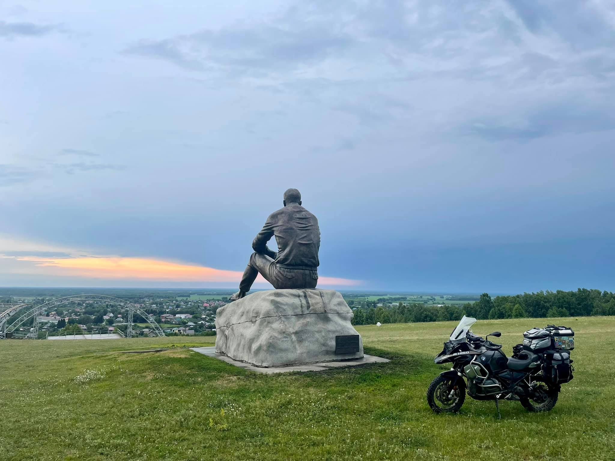
But there is one attraction that I could not pass by.
At the very entrance to the village, I turned off the highway and followed a narrow paved road that leads by the graveyard uphill. A few hundred metres to the top the road ends with an asphalt platform. I squeezed into a narrow passage between the fences and rode on along the ground path. Half a minute later a huge figure of a barefoot man sitting on a gray stone appeared. And there was a dark blue sky covered with clouds on the background. His hands are lying one on the top of the other, his elbows are touching his knees and a thoughtful calm glance is directed far away. He is watching the village where he was born, lived and worked…
He is Vasily Makarovich Shukshin, a talented writer and actor, who had got a great personality.

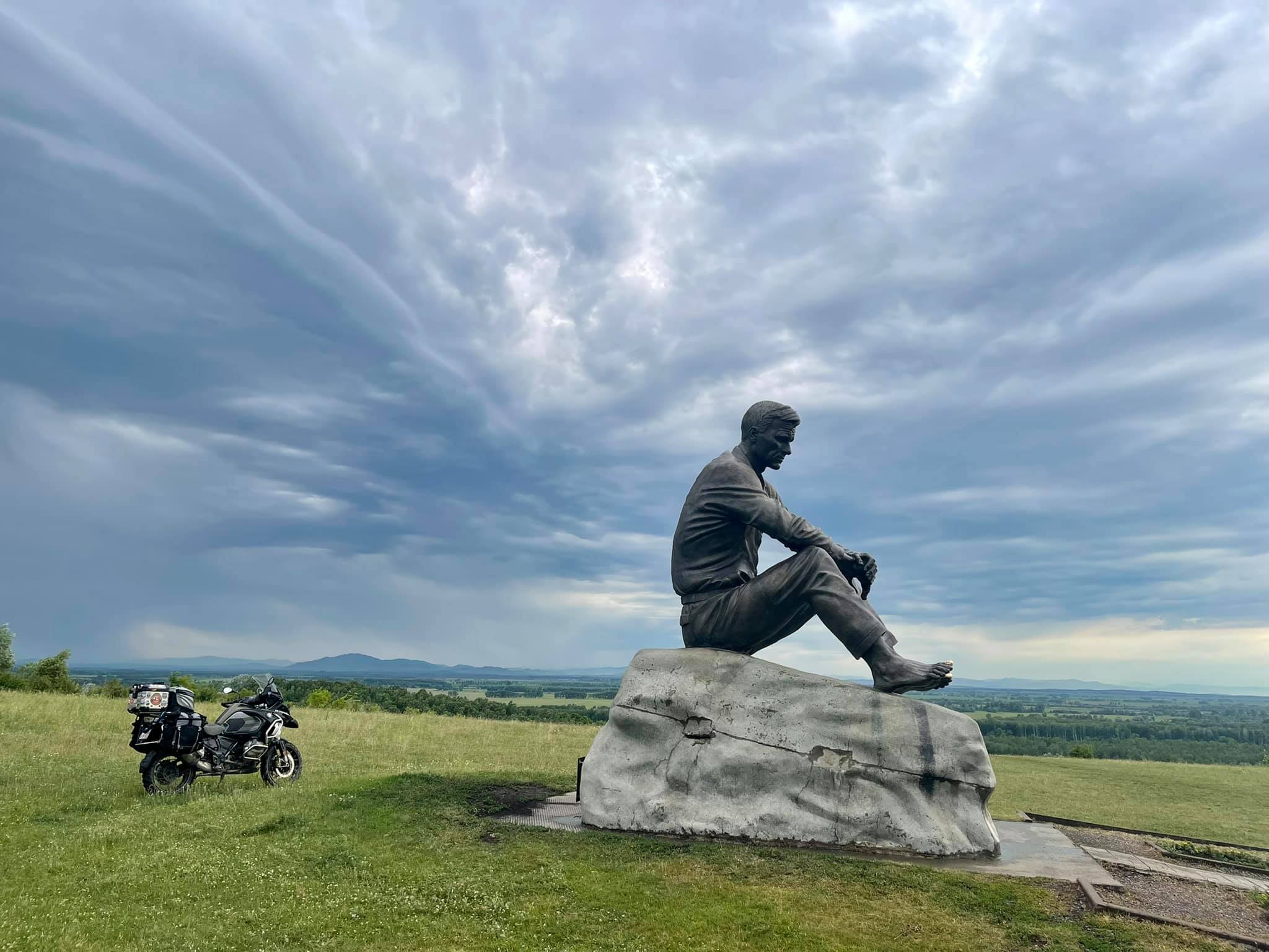
I have seen a lot of monuments to different famous and not so famous people in my life. I've seen the Kings riding the horses, dressed in appropriate gowns, with swords in their hands and crowns on their heads. The granite monuments to different men in coats (and without a coat) seem to be made according to the same template, the same concept of bright future, etc.
But this sculpture of a barefoot man in a shirt and simple trousers is outstanding. There is no pathos and no unnecessary details in it, no horses and pedestals. And the sculptor must be a genius because he managed to express precisely such a rich inner world of a simple and at the same time brilliant man from the Altai village. That's fantastic!
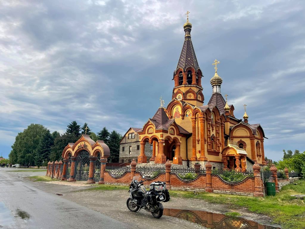
This is the temple in Srostki.
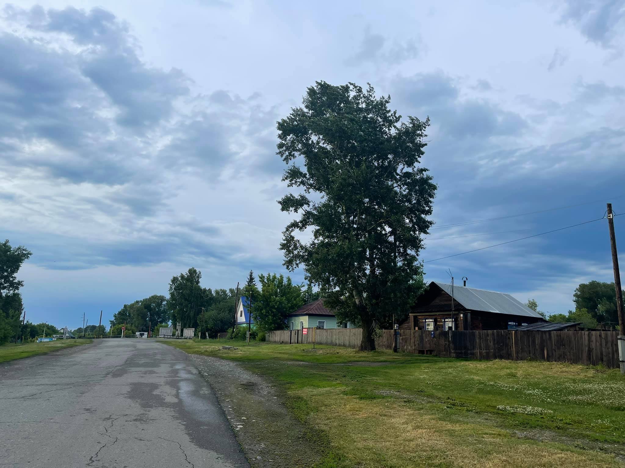
And this is the picture of one of the streets in the village. However, most of them are paved.
All in all, this location has an amazing and wonderful vibe. If you happen to travel around Altai, you should definitely visit it.
(52.412756, 85.713609)